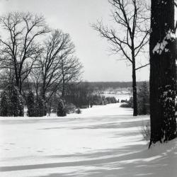
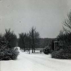
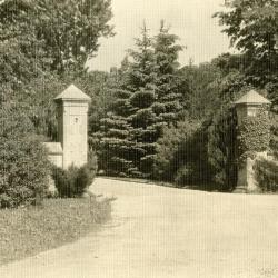
Looking east from Morton residence to entrance gates in winter, Thornhill Drive toward Park Blvd. (3.32151)
Date: 1930sType: Photographic image
Description:Looking east from Morton residence to entrance gates in winter, Thornhill Drive toward Park Blvd.
Extent: 1 negative

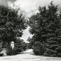
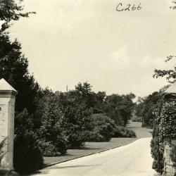
Arboretum east gate entrance (3.32156)
Date: 1930sType: Photographic image
Description:Arboretum east gate entrance
Extent: 1 negative
Arboretum East Gate Entrance in winter with stop sign on left (3.32157)
Date: 1930sType: Photographic image
Description:Arboretum East Gate Entrance in winter with stop sign on left
Extent: 1 negative
Arboretum west entrance road (Route 53/Joliet Road), Clarence Godshalk's first Arboretum house along right side of road (3.36092)
Date: 1930Type: Photographic image
Description:Arboretum west entrance road (Route 53/Joliet Road), Clarence Godshalk's first Arboretum house along right side of road
Extent: 1 negative
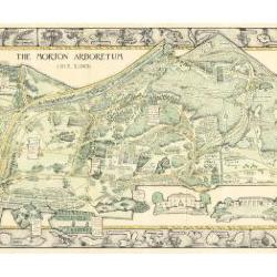
Morton Arboretum Map (3.19479)
Date: 1943Creator: Watts, May Theilgaard
Type: Map
Description:2014 reprint of The Morton Arboretum's first color map, circa 1943.
Detailed map of Arboretum grounds, showing roads, paths, landscaping, shelters, structures, enlargement of some specific features, hedge garden, some specific trees, and trails with markers numbered 1 - 42. Other features include a scale, a calendar, and a compass rose consisting of directions depicted with leaves. A highly ornamental border includes grid marks, as well as drawings of animal tracks and detailed drawings and labels of plants. The Morton Arboretum encompassed 813 acres at time of map.
Extent: 1 sheet

Arboretum east gate entrance in winter with sign on right side (3.32158)
Date: 1930sType: Photographic image
Description:Arboretum east gate entrance in winter with sign on right side
Extent: 1 negative

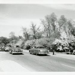
Traffic being directed at Arboretum entrance and Route 53 (3.3619)
Date: 1940sType: Photographic image
Description:Traffic being directed at Arboretum entrance and Route 53
Extent: 1 photograph
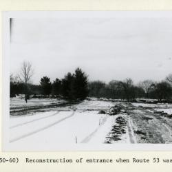
Arboretum entrance drive in winter during reconstruction when Route 53 was widened (3.32051)
Date: 1950sType: Photographic image
Description:Arboretum entrance drive in winter during reconstruction when Route 53 was widened
Extent: 1 photograph
Arboretum east gate entrance in winter with close view of east side (3.32159)
Date: 1930sType: Photographic image
Description:Arboretum east gate entrance in winter with close view of east side
Extent: 1 negative

Cop directing traffic at entrance of Arboretum (3.3620)
Date: 1940sType: Photographic image
Description:Cop directing traffic in Arboretum
Extent: 1 photograph

Morton Arboretum Map: Preliminary Drawing for Colored Map (3.19480)
Date: 1943Creator: Watts, May Theilgaard
Type: Drawing
Description:Preliminary drawing for detailed colored map of Arboretum grounds that was printed in 1943, showing roads, paths, landscaping, shelters, enlargement of some specific features, hedge garden, and center of hedge garden. Blank spaces indicate water and text placement. Tree symbols show exceptional specimens on east and west sides. The Morton Arboretum encompassed 813 acres at time of map. Drawing is in two pieces.
Extent: 2 sheets
Side view of Arboretum entrance drive with trees during reconstruction when Route 53 was widened (3.32052)
Date: 1958 – 1959Type: Photographic image
Description:Side view of Arboretum entrance drive with trees during reconstruction when Route 53 was widened
Extent: 1 photograph

Morton Arboretum Map (3.19481)
Date: 1943Creator: Watts, May Theilgaard
Type: Map
Description:Detailed map of Arboretum grounds, showing roads, paths, landscaping, shelters, structures, enlargement of some specific features, hedge garden, some specific trees, and trails with markers numbered 1 - 42. Other features include a scale, a calendar, and a compass rose consisting of directions depicted with leaves. A highly ornamental border includes grid marks, as well as drawings of animal tracks and detailed drawings and labels of plants. Some replacement illustration and text has been adhered to the map. The Morton Arboretum encompassed 813 acres at time of map. One section is partially missing.
Extent: 1 sheet
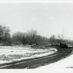
Reconstruction of Arboretum entrance drive in winter when Route 53 was widened showing road curve to left (3.32053)
Date: 1958 – 1959Type: Photographic image
Description:Reconstruction of Arboretum entrance drive in winter when Route 53 was widened showing road curve to left
Extent: 1 photograph
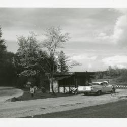
Traffic on Route 53 waiting to enter Arboretum (3.2941)
Date: 1940sType: Photographic image
Description:Traffic on Route 53 waiting to enter Arboretum
Extent: 1 photograph
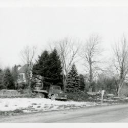
Truck at Arboretum entrance road during recontruction when Route 53 was widened (3.32054)
Date: 1958 – 1959Type: Photographic image
Description:Truck at Arboretum entrance road during recontruction when Route 53 was widened
Extent: 1 photograph
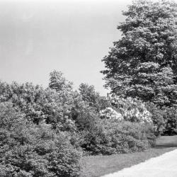
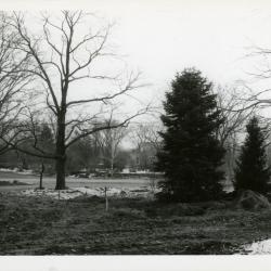
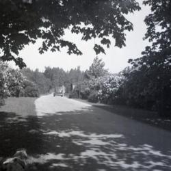
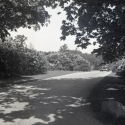
Trees and shrubs along east side of west entrance drive (3.32247)
Type: Photographic image
Description:Trees and shrubs along east side of west entrance drive
Extent: 1 negative
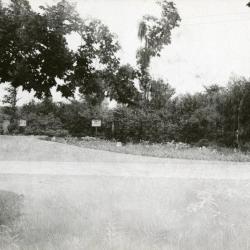
Entrance to Arboretum east side off what is now IL Route 53 (3.2946)
Date: 1935Type: Photographic image
Description:Postcard of entrance to Arboretum east side off what is now IL Route 53
Extent: 1 postcard
Traffic at intersection of Oakwood Drive and Route 53 looking north (3.32063)
Date: 1940sType: Photographic image
Description:Traffic at intersection of Oakwood Drive and Route 53 looking north.
Extent: 1 photograph
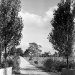
Arboretum road over DuPage River bridge, southeast view toward main entrance (3.32739)
Date: 1930Type: Photographic image
Description:Arboretum road over DuPage River bridge, southeast view toward main entrance
Extent: 1 negative
A Landscape Development Plan for the North Exit, West Side, the Morton Arboretum (3.6126)
Date: circa 1983Creator: Tyznik, Anthony
Type: Plan
Extent: 1 sheet

Old car driving through west entrance (3.3019)
Date: October 1941Creator: Teuscher, Henry
Type: Photographic image
Description:Old car driving through west entrance
Extent: 1 photograph

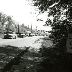
Traffic backed up to get into Arboretum on Rte. 53 looking north (3.32065)
Date: 1940sType: Photographic image
Description:Traffic backed up to get into Arboretum on Rte. 53 looking north
Extent: 1 negative filmstrip
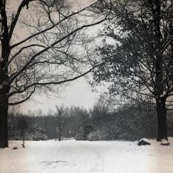
Morton Residence Grounds at Thornhill, early entrance gates (3.3383)
Date: 1930sType: Photographic image
Description:Morton Residence Grounds at Thornhill, early entrance gates, now currently off of Park Blvd.
Extent: 1 photograph
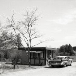
Car stopped at east entrance gatehouse (3.32066)
Date: 1960sType: Photographic image
Description:Car stopped at east entrance gatehouse
Extent: 1 negative filmstrip
Arbor entrance to Morton residence grounds (3.3078)
Date: 1933Creator: Streator, Sidney V.
Type: Photographic image
Description:Arbor entrance to Morton residence grounds
Extent: 1 photograph
White car stopped at east entrance gatehouse (3.32067)
Date: 1960sType: Photographic image
Description:White car stopped at east entrance gatehouse
Extent: 1 photograph
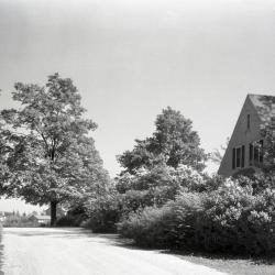
Morton Residence at Thornhill, entrance to main drive (3.3482)
Date: 1920sType: Photographic image
Description:Morton Residence at Thornhill, entrance to main drive
Current Arboretum entrance from Park Blvd.
Extent: 1 photograph
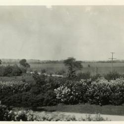
Lilacs, entrance, and highway (now Route 53) viewed from upstairs window of Clarence Godshalk's first Arboretum house, looking northeast (3.38216)
Date: 1920sType: Photographic image
Description:Lilacs, entrance, and highway (now Route 53) viewed from upstairs window of Clarence Godshalk's first Arboretum house, looking northeast
Extent: 1 photopgraph
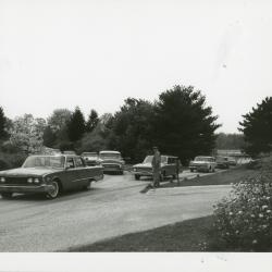
Man directing sunday traffic as cars merge on road (3.32068)
Date: 1960sType: Photographic image
Description:Man directing sunday traffic as cars merge on road
Extent: 1 photograph
Coord. Sketch for Park Blvd. Entrance & Parking (3.7097)
Date: June 26 2001Creator: Mehaffey, Scott A.
Type: Plan
Description:Circulation study for new entry road and relocated Forest Road through near East Side. Early concept for entry road and underpass realignment, with studies for Meadow Lake and Arbor Court S.M.
Extent: 1 sheet
[Route 53, entry road, parking lot, Meadow Lake area landscape plan] (3.31967)
Type: Plan
Extent: 1 sheet
East entrance gatehouse on Forest Road with two lines of cars (3.32069)
Date: 1960sType: Photographic image
Description:East entrance gatehouse on Forest Road with two lines of cars
Extent: 1 photograph
[Route 53, entry road, parking lot, Meadow Lake area landscape plan - colored version] (3.31968)
Type: Plan
Description:Areas highlighted in color pencil on landscape plan
Extent: 1 sheet
Car driving out of Arboretum west entrance toward Route 53 (3.32120)
Date: 1930sType: Photographic image
Description:Car driving out of Arboretum west entrance toward Route 53
*located at about 38-L on Arboretum map/grid
Extent: 1 negative
Car entering Arboretum west entrance at Route 53 (3.32121)
Date: 1930sType: Photographic image
Description:Car entering Arboretum west entrance at Route 53
*located at about 38-L on Arboretum map/grid
Extent: 1 negative