
Car Tracks in the snow (3.2990)
Creator: Miller, W. L.
Type: Photographic image
Description:Car Tracks in the snow
Extent: 1 photograph

Snow melting on asphalt road (3.2991)
Type: Photographic image
Description:Snow melting on asphalt road
Extent: 1 photograph

Cote d'Azur, France (3.36846)
Type: Photographic image
Description:Colorful vines grow on a roadside wall in Cote d'Azur, France.
This image is part of a group of slides that belonged to May T. Watts, related to her book Reading the Landscape.
Extent: 1 slide

Cote d'Azur, France (3.36847)
Type: Photographic image
Description:Colorful vines grow on roadside walls in Cote d'Azur, France.
This image is part of a group of slides that belonged to May T. Watts, related to her book Reading the Landscape.
Extent: 1 slide
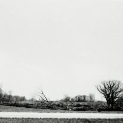
Bare trees, some fallen, near road (3.44600)
Date: circa 1957Type: Photographic image
Description:Bare trees, some fallen, near road, depicting land at or near location of Arbor Lake excavation
Extent: 1 filmstrip
Intersection Design Study, S.B.I. Route 53 … with Morton Arboretum Tunnel, DuPage County (3.5607)
Date: August 26 1958Creator: George W. Barton and Associates
Type: Map
Description:First issued Oct. 21, 1957. Inclueds handwritten notes in red ink and pencil and an attached piece of paper with additional handwritten notes in pencil.
Extent: 1 sheet
Intersection Design Study, S.B.I. Route 53 … with Morton Arboretum Tunnel, DuPage County (3.5608)
Date: August 26 1958Creator: George W. Barton and Associates
Type: Map
Description:First issued Oct. 21, 1957. Copy 1 inclueds handwritten notes in red ink and pencil and an attached piece of paper with additional handwritten notes in pencil.
Extent: 1 sheet
Map of DuPage County … showing rural routes and state aid roads (3.5902)
Date: 1910sCreator: Webster, Arthur L.
Type: Map
Extent: 1 sheet
Map of DuPage County…showing rural routes and state aid roads (3.6000)
Date: 1910sCreator: Webster, Arthur L.
Type: Map
Description:This copy has slightly different layout although the map content appears identical on the two copies.
Extent: 1 sheet
General [County] highway and transportation [maps for Indiana] (3.6545)
Date: 1961Creator: Indiana State Highway Commission, Division of Planning
Type: Map
Description:Quadrangles are drawn in yellow marker, with names in green pencil. Sheet 1 - Jasper County. Sheet 2 - Lake County. Sheet 3 - Laporte County. Sheet 4 - Newton County. Sheet 5 - Porter County. Sheet 6 - St. Joseph County. Sheet 7 - Starke County.
Extent: 7 sheets
Highway map of Kendall County [Illinois] - created by Kendall County superintendant of highways (3.6546)
Type: Map
Description:Pencil notes on tree varieties.
Extent: 1 sheet