Browsing by Subject/Keyword: people, organizations and landmarks:
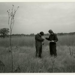
Pat Kelsey (left) and Rick Hootman soil testing in the prairie (3.4515)
Date: 1986 – 1987Type: Photographic image
Description:Pat Kelsey (left) and Rick Hootman soil testing in the prairie
Extent: 1 photograph
Topographic Map of Willoway Creek Area Along Schulenberg Prairie by K.A. Altvatter, Richard G. Hootman, and Patrick D. Kelsey [preliminary] (3.6104)
Date: 1989Creator: Allen, Kimberly
Type: Map
Description:# 810 (3.6038) is stamped PRELIMINARY, but it is a duplicate of copy 1, # 876 (3.6104) which is not marked as preliminary. Recorded # 810 as a duplicate in this record.
Extent: 1 sheet
Topographic Map of Willoway Creek Area Along Schulenberg Prairie by K.A. Altvatter, Richard G. Hootman, and Patrick D. Kelsey (3.6105)
Date: 1989Creator: Allen, Kimberly
Type: Map
Description:Individual location elevations.
Extent: 1 sheet
Topographic Map of Willoway Creek Area Along Schulenberg Prairie by K.A. Altvatter, Richard G. Hootman, and Patrick D. Kelsey [ink on mylar] (3.6106)
Date: 1989Creator: Allen, Kimberly
Type: Map
Description:Copy 3 is an ink on mylar topographic map 220 cm x 92 cm (scale is 1 inch = 20 feet).
Extent: 1 sheet
Soils Mapped on the Schulenberg Prairie of the Morton Arboretum (3.6772)
Date: 1990Creator: Hootman, Rick, Allen, Kimberly
Type: Map
Description:Key names of soil series and percent of slopes.
Extent: 1 sheet on board