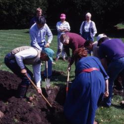
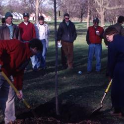
Employees digging hole for tree planting on Arbor Day (3.55578)
Date: April 1993Creator: Nachel, Jim
Type: Photographic image
Description:Employees digging hole for tree planting on Arbor Day.
Digging hole, L to R: unidentified man, Peter Wang, Craig Johnson, Susan Klatt, Dave Cascarano, Doug Monroe
Standing, L to R: Rick Hootman, unidentified woman, Helen Langrill
Extent: 1 slide

Plant Clinic staff/volunteer meeting (3.59035)
Date: September 1993Creator: Nachel, Jim
Type: Photographic image
Description:Plant Clinic staff/volunteer meeting
Clockwise around table (starting at bottom left): Rick Hootman, Merrill McNicholas, John Beckett, Bill Dreyer, Web Crowley, Ed Hedborn, Gary Watson, unidentified man, Deb Seymour, Chris Martner, Doris Taylor, Ron Picco
Extent: 1 slide
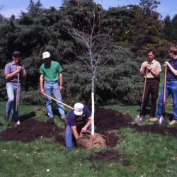
Doug Monroe removing burlap from tree for Arbor Day tree planting while employees hold shovels and watch (3.55587)
Date: April 1993Creator: Nachel, Jim
Type: Photographic image
Description:Doug Monroe removing burlap from tree for Arbor Day tree planting while employees hold shovels and watch
L to R: Allison Nesbitt, unidentified man, unidentified man, Doug Monroe, Dave Cascarano, Rick Hootman, Peter Wang
Extent: 1 slide
Undated: From George Ware to Dr. Donnelly (3.56106)
Creator: Ware, George
Type: Document
Description:Memo from George Ware to Dr. Donnelly discussing a meeting held May 20th with members of the DuPage County Forest Preserve to discuss an exchange in kind of property bordering the Hidden Lake Forest Preserve.
Extent: 1 sheet
Evaluating Vegetative Communities by Edaphic Conditions at the West Chicago Prairie, West Chicago, Illinois (3.62622)
Date: 1990Creator: Hootman, Rick, Kelsey, Pat, Lampa, Wayne
Type: Article
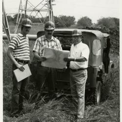
Rick Hootman (left), Pat Kelsey, and George Ware (right) in hard hats studying contour maps for future site of Crabapple Lake (3.4513)
Date: 1986 – 1987Creator: Irving, Gary
Type: Photographic image
Description:Rick Hootman (left), Pat Kelsey, and George Ware (right) in hard hats studying contour maps for future site of Crabapple Lake
Extent: 1 photograph
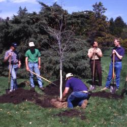
Doug Monroe removing burlap from tree for Arbor Day tree planting while employees hold shovels and watch (3.55588)
Date: April 1993Creator: Nachel, Jim
Type: Photographic image
Description:Doug Monroe removing burlap from tree for Arbor Day tree planting while employees hold shovels and watch
L to R: Allison Nesbitt, unidentified man, unidentified man, Doug Monroe, Dave Cascarano, Rick Hootman, Peter Wang
Extent: 1 slide
2000/10/23: Christo Pienaar to Rick Hootman (3.57663)
Date: October 23 2000Creator: Pienaar, Christo
Type: Document
Description:Email from Christo Pienaar of the The University of The Free Sate, South Africa asking for the email address of George H. Ware.
Extent: 1 sheet
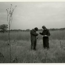
Pat Kelsey (left) and Rick Hootman soil testing in the prairie (3.4515)
Date: 1986 – 1987Type: Photographic image
Description:Pat Kelsey (left) and Rick Hootman soil testing in the prairie
Extent: 1 photograph
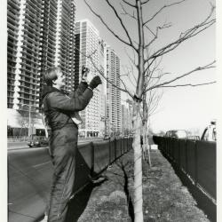
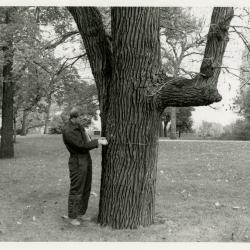
Salt study, Rick Hootman taking twig samples on Lake Shore Drive, Chicago (3.4997)
Date: February 1993Creator: Nachel, Jim
Type: Photographic image
Description:Salt study, Rick Hootman taking twig samples on Lake Shore Drive, Chicago
Extent: 1 photograph
Drainage Swale Topography and Pipeline Cross-sections Along North Edge of Tollway Berm: Centennial Grove to Crabapples (3.6100)
Date: 1989Creator: Allen, Kimberly
Type: Map
Description:Preliminary survey of swale and drain pipe along north end of tollway berms. This was modified in 1991 with the installation of drain tiles.
Extent: 1 sheet
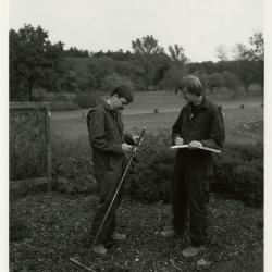
Pat Kelsey (left) and Rick Hootman soil testing in the Japanese Collection (3.4516)
Date: 1986 – 1987Creator: Irving, Gary
Type: Photographic image
Description:Pat Kelsey (left) and Rick Hootman soil testing in the Japanese Collection
Extent: 1 photograph
Drainage Swale Topography and Pipeline Cross-sections Along North Edge of Tollway Berm: Centennial Grove to Crabapples (3.6101)
Date: 1989Creator: Allen, Kimberly
Type: Map
Description:Preliminary survey of swale and drain pipe along north end of tollway berms. This was modified in 1991 with the installation of drain tiles. Copy 2 is original elevation numbers and topographic plot (3 sheets).
Extent: 3 sheets
1987/11/06: C. Lewis to G. Ware et al. (3.67074)
Date: November 6 1987Creator: Lewis, Charles A.
Type: Document
Description:Memo from Charles Lewis of the Morton Arboretum to George Ware concerning drainage problems in tree nurseries and proposed action plans.
Extent: 2 sheets
Pat Kelsey (left) and Rick Hootman soil testing in the lab (3.4517)
Date: 1986 – 1987Creator: Irving, Gary
Type: Photographic image
Description:Pat Kelsey (left) and Rick Hootman soil testing in the lab
Extent: 1 photograph
Cross-sections and Elevations of the Cactus Pit [preliminary to development of the Endangered Species Habitat] (3.6102)
Date: July 17 1989Creator: Hootman, Rick
Type: Map
Extent: 1 sheet
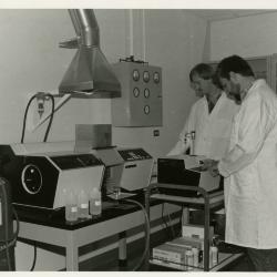
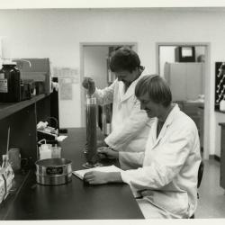
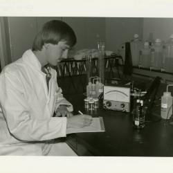
Pat Kelsey (left) and Rick Hootman using the Atomic Absorption Spectrophotometer to test for heavy metal and salt contaminants in the lab (3.4518)
Date: 1980sCreator: Kohout, John
Type: Photographic image
Description:Pat Kelsey (left) and Rick Hootman using the Atomic Absorption Spectrophotometer to test for heavy metal and salt contaminants in the lab
Extent: 1 photograph
Visitor Center Parking Lot [topographic] Survey (3.5271)
Date: March 20 1989Creator: Hootman, Rick
Type: Map
Extent: 1 sheet
Kris Bachtell and Patti Jelen shoveling soil over newly planted tree at Arbor Day employee tree planting (3.55667)
Date: April 1996Creator: Hootman, Rick
Type: Photographic image
Description:Kris Bachtell and Patti Jelen shoveling soil over newly planted tree at Arbor Day employee tree planting. George Ware far left, Peter van der Linden in green hat, Carol Doty in beige jacket, Becky Monroe in blue jacket.
Extent: 1 slide
Proposed, Initial, and Final Grades Along Crabapple Lake Swale (3.6103)
Date: July 1989Creator: Allen, Kimberly
Type: Map
Extent: 1 sheet
Urban Vegetation Laboratory Newsletter Volume 1, Number 1, Spring 1988 (3.67125)
Date: 1988Creator: Irving, Gary
Type: Document
Description:Text only content for a newsletter titled Urban Vegetation Laboratory Newsletter for the Morton Arboretum in Lisle, Illinois. The document also contains a history of the laboratory's objectives, facilities, and personnel.
Extent: 11 sheets
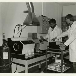
Pat Kelsey (left) and Rick Hootman using the Atomic Absorption Spectrophotometer to test for heavy metal and salt contaminants in the lab (3.4519)
Date: 1980sCreator: Kohout, John
Type: Photographic image
Description:Pat Kelsey (left) and Rick Hootman using the Atomic Absorption Spectrophotometer to test for heavy metal and salt contaminants in the lab
Extent: 1 photograph
South Farm Land Use [and topographic survey] (3.5273)
Date: February 13 1989Creator: Kelsey, Pat
Type: Map
Description:First issued Dec.30,1988 showing the South Farm area and building layout; the collection lacks this issuance. Collection has issuance dated Feb.13,1989 on which true elevation points determined upon by Richard G. Hootman have been added. A subsequent copy of the map (3.5275) showing additions dated February 14, 1989 and March 3, 1989 is also represented in the collections. Contour lines linking elevation points and benchmark indicators were added by P.D.Kelsey under date of Feb. 14 and a subsurface drainage installation was added by R.G.Hootman under date of March 3.
Extent: 1 sheet
Topographic Map of Willoway Creek Area Along Schulenberg Prairie by K.A. Altvatter, Richard G. Hootman, and Patrick D. Kelsey [preliminary] (3.6104)
Date: 1989Creator: Allen, Kimberly
Type: Map
Description:# 810 (3.6038) is stamped PRELIMINARY, but it is a duplicate of copy 1, # 876 (3.6104) which is not marked as preliminary. Recorded # 810 as a duplicate in this record.
Extent: 1 sheet
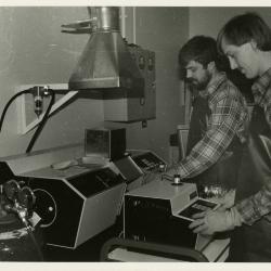
Soil scientists, Pat Kelsey (left) and Rick Hootman, at work in lab (3.4523)
Date: 1980sType: Photographic image
Description:Soil scientists, Pat Kelsey (left) and Rick Hootman, at work in lab
Extent: 1 photograph
South Farm Land Use [and topographic survey] (3.5275)
Date: February 14 – March 3 1989Creator: Kelsey, Pat
Type: Map
Description:First issued Dec.30,1988 showing the South Farm area and building layout; the collection lacks this issuance. Collection has issuance dated Feb.13,1989 on which true elevation points determined upon by Richard G. Hootman have been added. This copy of the map also shows additions dated February 14, 1989 and March 3, 1989 is also represented in the collections. Contour lines linking elevation points and benchmark indicators were added by P.D.Kelsey under date of Feb. 14 and a subsurface drainage installation was added by R.G.Hootman under date of March 3.
Extent: 1 sheet
Recent and Proposed Conservation Projects of The Morton Arboretum (3.5891)
Date: January 1991Creator: Hootman, Rick
Type: Map
Description:Map developed for a grant proposal to the Institute of Museum Services (IMS).
Includes key for proposed project areas, recent projects identifies areas of open water and marsh.
Proposed Project Areas: 1)Fischer Research Tract 2) Pin Oak Collection 3) Planted Berms 4) Honey Locust, Green Ash, Tulip Tree, American Elm Collections
Recent Projects: Conservation Nursery (1984), Ecosystems Survey (1985), East Woods, Prairie, Soil Survey (1986)
Extent: 1 sheet
Topographic Map of Willoway Creek Area Along Schulenberg Prairie by K.A. Altvatter, Richard G. Hootman, and Patrick D. Kelsey (3.6105)
Date: 1989Creator: Allen, Kimberly
Type: Map
Description:Individual location elevations.
Extent: 1 sheet
1992 Annual Report, Research Group (3.81725)
Date: 1992Type: Document
Description:Annual report for the Research Group of the Morton Arboretum which contains a mission statement, group structure, chronology of events, interactions, priorities, and strengths and weaknesses.
Extent: 8 sheets
Rick Hootman in the laboratory (3.4525)
Date: 1988Type: Photographic image
Description:Rick Hootman in the laboratory
Extent: 1 photograph
Topographic Map of Willoway Creek Area Along Schulenberg Prairie by K.A. Altvatter, Richard G. Hootman, and Patrick D. Kelsey [ink on mylar] (3.6106)
Date: 1989Creator: Allen, Kimberly
Type: Map
Description:Copy 3 is an ink on mylar topographic map 220 cm x 92 cm (scale is 1 inch = 20 feet).
Extent: 1 sheet
Chemical Deicers and the Environment (1.10299)
Date: 1992Creator: Kelsey, Pat, Hootman, Rick
Type: Book
Rick Hootman doing tree inventory at Northwestern University (3.4529)
Date: 1987Type: Photographic image
Description:Rick Hootman doing tree inventory at Northwestern University
Extent: 1 photograph
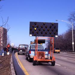
Salt Study, Pat Kelsey and Rick Hootman in median next to vehicles and caution sign along Lake Shore Drive (3.58916)
Date: February 1993Creator: Nachel, Jim
Type: Photographic image
Description:Salt Study, Pat Kelsey and Rick Hootman in median next to vehicles and caution sign along Lake Shore Drive
Extent: 1 slide
[Elevation Bench Marks on the Arboretum] (3.6110)
Date: May 1 1992Creator: Hootman, Rick
Type: Map
Description:Base map is a 1990 aerial photo of the Morton Arboretum prepared by the Sidwell Company of West Chicago, IL. Includes an 8.5"x11" sheet providing exact benchmark locations and elevations.
Extent: 5 sheets in binder

Collaborative researchers from Northern Illinois University and Arboretum staff study root-system-nutrient interrelationships (3.4530)
Date: 1982 – 1983Creator: Kohout, John
Type: Photographic image
Description:Collaborative researchers from Northern Illinois University and Arboretum staff study root-system-nutrient interrelationships
Bottom left to right: Mike Duet, Mike Connor, Rick Hootman
Extent: 1 photograph