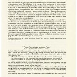
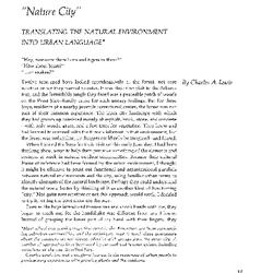
“Nature City”: Translating the Natural Environment into Urban Language (3.10714)
Date: June 21 – September 20 1975Creator: Lewis, Charles A.
Type: Article
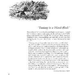
“Fantasy in a Wood-Block” (3.10680)
Date: March 21 – June 20 1974Creator: Doty, Carol L.
Type: Article
[Visitor] Center Stair Fence Detail (3.6883)
Date: November 14 1978Creator: Tyznik, Anthony, Tyznik, Anthony
Type: Plan
Extent: 1 sheet
[Visitor Center, Audio-Visual Building, the Morton Arboretum] (3.5567)
Date: December 21 1970 – May 16 1972Creator: Myhrum, Arthur
Type: Plan
Description:Site plan, building layout, and audio-visual plans.
Extent: 6 sheets, stapled
[Visitor Center at the Morton Arboretum: Site Plans] (3.5554)
Date: July 21 1970 – March 31 1971Creator: Myhrum, Arthur
Type: Plan
Extent: 8 sheets
[South Dakota general highway maps] (3.6547)
Date: 1970 – 1976Creator: South Dakota Department of Transportation, Office of System Analysis
Type: Map
Description:Maps of various counties or parts of counties in western South Dakota.
Extent: 25 sheets
[Sketchbook] [graphic] / A. Olson. (3.24212)
Date: 1970Creator: Olson, Amanda, 1897-1972.
Type: Drawing
Extent: 1 sketchbook (6 drawings) : graphite 23 x 26 cm.
[Sanitary Sewer Along Route 53: Application for Permit] (3.5580)
Date: 1972 – 1977Creator: Clark, Dietz & Associates, Engineers, Inc.
Type: Map
Description:This item comprises correspondence, documents, and schematic drawings prepared variously between 1972 and 1977.
Extent: 6 sheets, paperclipped
[Remodeling plans and details for the Hall residence] (3.6861)
Date: June 1972Creator: Tyznik, Anthony
Type: Plan
Description:Structure sometimes referred to as the Slusser residence, located in the southwestern portion of the Arboretum, occupied in 1972 by Dr. Marion T. Hall.
Several sheets are unlabeled and are questionable in their assignment to this project.
The house was razed in 2001.
Extent: 10 sheets
[Prospectus for] Thistles and thorns [graphic] / Paul Smyth, [illuminated by] Barry Moser. (3.26613)
Date: 1976Creator: Moser, Barry.
Type: Print
Extent: 1 print : wood engraving, b&w plate mark 9 x 7 cm., on sheet 18 x 24 cm., folded to two leaves and 4 pages, 18 x 12 cm.
[Prospectus for the Basilisk Press facsimile of The Kelmscott Chaucer] (3.31066)
Date: circa 1974Type: Painting
Extent: 2 leaves [4 p.] : ill. 43 x 29 cm.
[Prospectus for Botanical drawings by Graham Rust] (3.31065)
Date: 1979Type: Painting
Extent: 2 leaves [4 p.] : ill., colored 46 x 35 cm.
[Planting plans for Courtland Street and Palmer Street [cartographic material] / O.C. Simonds]. (3.24871)
Date: 20th centuryCreator: Simonds, O. C.
Type: Plan
Extent: 1 plan 98 x 37 cm.
[Planting map of Schulenberg Prairie] - possibly done by Ray Schulenberg? (3.6816)
Date: circa 1971Type: Map
Description:Planting dates and methods labeled in ink
Extent: 1 sheet in framed cardboard mount
[Oblique aerial photograph of the east half of the Morton Arboretum] (3.6017)
Date: January 12 1973Creator: Airpix
Type: Photographic image
Extent: 1 sheet
[North Dakota general highway maps] (3.6548)
Date: 1975 – 1977Creator: North Dakota State Highway Department, Transportation Services Division
Type: Map
Description:Maps of 13 counties or parts of counties
Extent: 23 sheets
[New phone lines under Rte. 53] (3.6880)
Date: October 22 1971Creator: Illinois Bell Telephone Company
Type: Map
Description:Attached sheet: "Supplement to work order"
Extent: 1 sheet
[Morton Arboretum Research Building] (3.6385)
Date: August 17 – 23 1979Creator: Keiser Associates
Type: Plan
Description:Building sections A and B; Stair tower No. 1 and 2; Details; East and west elevations; North and south elevations; Roof plan; Room finish schedule; [untitled elevation]
Extent: 8 sheets
[Montana County highway maps] (3.6549)
Date: 1976Creator: State of Montana Department of Highways, Planning and Research Bureau
Type: Map
Description:20 counties. City maps included.
Extent: 20 sheets
[Indiana topographic maps] (3.6554)
Date: 1960 – 1973Creator: Geological Survey (U.S.)
Type: Map
Description:7.5 minute series. Sheet 1 - Illiana Heights Quadrangle. Sheet 2-3 - Mongo Quadrangle. Sheet 4-5 - Orland Quadrangle. Sheet 6 - Wakarusa Quadrangle.
Extent: 6 sheets
[Glenbard] South Regional Interceptor Plan & Profile, Sta. 90 to Sta. 114 (3.5579)
Date: October 17 1977Creator: Clark, Dietz & Associates, Engineers, Inc.
Type: Map
Description:Sheets contain revisions made in April 1978. Sewer installations along Route 53 are shown.
Only drawing no. 6 [and 7] of 17 are included.
Includes cover letter.
Extent: 2 sheets paperclipped, plus cover letter
[Geographic Collections, Morton Arboretum] (3.6638)
Date: December 21 1978 – January 19 1979Creator: Flexman, Nancy
Type: Plan
Description:Plant names identified along with grid location
Sheet 1: Taxodium Swamp, Caucasus Collection
Sheet 2: Caucaus Collection, Balkan Collection
Sheet 3: Balkan Collection
Sheet 4: Balkan Collection, Larix Collection
Sheet 5: Japanese Island
Sheet 6: Japanese Island
Sheet 7: Japanese Island, Chinese Collection
Sheet 8: Japanese Island, Chinese Collection
Sheet 9: Chinese Collection
Sheet 10: Chinese Collection
Sheet 11: Chinese Collection, Caucasus Collection
Sheet 12: Chinese Collection, Taxodium Swamp
Extent: 12 sheets
[Artist's Conceptions & Floor Plans for the Visitor Center, Morton Arboretum] (3.5553)
Date: July 21 1970 – July 31 1971Creator: Myhrum, Arthur
Type: Plan
Extent: 4 sheets, stapled
[Arboretum - Southwest Section of East Side] (3.6577)
Date: circa 1978Type: Plan
Description:Administration Building proposed additions added in pencil. Collections labeled in ink. Date hint: East-West Tollway is marked Illinois 5.
Extent: 1 sheet
[Aerial photograph of the west half of the Morton Arboretum] (3.6016)
Date: October 17 1970Type: Photographic image
Description:The four photos, taken as stereo pairs, are numbered 3, 4, 5, and 6 and extend from Leask Lane to Route 53.
Extent: 4 sheets
[Aerial photograph of the Schulenberg Prairie] (3.92340)
Date: October 17 1970Type: Photographic image
Description:Two aerial images of the Schulenberg Prairie area. One photograph is black and white. One photograph is in color.
Extent: 2 sheets
[Aerial Photograph of the Morton Arboretum, sectional enlargements] (3.6562)
Date: circa 1977Type: Photographic image
Description:These photographs are a sectional enlargement of the Street Trees Collection appearing in the larger photograph, an area ca. one-quarter mile square located south of the King's Grove area. Copies 4, 5, 6 from vault 2/99.
Collections A
Extent: 3 sheets
[Aerial Photograph of the Morton Arboretum, sectional enlargements] (3.5423)
Date: circa 1977Type: Photographic image
Description:These photographs are a sectional enlargement of the Street Trees Collection appearing in the larger photograph, an area ca. one-quarter mile square located south of the King's Grove area.
In marker on back: "TA File # D322. Geo. Ware has prints from color transparencies. Dr. Virgil Howe @ Wn/Illinois (?) has original Infra-red positive transparencies (9 x 9). TMA has set of copy 35mm from early summer 1977 (Street Trees)."
Extent: 2 sheets
[Aerial Photograph of the Morton Arboretum, original screened photograph] (3.6560)
Date: circa 1977Type: Photographic image
Description:Collection has enlargement of the Street Trees Collection (28x35 cm.) appearing in the larger photograph, an area ca. one-quarter mile square located south of the King's Grove area. Copies 4, 5, 6 from vault 2/99.
In pencil on outside of envelope: "Morton Arboretum Original Screened Photograph From Infra-red Mock up." "Do Not Remove From Drawer" "Do Not Mark Upon"
Collections A
Extent: 2 sheets
[Aerial Photograph of the Morton Arboretum, infrared] (3.6561)
Date: circa 1977Type: Photographic image
Description:Infrared photo. Collection has enlargement of the Street Trees Collection (28x35 cm.) appearing in the larger photograph, an area ca. one-quarter mile square located south of the King's Grove area. Copies 4, 5, 6 from vault 2/99.
Written in ink on envelope: "IR Color Contact Prints"
Collections A
Extent: 7 sheets
[Aerial Photograph of the Morton Arboretum, full] (3.5421)
Date: circa 1977Type: Photographic image
Description:Collection has enlargement of the Street Trees Collection (28x35 cm.) appearing in the larger photograph, an area ca. one-quarter mile square located sourth of the King's Grove area.
This object is the full aerial photograph.
Extent: 1 sheet
[Aerial Photograph of a Portion of the East Half, the Morton Arboretum] (3.5424)
Date: November 7 1974Type: Photographic image
Description:"Photographed from 9,600 feet." Shows the area from Route 53 eastwards through the King's Grove. Grid crosses set out on the ground are visible in the photo. The collection's photograph is an enlargement of one displayed on the second floor of the Administration Building.
Extent: 1 sheet
[Aerial photo of sections of The Morton Arboretum] (3.6274)
Date: 1975Creator: Chicago Aerial Survey Co.
Type: Map
Description:Survey includes northwest portion of Arboretum (1" = 400') and "Johnson Farm" and Hidden Lake area. One photo by Chicago Aerial Survey, second photo unknown. "Johnson Farm" includes partial topographic overlay and boundaries of "existing holdings and proposed acquisitions."
Extent: 2 sheets
[A Landscape Development Plan for a Rose and Water Garden, untitled variation] (3.6464)
Date: September 22 1978Creator: Tyznik, Anthony
Type: Plan
Description:Note on back: "Flower Show 1978"
Extent: 1 sheet
Young ferns [graphic] / Clare Leighton. (3.26525)
Date: 20th centuryCreator: Leighton, Clare, 1898-1989.
Type: Print
Extent: 1 print : wood engraving, b&w 17 x 13 cm.