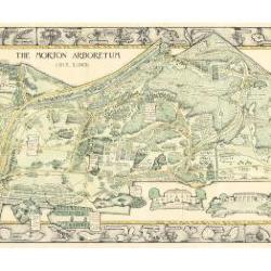
Morton Arboretum Map (3.19479)
Date: 1943Creator: Watts, May Theilgaard
Type: Map
Description:2014 reprint of The Morton Arboretum's first color map, circa 1943.
Detailed map of Arboretum grounds, showing roads, paths, landscaping, shelters, structures, enlargement of some specific features, hedge garden, some specific trees, and trails with markers numbered 1 - 42. Other features include a scale, a calendar, and a compass rose consisting of directions depicted with leaves. A highly ornamental border includes grid marks, as well as drawings of animal tracks and detailed drawings and labels of plants. The Morton Arboretum encompassed 813 acres at time of map.
Extent: 1 sheet

Morton Arboretum Map (3.19481)
Date: 1943Creator: Watts, May Theilgaard
Type: Map
Description:Detailed map of Arboretum grounds, showing roads, paths, landscaping, shelters, structures, enlargement of some specific features, hedge garden, some specific trees, and trails with markers numbered 1 - 42. Other features include a scale, a calendar, and a compass rose consisting of directions depicted with leaves. A highly ornamental border includes grid marks, as well as drawings of animal tracks and detailed drawings and labels of plants. Some replacement illustration and text has been adhered to the map. The Morton Arboretum encompassed 813 acres at time of map. One section is partially missing.
Extent: 1 sheet

Evergreen Nature Trail Guide, page 2 illustrations and layout with preliminary sketches (3.24676)
Date: 1940sCreator: Watts, May Theilgaard
Type: Drawing
Description:Sheet One: Original illustrations and layout for page 2 (inside front cover), excluding text, for The Morton Arboretum Evergreen Nature Trail Guide booklet. Key lines included.
Introductory page to trail guide, including map of the trail's location on Arboretum grounds near parking lot 2. Map header text "LOCATION OF EVERGREEN NATURE TRAIL in the Arboretum" points arrow to Evergreen Nature Trail on map. Thornhill Building and Administration Building identified in map for reference to trail location on grounds.
Map also identifies 2 other trails in the Arboretum:
Thornhill Trail - identified by circles located near Thornhill Building
Forest Trail - identified by crosses in far right section of the map
Sheet Two: Preliminary sketch of green-colored map with page number and various ink lines.
Extent: 2 sheets
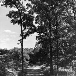
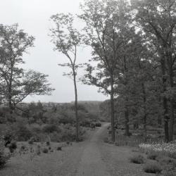
Joy Path looking south (3.2975)
Date: 1942Creator: Miller, W. L.
Type: Photographic image
Description:Joy Path looking south
Extent: 1 photograph
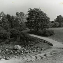
Meadow Lake walk near Visitor Center (3.3008)
Type: Photographic image
Description:Meadow Lake walk near Visitor Center
Extent: 1 photograph


Geographic Trail Entrance (3.3021)
Type: Photographic image
Description:Geographic Trail Entrance
Extent: 1 photograph

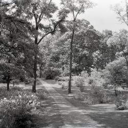
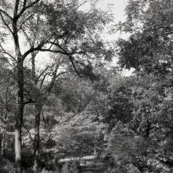
Path Through Woods In Summer (3.3086)
Date: 1933Creator: Streator, Sidney V.
Type: Photographic image
Description:Path Through Woods In Summer
Extent: 1 photograph
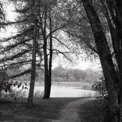
Meadow Lake along Illinois Trees Trail Loop (3.31782)
Date: 1969Type: Photographic image
Description:Meadow Lake along Illinois Trees Trail Loop
Extent: 1 negative
Core Area Update Planting Plan (3.31989)
Date: October 2 2003Creator: Pelkonen, Peggy
Type: Plan
Description:Update planting plan for Core Area, including areas near Arboretum entrance drive, Visitor Center, Meadow Lake, and parking areas
Extent: 2 sheets
Core Area Irrigation Plan (3.31996)
Date: March 24 2004Creator: Pelkonen, Peggy
Type: Plan
Description:Irrigation plan for Core Area, including areas near Arboretum entrance drive, Visitor Center, Meadow Lake, and parking areas
Extent: 5 sheets
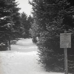
Evergreen Trail covered in snow, first post sign from trail guide on right (3.33267)
Date: 1940sType: Photographic image
Description:Evergreen Trail covered in snow, first post sign from trail guide on right
Extent: 1 negative
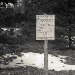
Evergreen Trail sign for post 21 from trail guide, Japanese White Pine (3.33268)
Date: 1940sType: Photographic image
Description:Evergreen Trail sign for post 21 from trail guide, Japanese White Pine
Extent: 1 negative
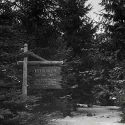
Evergreen Nature Trail entrance sign (3.33269)
Date: 1940sType: Photographic image
Description:Evergreen Nature Trail entrance sign in winter
Extent: 1 negative
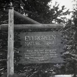
Evergreen Nature Trail entrance sign, close view (3.33270)
Date: 1940sType: Photographic image
Description:Evergreen Nature Trail entrance sign, close view
Extent: 1 negative

Footprints in snow path along west end Lake Marmo (3.33280)
Type: Photographic image
Description:Footprints in snow path along west end Lake Marmo
*located at about 11-T on Arboretum map/grid
Extent: 1 negative

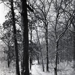
Hatch Woods main trail in winter (3.33290)
Date: 1930sType: Photographic image
Description:Hatch Woods main trail in winter
Extent: 1 negative
European group west of DuPage River and east of Simonds Road (3.33291)
Date: 1930sType: Photographic image
Description:European group west of DuPage River and east of Simonds Road
Extent: 1 negative
Gulch Trail as it intersects with Blackberry Trail (3.33292)
Date: 1933Type: Photographic image
Description:Gulch Trail as it intersects with Blackberry Trail
Extent: 1 negative
Thornhill residence grounds along Iris Path, man near iris plantings (3.33293)
Date: 1930sType: Photographic image
Description:Thornhill residence grounds along Iris Path, man near iris plantings
Extent: 1 negative
Thornhill residence grounds along Iris Path (3.33294)
Date: 1932Type: Photographic image
Description:Thornhill residence grounds along Iris Path
Extent: 1 negative
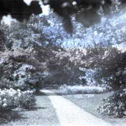
Joy Path alongside peonies (3.33295)
Type: Photographic image
Description:Joy Path alongside peonies
Extent: 1 negative
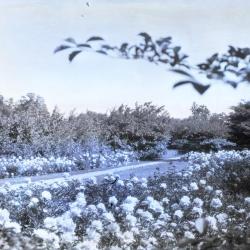
Joy Path through peonies in bloom (3.33296)
Type: Photographic image
Description:Joy Path through peonies in bloom
Extent: 1 negative
Joy Path looking north toward man on path in the distance (3.33297)
Type: Photographic image
Description:Joy Path looking north toward man on path in the distance
Extent: 1 negative
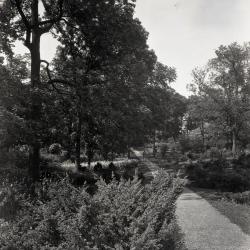
Joy Path, south of Thornhill residence (3.33298)
Type: Photographic image
Description:Joy Path, south of Thornhill residence
Extent: 1 negative
Joy Path, early spring (3.33299)
Type: Photographic image
Description:Joy Path, early spring
Extent: 1 negative
Joy Path, early spring with iris in bloom on right side (3.33300)
Date: June 1 1931Type: Photographic image
Description:Joy Path, early spring with iris in bloom on right side
Extent: 1 negative
Joy Path with two tall trees along path opposite each other (3.33301)
Date: June 1931Type: Photographic image
Description:Joy Path with two tall trees along path opposite each other
Extent: 1 negative
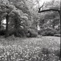
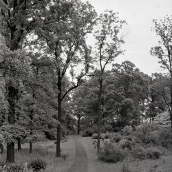
Joy Path through grass in Sargents Glade (3.33302)
Type: Photographic image
Description:Joy Path through grass in Sargents Glade
Extent: 1 negative
Joy Path in winter, south end (3.33303)
Date: 1930 – 1949Type: Photographic image
Description:Joy Path in winter, south end
Extent: 1 negative
Joy Path through native hawthorns (3.33304)
Type: Photographic image
Description:Joy Path through native hawthorns
Extent: 1 negative

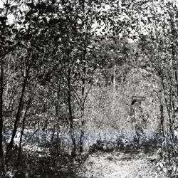
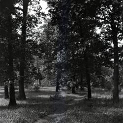
Joy Path through woods (3.33305)
Type: Photographic image
Description:Joy Path through woods
Extent: 1 negative
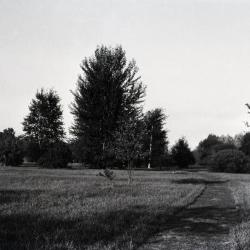
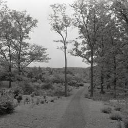
Area of trees near Joy Path (3.33306)
Date: 1930 – 1949Type: Photographic image
Description:Area of trees near Joy Path
Extent: 1 negative
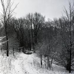
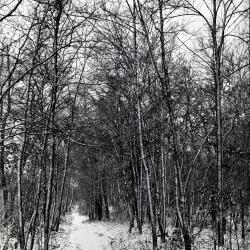
Trail in winter (3.33437)
Date: 1930 – 1949Type: Photographic image
Description:Trail in winter covered with light snow
Extent: 1 negative
Trail in winter, east side (3.33438)
Date: 1930 – 1949Type: Photographic image
Description:Trail in winter covered with light snow, east side
Extent: 1 negative
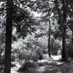
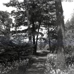
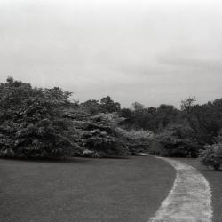
Trail in summer near Thornhill residence, west side (3.33441)
Date: 1930 – 1949Type: Photographic image
Description:Trail in summer near Thornhill residence, west side
Grassy path through trees
Extent: 1 negative