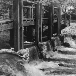
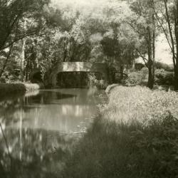
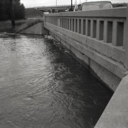
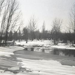
Bridge and dam across DuPage River (west branch) (3.2979)
Date: 1950sCreator: Miller, W. L.
Type: Photographic image
Description:Bridge and dam across DuPage River (west branch)
Bridge and dam with gates designed by Clarence Godshalk to control water level of Lake Jopamaca.
Replaced the artificial concrete & stone rapids built in 1930's. This bridge/gate taken out around 1980
Extent: 1 photograph
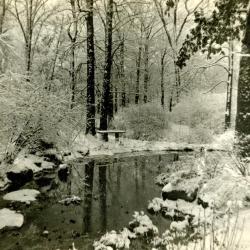
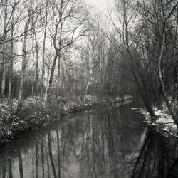
Winter - Morton Arboretum (3.2981)
Creator: Baker, W. H.
Type: Photographic image
Description:DuPage River in Winter - Morton Arboretum
Extent: 1 photograph
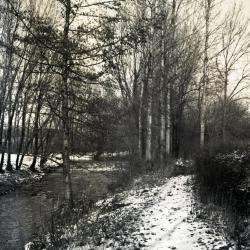
DuPage River winter scene (3.2986)
Date: 1940Creator: Andersen, Howard
Type: Photographic image
Description:DuPage River winter scene
Won Third Prize -1940 Photographic Contest
Extent: 1 photograph
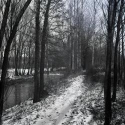
DuPage River winter scene (3.2992)
Type: Photographic image
Description:DuPage River winter scene
Extent: 1 photograph
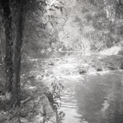
The Waterfall (3.3031)
Date: 1930sCreator: Hartshorn, Ken
Type: Photographic image
Description:The Waterfall - the rapids built in DuPage River to raise water level in Lake Jopamaca. These were made from concrete with stones set in while soft. Later replaced by dam with gates to control water level. Used to see large northern pike go up over the rapids in Spring
Extent: 1 photograph
Looking southwest from bridge over DuPage River toward Lake Jopamaca (3.3040)
Date: October 1941Type: Photographic image
Description:Looking southwest from bridge over DuPage River toward Lake Jopamaca
Extent: 1 photograph

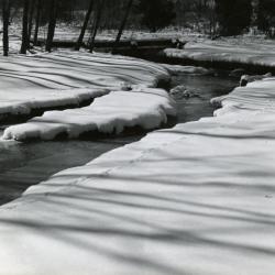
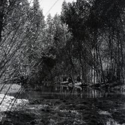
Winter snowy DuPage River (3.3041)
Type: Photographic image
Description:Winter snowy DuPage River
Extent: 1 photograph

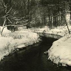
DuPage River running through snow-covered landscape (3.3042)
Type: Photographic image
Description:DuPage River running through snow-covered landscape
Extent: 1 photograph

DuPage River looking east toward old iron bridge and old Rt.53 from Sunfish Pond (3.3047)
Type: Photographic image
Description:DuPage River looking east toward old iron bridge and old Rt.53 from Sunfish Pond
Extent: 1 photograph
Concrete bridge over DuPage River, looking north (3.3050)
Date: 1920sCreator: Melton, W.
Type: Photographic image
Description:Concrete bridge over DuPage River, looking north, before metal railings were installed
Extent: 1 photograph
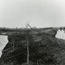
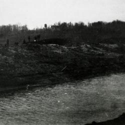
Ozarks first planting alongside nearly constructed Lake Jopamaca, DuPage River to the right (3.3070)
Date: March 21 – June 20 1922Type: Photographic image
Description:Looking north at Ozarks first planting alongside nearly constructed Lake Jopamaca, DuPage River to the right
Extent: 1 photograph

Man on tree over DuPage River (3.3090)
Date: 1933Creator: Streator, Sidney V.
Type: Photographic image
Description:Man on tree over DuPage River
Extent: 1 photograph

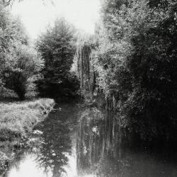
Weeping willow over lazy DuPage River (3.3091)
Date: 1933Creator: Streator, Sidney V.
Type: Photographic image
Description:Weeping willow over lazy DuPage River
Extent: 1 photograph
Lunching & Learning with Clarence Godshalk: Evolution of the Arboretum - From Farm to Arboretum (3.31582)
Date: January 25 1978Type: Audio
Description:Lunching and Learning program presented by Clarence Godshalk as he describes the evolution of the Arboretum, from farm land to Arboretum.
Extent: 1 audio cassette
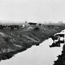
Lisle Farms registered Holstein cattle in and around a section of the DuPage River after it was straightened in 1921 (3.31740)
Date: 1920 – 1939Type: Photographic image
Description:Lisle Farms registered Holstein cattle in and around a section of the DuPage River after it was straightened in 1921
Extent: 1 negative

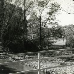
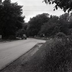
Road leading up to bridge over DuPage River looking northwest (3.31939)
Date: circa 1935Type: Photographic image
Description:Road leading up to bridge over DuPage River looking northwest
Extent: 1 photograph
Route 53 bridge over DuPage River from north of Park Blvd. (3.33213)
Date: April 1959Creator: Gall, Richard
Type: Photographic image
Description:Route 53 bridge over DuPage River from north of Park Blvd.
Extent: 1 negative
Route 53 bridge over DuPage River and curve in road looking north (3.33215)
Date: April 1959Creator: Gall, Richard
Type: Photographic image
Description:Route 53 bridge over DuPage River and curve in road looking north
Extent: 1 negative
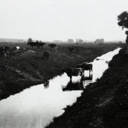
DuPage River just after dredging with cattle (3.33519)
Date: 1920Type: Photographic image
Description:DuPage River just after dredging with cattle, north of the Arboretum
Extent: 1 negative filmstrip
DuPage River, north of the Arboretum, just after dredging (3.33520)
Date: 1920Type: Photographic image
Description:DuPage River, north of the Arboretum, just after dredging
Thornhill residence in background
Extent: 1 negative filmstrip
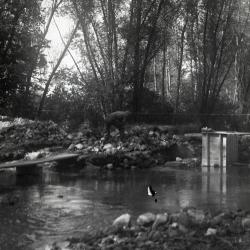
DuPage River, looking south from bridge (3.33524)
Date: 1930sType: Photographic image
Description:DuPage River, looking south from bridge
Extent: 1 negative filmstrip
Rapids built in DuPage River to raise water level in Lake Jopamaca (3.33532)
Date: 1922Type: Photographic image
Description:First rapids built in DuPage River to raise water level in Lake Jopamaca, made of sod, fence wire, etc. (the rapids did not last)
Extent: 1 negative filmstrip
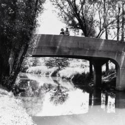
Woman and man on concrete bridge over DuPage River (3.33533)
Date: 1930sType: Photographic image
Description:Woman and man on concrete bridge over DuPage River
Concrete rail later replaced by present metal rail designed by Holabird & Root
Extent: 1 negative filmstrip

Two men and a woman on concrete bridge over DuPage River (3.33534)
Date: 1930sType: Photographic image
Description:Two men and a woman on concrete bridge over DuPage River
Concrete rail later replaced by present metal rail designed by Holabird & Root
Extent: 1 negative filmstrip

DuPage River looking north, stereograph (3.33535)
Date: 1930sType: Photographic image
Description:DuPage River looking north, stereograph
Extent: 1 stereograph
Old Route 53 two lane bridge over DuPage River (3.33537)
Date: 1960sType: Photographic image
Description:Old Route 53 two lane bridge over DuPage River
New highway bridge being built in background
Extent: 1 negative filmstrip
DuPage River looking north (3.33540)
Type: Photographic image
Description:DuPage River looking north
*located at about 39-V on Arboretum map/grid
Extent: 1 negative
East side DuPage River path in winter looking north (3.33541)
Type: Photographic image
Description:East side DuPage River path in winter looking north
*located at about 25-I on Arboretum map/grid
Extent: 1 negative
East side DuPage River path in winter looking north (3.33542)
Type: Photographic image
Description:East side DuPage River path in winter looking north
*located at about 25-I on Arboretum map/grid
Extent: 1 negative
Looking northwest from DuPage River dam in winter (3.33551)
Type: Photographic image
Description:Looking northwest from DuPage River dam in winter
*located at about 25-J on Arboretum map/grid
Extent: 1 negative
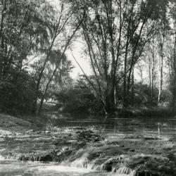
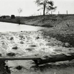
DuPage River rapids (3.33560)
Date: 1930 – 1949Type: Photographic image
Description:DuPage River rapids built to raise water level in Lake Jopamaca
Extent: 1 negative
DuPage River dam and rapids (3.33561)
Date: 1934Type: Photographic image
Description: DuPage River dam and rapids built to raise water level in Lake Jopamaca
Extent: 1 negative
DuPage River dam and rapids (3.33562)
Date: 1934Type: Photographic image
Description:DuPage River dam and rapids built to raise water level in Lake Jopamaca
Extent: 1 negative
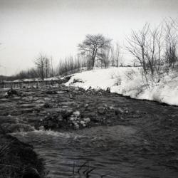
First DuPage River dam in winter (3.33563)
Date: 1923 – 1925Type: Photographic image
Description:First DuPage River dam, a rapid of rocks and concrete with no way to control water level to Lake Jopamaca
Extent: 1 negative
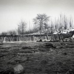
First DuPage River dam, closer view of waterfall (3.33564)
Date: 1923 – 1925Type: Photographic image
Description:First DuPage River dam, a rapid of rocks and concrete with no way to control water level to Lake Jopamaca
Extent: 1 negative
DuPage River dam, construction (3.33565)
Type: Photographic image
Description:Construction of DuPage River dam, with gates to control water level to Lake Jopamaca
Dam torn out in 1982
Extent: 1 negative