Browsing by Subject/Keyword: year:

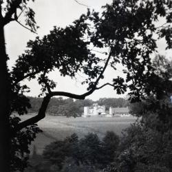
Lookout along Ridge Road above Geographic Groups (3.32762)
Date: 1922 – 1949Type: Photographic image
Description:Lookout along Ridge Road above Geographic Groups, Rogers Farm in the distance
Extent: 1 negative
Rogers Farm on Park Blvd. as viewed through trees from Ridge Road (3.32765)
Date: 1922 – 1949Type: Photographic image
Description:Rogers Farm on Park Blvd. as viewed through trees from Ridge Road
Extent: 1 negative
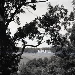
Rogers Farm on Park Blvd. viewed through trees from Ridge Road (3.32766)
Date: 1922 – 1949Type: Photographic image
Description:Rogers Farm on Park Blvd. viewed through trees from Ridge Road
Extent: 1 negative
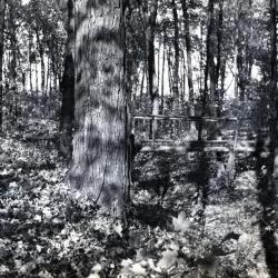
First ravine path bridge, Schultz Woods (3.33289)
Date: 1920sType: Photographic image
Description:First ravine path bridge, Schultz Woods
Extent: 1 negative
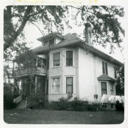
South Farm house, originally Jeffrey Farm residence (3.38235)
Date: 1922Type: Photographic image
Description:South Farm house, originally Jeffrey Farm residence (built 1917). In 1921, Clarence Godshalk lived there with Wyllie family in room over bay. Later Senn's, then Van Gemert's lived there. Cookhouse for workers was in basement. House was torn down. Fireplace smoked upstairs and down.
Extent: 1 photograph
Thomas H. Slusser Farm, Wheaton, Illinois (3.5287)
Date: 1920sCreator: Steinbrecher, Harold F.
Type: Map
Description:Shows a portion only of Slusser properties which bordered on Leask Lane to the west and on Thornhill Farm to the east. The area shown was subsequently purchased by the Arboretum.
Extent: 1 sheet
Morton Arboretum [development and land acquisitions] (3.5288)
Date: 1920sType: Map
Description:A schematic drawing showing principal land tracts and ownership within the projected boundaries of the Arboretum.
Extent: 1 sheet