Skip to main content
User Options
Toggle navigation
Login
Register
Login
Register
About
Help
Browse
Browse
Search
Featured
Collections
Filter by
has image
Digitized
Not yet digitized
object type
Maps
Photographic images
people, organizations and landmarks
Slusser, Thomas H.
South Farm
Steinbrecher, Harold F.
language
English
collection
The Morton Arboretum Records
Subject/Keyword
Arbor Farm
Arboretum Bodies of Water
Arboretum development and land acquisitions
Arboretum Farm Land and Surrounding Property
Arboretum Residential Housing
Arboretum Roads
Arboretum, East Side
Benches
Bridges
Dwellings
Geographic Collections
Greenhouses
Home Farm
Jeffrey Farm
Lacy Farm
Land tenure
Leask Lane
Lisle Township
Milton Township
Plat Surveys
Puffer Lake
Puffer Land
Ravines
Ridge Road
Rogers Farm
Scenic overlooks
Schultz Land
Slusser Farm
South Farm
Thornhill Farm
Thornhill Residence Grounds
Water towers
and 25 more
Objects
(9 results)
Add selected results to lightbox
Sort By:
Identifier
Identifier
Title
Date
Rank
Sort Order:
Ascending
Ascending
Descending
View:
images
images
list
Browsing by
Subject/Keyword:
Arboretum Farm Land and Surrounding Property
year:
1924
Start Over
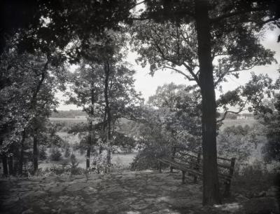
Photographic image
Lookout along Ridge Road above Geographic Groups
1922 – 1949
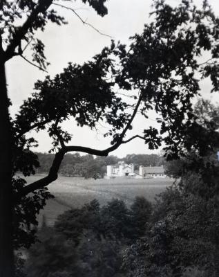
Photographic image
Rogers Farm on Park Blvd. as viewed through trees from Ridge Road
1922 – 1949
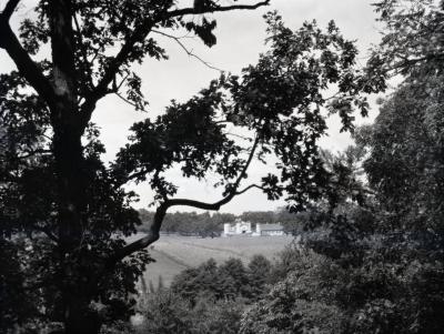
Photographic image
Rogers Farm on Park Blvd. viewed through trees from Ridge Road
1922 – 1949
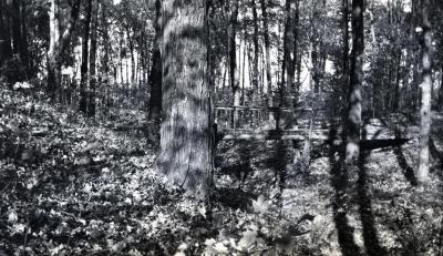
Photographic image
First ravine path bridge, Schultz Woods
1920s
Photographic image
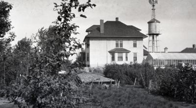
Jeffrey Farm House at South Farm with greenhouse
1924 – 1930
Photographic image
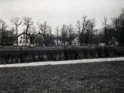
Home Farm buildings, cookhouse and dormitory for laborers (big bldg)
1924 – 1930
Photographic image
Puffer Lake with Lacy Farm and Arbor Farm in background
1923 – 1924
Map
Thomas H. Slusser Farm, Wheaton, Illinois
1920s
Steinbrecher, Harold F.
Map
Morton Arboretum [development and land acquisitions]
1920s
Next 36