Browsing by Subject/Keyword: year:

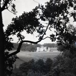
Lookout along Ridge Road above Geographic Groups (3.32762)
Date: 1922 – 1949Type: Photographic image
Description:Lookout along Ridge Road above Geographic Groups, Rogers Farm in the distance
Extent: 1 negative
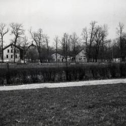
Rogers Farm on Park Blvd. as viewed through trees from Ridge Road (3.32765)
Date: 1922 – 1949Type: Photographic image
Description:Rogers Farm on Park Blvd. as viewed through trees from Ridge Road
Extent: 1 negative
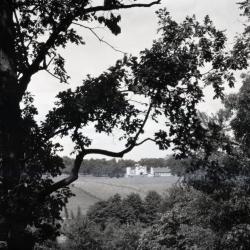
Rogers Farm on Park Blvd. viewed through trees from Ridge Road (3.32766)
Date: 1922 – 1949Type: Photographic image
Description:Rogers Farm on Park Blvd. viewed through trees from Ridge Road
Extent: 1 negative
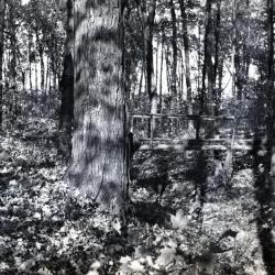
First ravine path bridge, Schultz Woods (3.33289)
Date: 1920sType: Photographic image
Description:First ravine path bridge, Schultz Woods
Extent: 1 negative
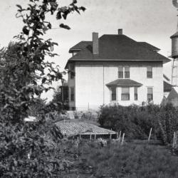
Jeffrey Farm House at South Farm with greenhouse (3.36103)
Date: 1924 – 1930Type: Photographic image
Description:Jeffrey Farm House at South Farm showing 1st Arboretum greenhouse built in 1922, water tower in distance
Extent: 1 negative
Home Farm buildings, cookhouse and dormitory for laborers (big bldg) (3.36454)
Date: 1924 – 1930Type: Photographic image
Description:Home Farm buildings, cookhouse and dormitory for laborers (big bldg)
Extent: 1 negative
Thomas H. Slusser Farm, Wheaton, Illinois (3.5287)
Date: 1920sCreator: Steinbrecher, Harold F.
Type: Map
Description:Shows a portion only of Slusser properties which bordered on Leask Lane to the west and on Thornhill Farm to the east. The area shown was subsequently purchased by the Arboretum.
Extent: 1 sheet
Morton Arboretum [development and land acquisitions] (3.5288)
Date: 1920sType: Map
Description:A schematic drawing showing principal land tracts and ownership within the projected boundaries of the Arboretum.
Extent: 1 sheet