
View looking southeast toward Downers Grove from high point on Forest Road (3.31937)
Date: 1940sType: Photographic image
Description:View looking southeast toward Downers Grove from high point where Forest Road starts curving back. Land just across fence became University of Illinois Research Area
Extent: 1 photograph

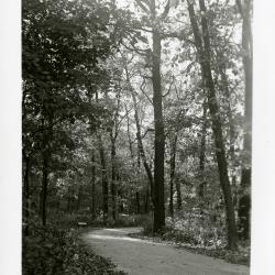
Meadow or Forest Road in winter (3.31938)
Date: 1930sType: Photographic image
Description:Meadow or Forest Road in winter
Extent: 1 negative filmstrip
Forest Road return before intersection of Meadow Road (3.31940)
Date: 1939Type: Photographic image
Description:Forest Road return before intersection of Meadow Road
Extent: 1 photograph
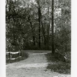
Cut-off at Meadow Road and Forest Road return looking north (3.31941)
Date: 1939Type: Photographic image
Description:Cut-off at Meadow Road and Forest Road return looking north
Extent: 1 photograph
The Morton Arboretum North Berm East Detention Basin Planting Plan (3.31951)
Date: June 27 2003Creator: Christopher B. Burke, Engineering West, Ltd.
Type: Plan
Description:Includes Low Profile Mesic To Dry Prairie plant list
Extent: 1 sheet
Site Improvement Plans for The Morton Arboretum North Berm (3.31953)
Date: November 10 2003Creator: Christopher B. Burke, Engineering West, Ltd.
Type: Plan
Description:Includes overall plan, existing conditions,demolition and tree protection plan, stormwater pollution prevention, soil erosion & sediment control, and grading & drainage plan.
Extent: 11 stapled sheets
Children's Garden, Lisle, Illinois: Site Improvements Construction Set [Electrical Plan] (3.32009)
Date: , April 2 2004Creator: Hitchcock Design Group
Type: Plan
Description:Updated copy of sheet E.1 Electrical Plan from Children's Garden Site Improvements Construction Set. Includes some notes made with a highlighter.
Extent: 1 sheet
Children's Garden, Lisle, Illinois: Landscape Improvements Construction Set [06/08/2004] (3.32010)
Date: June 8 2004Creator: Hitchcock Design Group
Type: Plan
Description:This copy issued for construction
Extent: 90 sheets bound
Children's Garden, Lisle, Illinois: Site Improvements Construction Set [Issued for Construction 2004/06/08] (3.32013)
Date: June 8 2004Creator: Hitchcock Design Group
Type: Plan
Description:Construction documents are intended to supplement the previously submitted "Landscape Improvements Construction Set" dated January 30, 2004, submitted for building permit (Tracking #T11888).
Extent: 29 sheets
The Morton Arboretum Gatehouses (3.32019)
Date: May 9 2003Creator: David Woodhouse Architects
Type: Plan
Description:"Issued for Construction - May 9, 2003"; new Arboretum entrance from Route 53.
Copy 1 and copy 2 both have differing written notes and highlighted sections.
Extent: 13 sheets
Crabapple Diversion (3.32031)
Date: September 25 2002Creator: Pelkonen, Peggy
Type: Plan
Description:Includes proposed piepline route from Crabapple Lake to Meadow Lake.
Extent: 1 sheet
Morton Arboretum, Meadow Lake Improvements/Lake Reconfiguration (3.32041)
Date: September 18 2003Creator: Montgomery Watson Harza (MWH)
Type: Plan
Extent: 20 sheets, bound
Morton Arboretum, Meadow Lake Improvements/Lake Reconfiguration (3.32042)
Date: May 14 2003Creator: Montgomery Watson Harza (MWH)
Type: Plan
Extent: 22 sheets, bound
Morton Arboretum, Meadow Lake Improvements (3.32043)
Date: October 25 2002Creator: Montgomery Watson Harza (MWH)
Type: Plan
Description:Includes Crabapple Lake plans.
Extent: 17 sheets, stapled
Morton Arboretum, Meadow Lake Improvements, Slurry Wall (3.32044)
Date: May 13 2003Creator: Montgomery Watson Harza (MWH)
Type: Plan
Description:Includes On-Site Disposal Facility Berm Grading Layout.
Extent: 11 sheets, paperclipped
Proposed Tram Road (3.32045)
Date: April 23 2003Creator: Pelkonen, Peggy
Type: Plan
Description:Aerial photo along south edge of Meadow Lake.
Copy 2 has a pencil note reading "Latest," but it is a duplicate of copy 1, except for six highlighted trees.
Extent: 1 sheet
The Morton Arboretum Entry Redevelopment (3.32049)
Date: May 9 2003Creator: David Woodhouse Architects
Type: Plan
Description:Seven page stapled booklet with entry gate site and arch plans.
Extent: 7 sheets, bound
The Morton Arboretum Entrance Bridge (3.32050)
Date: May 12 2003Creator: Christopher B. Burke, Engineering West, Ltd.
Type: Plan
Description:35 page stapled booklet; new Arboretum entrance from Route 53.
Extent: 35 sheets
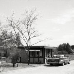
Car stopped at east entrance gatehouse (3.32066)
Date: 1960sType: Photographic image
Description:Car stopped at east entrance gatehouse
Extent: 1 negative filmstrip
White car stopped at east entrance gatehouse (3.32067)
Date: 1960sType: Photographic image
Description:White car stopped at east entrance gatehouse
Extent: 1 photograph
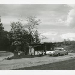
East entrance gatehouse on Forest Road with two lines of cars (3.32069)
Date: 1960sType: Photographic image
Description:East entrance gatehouse on Forest Road with two lines of cars
Extent: 1 photograph
Site Improvement Plans for The Morton Arboretum Main Entrance / Main Road / Phase Two (3.32073)
Date: November 11 2003Creator: Christopher B. Burke, Engineering West, Ltd.
Type: Plan
Description:Overall plan including demolition, erosion and pollution prevention, grading, electrical, traffic plan, and planting plan.
Collection also includes a 48-page version with only the 2003-05-13 revisions.
Extent: 53 sheets
Geographic Visitor Station Proposed Development (3.32084)
Date: November 15 2004Creator: Pelkonen, Peggy
Type: Plan
Description:One sheet in color; includes Collection Node.
Extent: 1 sheet
Tree Removal Around Meadow Lake (3.32085)
Date: September 17 2002Type: Plan
Description:Landscape design on aerial photograph; shows different section of the lake from other plan with the same title dated 9/17/2002 (3.32098). Updated version of 3.32097.
Includes marks denoting trees to be removed, saved, and trees that are "important to try to save."
Extent: 1 sheet
Tree Removal for Meadow Lake and Visitor Center Development (3.32086)
Date: August 28 2002Creator: Pelkonen, Peggy
Type: Plan
Description:Aerial photo includes Meadow Lake, Visitor Center, parking lot; includes larger area than item with same name and date; notes added in pencil, ink, and colored pencil.
Extent: 1 sheet
Tree Removal for Meadow Lake and Visitor Center Development (3.32087)
Date: August 28 2002Creator: Pelkonen, Peggy
Type: Plan
Description:Landscape design with marking in color on aerial photograph; enlargement of an area in c.1. Includes notes in ink.
Extent: 1 sheet
Tree Removal for Meadow Lake and Visitor Center Development (3.32089)
Date: August 28 2002Creator: Pelkonen, Peggy
Type: Plan
Description:Landscape design on aerial photograph; enlargement of an area in c.1; numerous ink and pencil notes.
Extent: 1 sheet
Tree Removal for Meadow Lake and Visitor Center Development (3.32091)
Date: August 28 2002Creator: Pelkonen, Peggy
Type: Plan
Description:Landscape design on aerial photograph; enlargement of an area in c.1; ink notes.
Extent: 1 sheet
Tree Removal for Meadow Lake and Visitor Center Development (3.32093)
Date: August 28 2002Creator: Pelkonen, Peggy
Type: Plan
Description:Landscape design on aerial photograph; enlargement of an area in c.1; ink and pencil notes.
Extent: 1 sheet
Tree Removal Around Meadow Lake (3.32095)
Date: August 28 2002Creator: Pelkonen, Peggy
Type: Plan
Description:Includes marks denoting trees to be removed, saved, and trees that are "important to try to save."
Extent: 1 sheet
Tree Removal Around Meadow Lake (3.32097)
Date: August 28 2002Creator: Pelkonen, Peggy
Type: Plan
Description:Landscape design on aerial photograph; shows different section of the lake from other plan with the same title dated 8/28/2002 (3.32095).
Includes marks denoting trees to be removed, saved, and trees that are "important to try to save."
Extent: 1 sheet
Tree Removal Around Meadow Lake (3.32098)
Date: September 17 2002Creator: Pelkonen, Peggy
Type: Plan
Description:Updated version of 3.32095 (#2024), dated 8/28/20002.
Includes marks denoting trees to be removed, saved, and trees that are "important to try to save."
Extent: 1 sheet
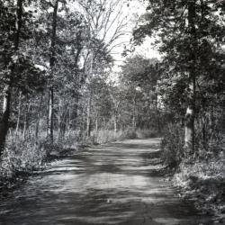
Unpaved road along Oakwood Loop looking east (3.32114)
Date: 1930sType: Photographic image
Description:Unpaved road along Oakwood Loop looking east
*located at about 88-S on Arboretum map/grid
Extent: 1 negative
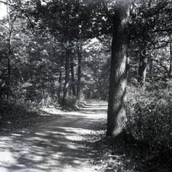
Unpaved road slightly curving along Oakwood Loop looking east (3.32115)
Date: 1930sType: Photographic image
Description:Unpaved road slightly curving along Oakwood Loop looking east
*located at about 82-W on Arboretum map/grid
Extent: 1 negative
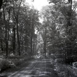
Unpaved road straight through wooded area along Oakwood Loop looking east (3.32116)
Date: 1930sType: Photographic image
Description:Unpaved road straight through wooded area along Oakwood Loop looking east
*located at about 90-AA on Arboretum map/grid
Extent: 1 negative
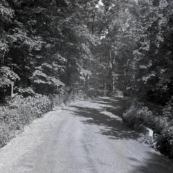
Unpaved road slightly curving to the right along Oakwood Loop looking east (3.32117)
Date: 1930sType: Photographic image
Description:Unpaved road slightly curving to the right along Oakwood Loop looking east
*located at about 105-AA on Arboretum map/grid
Extent: 1 negative