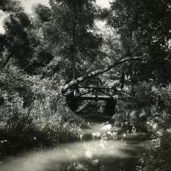
Arboretum Landscape Teaching Aid Series: An Old Bridge (3.19501)
Date: 1940 – 1960Creator: Watts, May Theilgaard
Type: Drawing
Description:Primarily textual teaching aid depicting Arboretum landscape. This material describes a bridge that was left on what are now the Arboretum grounds, as well as part of the story of the Morton Arboretum's origins.
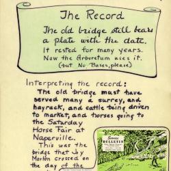
[Illustration of the bridge] Header: AN OLD BRIDGE was left behind when the HIGHWAY cut through [illustration of the highway]
Text and illustrations from top to bottom:
- [Depicted in stylized scroll] The Record: The old bridge still bears a plate with the date. It rested for many years. Now the Arboretum uses it. (but No Buses, please)
- Interpreting the record: The old bridge must have served many a surrey, and hayrack, and cattle being driven to market, and horses going to the Saturday Horse Fair at Naperville. This was the bridge that Joy Morton crossed on the day of the event described here [to the right of this text is pasted material from the May 1952 "Service Bulletin," Vol. 21, No. 2, including the front cover illustration depicting an antique vehicle and two men putting out a brush fire and partial text describing how Joy Morton found the location where he had his home Thornhill built.]
Extent: 1 sheet
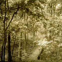
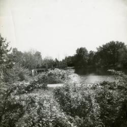
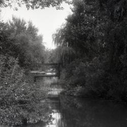
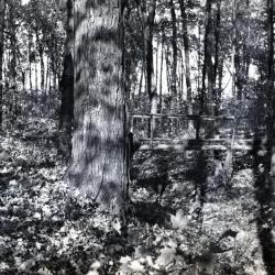
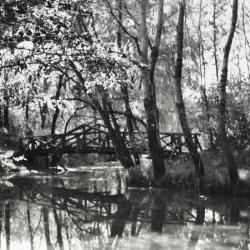
Ravine path bridge on land purchased from John Schultz (3.2968)
Type: Photographic image
Description:Ravine path bridge on land purchased from John Schultz. East side above geographical group.
Extent: 1 photograph
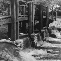
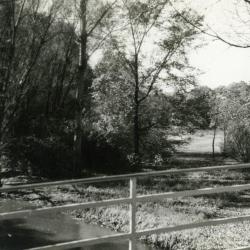
Bridge and dam across DuPage River (west branch) (3.2979)
Date: 1950sCreator: Miller, W. L.
Type: Photographic image
Description:Bridge and dam across DuPage River (west branch)
Bridge and dam with gates designed by Clarence Godshalk to control water level of Lake Jopamaca.
Replaced the artificial concrete & stone rapids built in 1930's. This bridge/gate taken out around 1980
Extent: 1 photograph

Winter creek scene (3.2987)
Creator: Andersen, Howard
Type: Photographic image
Description:Winter creek scene
Extent: 1 photograph
Dutch country scene / Chas. P. Gruppe. (3.30241)
Date: 1898Creator: Gruppe, Charles Paul, 1860-1940.
Type: Painting
Extent: 1 painting : watercolor, visible image 43 x 64 cm.
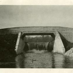
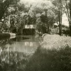
Lake Marmo dam & bridge as originally designed by O.C. Simonds (3.3032)
Date: 1922Type: Photographic image
Description:Lake Marmo dam & bridge as originally designed by O.C. Simonds
Extent: 1 photograph
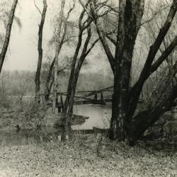
Lake Marmo, looking southeast (3.3033)
Date: 1930sType: Photographic image
Description:Lake Marmo, looking southeast, bridge and dam in the distance
Extent: 1 photograph
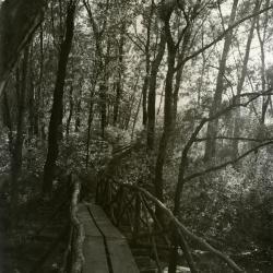
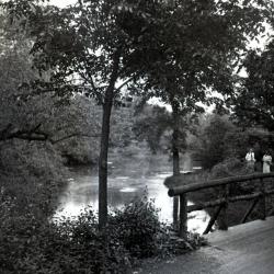
Footbridge over Lake Jopamaca leading into Ozarks Collection (3.3038)
Date: 1930sType: Photographic image
Description:Footbridge over Lake Jopamaca leading into Ozarks Collection
Extent: 1 photograph

Footbridge view over water (3.3039)
Creator: Linchester, Ed
Type: Photographic image
Description:Footbridge view over water
Extent: 1 photograph
Looking southwest from bridge over DuPage River toward Lake Jopamaca (3.3040)
Date: October 1941Type: Photographic image
Description:Looking southwest from bridge over DuPage River toward Lake Jopamaca
Extent: 1 photograph

Footbridge in Winter (3.3043)
Creator: D'Olive, E. R.
Type: Photographic image
Description:Footbridge in Winter
Extent: 1 photograph
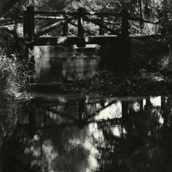
Bridge over Lake Marmo inlet looking upstream (3.3048)
Date: 1940Type: Photographic image
Description:Bridge over Lake Marmo inlet looking upstream
Extent: 1 photograph
Expanded bridge over Lake Marmo (3.3049)
Date: 1940sType: Photographic image
Description:Expanded bridge over Lake Marmo
Extent: 1 photograph
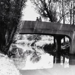
Concrete bridge over DuPage River, looking north (3.3050)
Date: 1920sCreator: Melton, W.
Type: Photographic image
Description:Concrete bridge over DuPage River, looking north, before metal railings were installed
Extent: 1 photograph
Lake Marmo Footbridge (3.3051)
Creator: Fischer, Richard
Type: Photographic image
Description:Lake Marmo Footbridge
Extent: 1 photograph
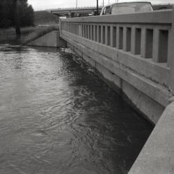
Concrete bridge (3.3082)
Date: 1930sCreator: Streator, Sidney V.
Type: Photographic image
Description:Concrete bridge
Extent: 1 photograph
Lunching & Learning with Clarence Godshalk: Evolution of the Arboretum - From Farm to Arboretum (3.31582)
Date: January 25 1978Type: Audio
Description:Lunching and Learning program presented by Clarence Godshalk as he describes the evolution of the Arboretum, from farm land to Arboretum.
Extent: 1 audio cassette

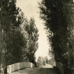
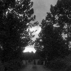
Road leading up to bridge over DuPage River looking northwest (3.31939)
Date: circa 1935Type: Photographic image
Description:Road leading up to bridge over DuPage River looking northwest
Extent: 1 photograph
Lighting Layout (3.31999)
Date: November 5 2004Creator: Pelkonen, Peggy
Type: Plan
Description:Sheet 1 of 4: Bridge, Entry Road, Meadow Lake, Parking Lot 1
Sheet 2 of 4: Arbor Court, Dining Deck, Meadow Lake, Visitor Center, Forecourt, Parking Lot 1, Staff Lot, Administration Building Walk, Research Lot
Sheet 3 of 4: I-88 sign, South Farm, Research lot
Sheet 4 of 4: Entry Road, Parking Lot 1, Meadow Lake, Arbor Court, Dining Deck, Visitor Center, Forecourt
Extent: 4 sheets
[Retaining Wall Elevations] (3.32016)
Date: November 24 2004Type: Plan
Description:Elevations of retaining wall, likely related to the I-88 retaining wall/noise wall locations as seen on STRU:A-III(f)7 (3.32018).
Extent: 1 sheet
[Retaining Wall, I-88 Parapet Over Route 53] (3.32017)
Type: Plan
Description:One sheet with eight elevations of I-88 parapet over Route 53, with retaining wall, abutments, and wing walls.
Extent: 1 sheet
I-88 (Ronald Reagan Tollway) Retaining Wall / Noise Wall Locations (3.32018)
Date: November 2004Creator: Bowman, Barrett & Associates, Inc.
Type: Plan
Description:Two sheets showing I-88 from west of Yackley east to Finley; one sticky note attached on sheet one: "North wall 1050 lf/ South wall 680 lf/Bridge 260 lf/800 lf wall South side of 88 (E. bound)"
Extent: 2 sheets
The Morton Arboretum Entrance Bridge (3.32050)
Date: May 12 2003Creator: Christopher B. Burke, Engineering West, Ltd.
Type: Plan
Description:35 page stapled booklet; new Arboretum entrance from Route 53.
Extent: 35 sheets

Unpaved road over Lake Marmo inlet bridge looking east toward car (3.32123)
Date: 1930sType: Photographic image
Description:Unpaved road over Lake Marmo inlet bridge looking east toward car
*located at about 9-S on Arboretum map/grid
Extent: 1 negative
Iron Bridge, Old Joliet Road, view from left over water (3.32162)
Date: September 1937Type: Photographic image
Description:Iron Bridge, Old Joliet Road, view from left over water
Extent: 1 negative
Iron Bridge, Old Joliet Road, view from center over water (3.32163)
Date: September 1937Type: Photographic image
Description: Iron Bridge, Old Joliet Road, view from center over water
Extent: 1 negative
Arboretum road over bridge, person leaning over bridge (3.32177)
Date: September 15 1937Type: Photographic image
Description:Arboretum road over bridge, person leaning over bridge
Extent: 1 negative
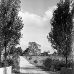
Arboretum road over DuPage River bridge, southeast view toward main entrance (3.32739)
Date: 1930Type: Photographic image
Description:Arboretum road over DuPage River bridge, southeast view toward main entrance
Extent: 1 negative
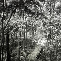
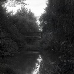
Ravine path bridge on east side above Geographic Groups (3.33263)
Date: 1930sType: Photographic image
Description:Ravine path bridge on east side above Geographic Groups
On land purchased from John Schultz
Extent: 1 negative filmstrip
First ravine path bridge, Schultz Woods (3.33289)
Date: 1920sType: Photographic image
Description:First ravine path bridge, Schultz Woods
Extent: 1 negative
Woman and man on concrete bridge over DuPage River (3.33533)
Date: 1930sType: Photographic image
Description:Woman and man on concrete bridge over DuPage River
Concrete rail later replaced by present metal rail designed by Holabird & Root
Extent: 1 negative filmstrip

Two men and a woman on concrete bridge over DuPage River (3.33534)
Date: 1930sType: Photographic image
Description:Two men and a woman on concrete bridge over DuPage River
Concrete rail later replaced by present metal rail designed by Holabird & Root
Extent: 1 negative filmstrip

DuPage River looking north, stereograph (3.33535)
Date: 1930sType: Photographic image
Description:DuPage River looking north, stereograph
Extent: 1 stereograph
Old Route 53 two lane bridge over DuPage River (3.33537)
Date: 1960sType: Photographic image
Description:Old Route 53 two lane bridge over DuPage River
New highway bridge being built in background
Extent: 1 negative filmstrip
Footbridge over inlet to Lake Jopamaca (3.33539)
Date: 1930sType: Photographic image
Description:First footbridge designed by Clarence Godshalk over inlet to Lake Jopamaca
Extent: 1 negative filmstrip
West end Lake Marmo from inlet bridge looking northeast (3.33546)
Type: Photographic image
Description:West end Lake Marmo from inlet bridge looking northeast
*located at about 10-S on Arboretum map/grid
Extent: 1 negative