Browsing by Subject/Keyword: people, organizations and landmarks:

Morton Arboretum Map (3.19481)
Date: 1943Creator: Watts, May Theilgaard
Type: Map
Description:Detailed map of Arboretum grounds, showing roads, paths, landscaping, shelters, structures, enlargement of some specific features, hedge garden, some specific trees, and trails with markers numbered 1 - 42. Other features include a scale, a calendar, and a compass rose consisting of directions depicted with leaves. A highly ornamental border includes grid marks, as well as drawings of animal tracks and detailed drawings and labels of plants. Some replacement illustration and text has been adhered to the map. The Morton Arboretum encompassed 813 acres at time of map. One section is partially missing.
Extent: 1 sheet
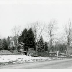
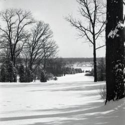
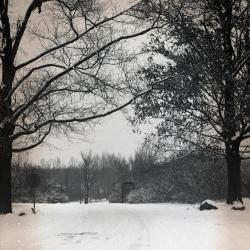
Arboretum entrance drive in winter during reconstruction when Route 53 was widened (3.32051)
Date: 1950sType: Photographic image
Description:Arboretum entrance drive in winter during reconstruction when Route 53 was widened
Extent: 1 photograph
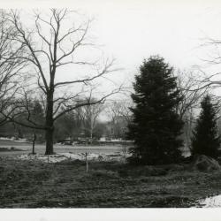
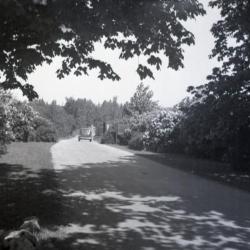
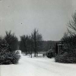
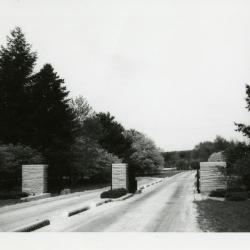
Side view of Arboretum entrance drive with trees during reconstruction when Route 53 was widened (3.32052)
Date: 1958 – 1959Type: Photographic image
Description:Side view of Arboretum entrance drive with trees during reconstruction when Route 53 was widened
Extent: 1 photograph
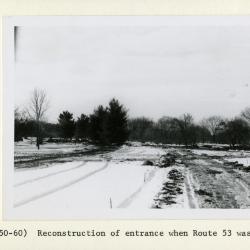
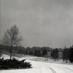
Reconstruction of Arboretum entrance drive in winter when Route 53 was widened showing road curve to left (3.32053)
Date: 1958 – 1959Type: Photographic image
Description:Reconstruction of Arboretum entrance drive in winter when Route 53 was widened showing road curve to left
Extent: 1 photograph
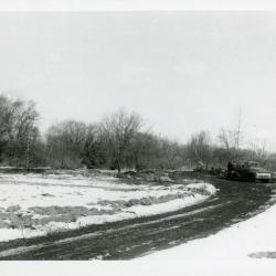
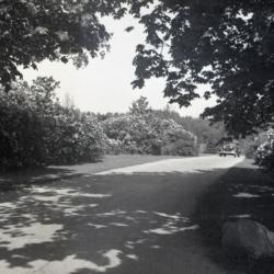
Truck at Arboretum entrance road during recontruction when Route 53 was widened (3.32054)
Date: 1958 – 1959Type: Photographic image
Description:Truck at Arboretum entrance road during recontruction when Route 53 was widened
Extent: 1 photograph
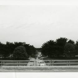
Sunday car traffic going under bridge (3.32055)
Date: 1960sType: Photographic image
Description:Sunday car traffic going under bridge
Extent: 1 photograph
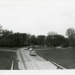
Sunday traffic heading to west side showing west entrance road, near Elm Collection (3.32056)
Date: 1960sType: Photographic image
Description:Sunday traffic heading to westside showing west entrance road, near Elm Collection
Extent: 1 photograph
Car stopped at east entrance gatehouse (3.32066)
Date: 1960sType: Photographic image
Description:Car stopped at east entrance gatehouse
Extent: 1 negative filmstrip
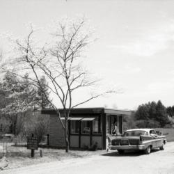
White car stopped at east entrance gatehouse (3.32067)
Date: 1960sType: Photographic image
Description:White car stopped at east entrance gatehouse
Extent: 1 photograph
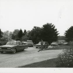
Man directing sunday traffic as cars merge on road (3.32068)
Date: 1960sType: Photographic image
Description:Man directing sunday traffic as cars merge on road
Extent: 1 photograph
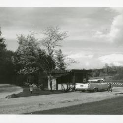
East entrance gatehouse on Forest Road with two lines of cars (3.32069)
Date: 1960sType: Photographic image
Description:East entrance gatehouse on Forest Road with two lines of cars
Extent: 1 photograph
Site Improvement Plans for The Morton Arboretum Main Entrance / Main Road / Phase Two (3.32073)
Date: November 11 2003Creator: Christopher B. Burke, Engineering West, Ltd.
Type: Plan
Description:Overall plan including demolition, erosion and pollution prevention, grading, electrical, traffic plan, and planting plan.
Collection also includes a 48-page version with only the 2003-05-13 revisions.
Extent: 53 sheets
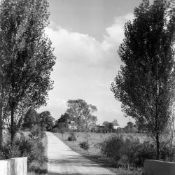
Car driving out of Arboretum west entrance toward Route 53 (3.32120)
Date: 1930sType: Photographic image
Description:Car driving out of Arboretum west entrance toward Route 53
*located at about 38-L on Arboretum map/grid
Extent: 1 negative
Car entering Arboretum west entrance at Route 53 (3.32121)
Date: 1930sType: Photographic image
Description:Car entering Arboretum west entrance at Route 53
*located at about 38-L on Arboretum map/grid
Extent: 1 negative
Looking east from Morton residence to entrance gates in winter, Thornhill Drive toward Park Blvd. (3.32151)
Date: 1930sType: Photographic image
Description:Looking east from Morton residence to entrance gates in winter, Thornhill Drive toward Park Blvd.
Extent: 1 negative

Arboretum east gate entrance (3.32156)
Date: 1930sType: Photographic image
Description:Arboretum east gate entrance
Extent: 1 negative
Arboretum East Gate Entrance in winter with stop sign on left (3.32157)
Date: 1930sType: Photographic image
Description:Arboretum East Gate Entrance in winter with stop sign on left
Extent: 1 negative

Arboretum east gate entrance in winter with sign on right side (3.32158)
Date: 1930sType: Photographic image
Description:Arboretum east gate entrance in winter with sign on right side
Extent: 1 negative
Arboretum east gate entrance in winter with close view of east side (3.32159)
Date: 1930sType: Photographic image
Description:Arboretum east gate entrance in winter with close view of east side
Extent: 1 negative
Looking north from inside East Gate in winter, sign on right side of road (3.32161)
Date: 1930sType: Photographic image
Description:Looking north from inside East Gate in winter, sign on right side of road
Extent: 1 negative
Arboretum road over DuPage River bridge, southeast view toward main entrance (3.32739)
Date: 1930Type: Photographic image
Description:Arboretum road over DuPage River bridge, southeast view toward main entrance
Extent: 1 negative
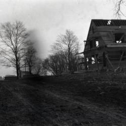
Arboretum entrance road (Joliet Road), showing Clarence Godshalk's first Arboretum house under construction along right side of road (3.36083)
Date: 1922Type: Photographic image
Description:Arboretum entrance road (Joliet Road), showing Clarence Godshalk's first Arboretum house under construction along right side of road
Extent: 1 negative
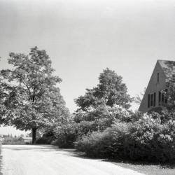
Arboretum west entrance road (Route 53/Joliet Road), Clarence Godshalk's first Arboretum house along right side of road (3.36092)
Date: 1930Type: Photographic image
Description:Arboretum west entrance road (Route 53/Joliet Road), Clarence Godshalk's first Arboretum house along right side of road
Extent: 1 negative

Cop directing traffic at entrance of Arboretum (3.3620)
Date: 1940sType: Photographic image
Description:Cop directing traffic in Arboretum
Extent: 1 photograph
East gate (3.37208)
Type: Photographic image
Description:East entrance road of Arboretum with gates open
Extent: 1 photograph

East entrance gatepost with ornamental stone acorn (3.37209)
Date: 1985Creator: Kohout, John
Type: Photographic image
Description:East entrance gatepost with ornamental stone acorn, moved to permit easier entrance for trucks and buses
Extent: 1 photograph
Main Entrance/Main Road, Phase 2, Overall Plan (3.44577)
Date: November 21 2002Creator: Christopher B. Burke, Engineering West, Ltd.
Type: Map
Description:Includes planting plans for East Branch, DuPage River Detention Facility and Compensatory/Wetland Mitigation Storage Facility. Includes Planting Specifications.
Extent: 5 Sheets
Main Entrance/Main Road Phase Two Planting Specifications (3.44581)
Creator: Christopher B. Burke, Engineering West, Ltd.
Type: Plan
Extent: 5 Sheets
Main Entrance/Main Road Phase Two Storm Sewer & Grading As-Built (3.47238)
Creator: Christopher B. Burke, Engineering West, Ltd.
Type: Plan
Description:As-built plan and topographical survey of the storm sewer and grading of the main road near the entrance in 2004.
"Project No. 00-927AA"
Extent: 1 Sheet
Main Entrance/Main Road Phase Two Storm Sewer & Grading As-Built (3.47239)
Creator: Christopher B. Burke, Engineering West, Ltd.
Type: Plan
Description:As-built plan of the storm sewer and grading and topographical survey of the main road near the main exit in 2004.
"Project No. 00-927AA"
Extent: 1 Sheet
General Plan Arboretum [Entrance] Interchange [on Route 53] (3.5605)
Date: November 10 1959Creator: George W. Barton and Associates
Type: Plan
Description:Includes marks where stakes were set in the field, along with a handwritten note for C.E. Godshalk.
Extent: 1 sheet
General Plan Arboretum [Entrance] Interchange [on Route 53] (3.5606)
Date: November 10 1959Creator: George W. Barton and Associates
Type: Plan
Description:Copy 1 includes marks where stakes were set in the field, along with a handwritten note for C.E. Godshalk.
Extent: 1 sheet
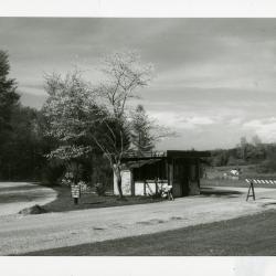
East entrance gatehouse (3.60069)
Date: 1960sType: Photographic image
Description:East entrance gatehouse
Extent: 1 photograph
Approximate Locations of Existing and Proposed Arboretum Signs (3.6292)
Date: circa 1990Creator: Hootman, Rick
Type: Map
Description:Map includes only signs at main entrances to west side from Route 53.
Extent: 1 sheet
Entrance Road Landscape Improvements (3.6436)
Date: May 27 1998Creator: Mehaffey, Scott A.
Type: Plan
Extent: 1 sheet
Coord. Sketch for Park Blvd. Entrance & Parking (3.7097)
Date: June 26 2001Creator: Mehaffey, Scott A.
Type: Plan
Description:Circulation study for new entry road and relocated Forest Road through near East Side. Early concept for entry road and underpass realignment, with studies for Meadow Lake and Arbor Court S.M.
Extent: 1 sheet