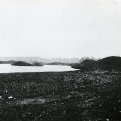
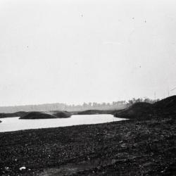
Lake Jopamaca Early Digging (3.3023)
Type: Photographic image
Description:Lake Jopamaca Early Digging
Extent: 1 photograph
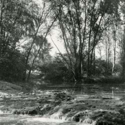
The Waterfall (3.3031)
Date: 1930sCreator: Hartshorn, Ken
Type: Photographic image
Description:The Waterfall - the rapids built in DuPage River to raise water level in Lake Jopamaca. These were made from concrete with stones set in while soft. Later replaced by dam with gates to control water level. Used to see large northern pike go up over the rapids in Spring
Extent: 1 photograph
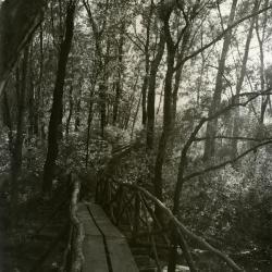
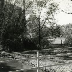
Footbridge over Lake Jopamaca leading into Ozarks Collection (3.3038)
Date: 1930sType: Photographic image
Description:Footbridge over Lake Jopamaca leading into Ozarks Collection
Extent: 1 photograph
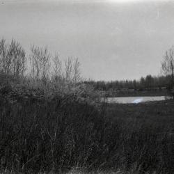
Looking southwest from bridge over DuPage River toward Lake Jopamaca (3.3040)
Date: October 1941Type: Photographic image
Description:Looking southwest from bridge over DuPage River toward Lake Jopamaca
Extent: 1 photograph
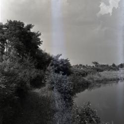
Ozarks first planting alongside nearly constructed Lake Jopamaca, DuPage River to the right (3.3070)
Date: March 21 – June 20 1922Type: Photographic image
Description:Looking north at Ozarks first planting alongside nearly constructed Lake Jopamaca, DuPage River to the right
Extent: 1 photograph
Lunching & Learning with Clarence Godshalk: Evolution of the Arboretum - From Farm to Arboretum (3.31582)
Date: January 25 1978Type: Audio
Description:Lunching and Learning program presented by Clarence Godshalk as he describes the evolution of the Arboretum, from farm land to Arboretum.
Extent: 1 audio cassette
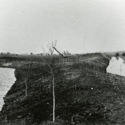
Lake Jopamaca in Ozarks after it was completed (3.33518)
Date: 1922Type: Photographic image
Description:Looking south over Lake Jopamaca in Ozarks soon after it was completed.
Lake dug by Yale and Regan with drag line. Grading done by Mr. Godshalk with men and mule teams.
Extent: 1 negative filmstrip
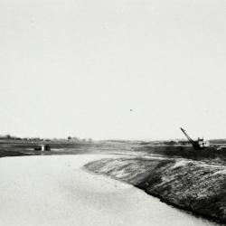
Lake Jopamaca in the Ozarks, dug by drag line (shown in background) (3.33531)
Date: 1922Type: Photographic image
Description:Lake Jopamaca in the Ozarks, dug by drag line (shown in background)
Extent: 1 negative filmstrip
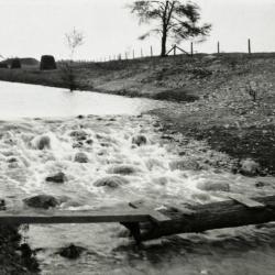
Rapids built in DuPage River to raise water level in Lake Jopamaca (3.33532)
Date: 1922Type: Photographic image
Description:First rapids built in DuPage River to raise water level in Lake Jopamaca, made of sod, fence wire, etc. (the rapids did not last)
Extent: 1 negative filmstrip
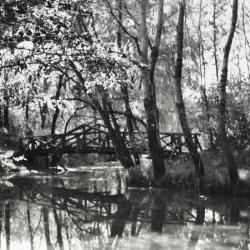
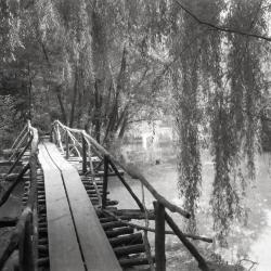
Footbridge over inlet to Lake Jopamaca (3.33539)
Date: 1930sType: Photographic image
Description:First footbridge designed by Clarence Godshalk over inlet to Lake Jopamaca
Extent: 1 negative filmstrip
Walking path along Lake Jopamaca looking south (3.33543)
Type: Photographic image
Description:Walking path along Lake Jopamaca looking south
*located at about 30-S on Arboretum map/grid
Extent: 1 negative
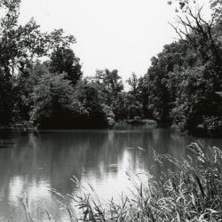
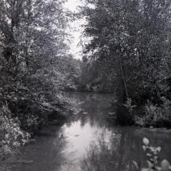
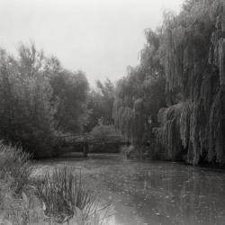
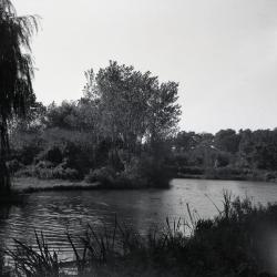
Lake Jopamaca looking north (3.33552)
Type: Photographic image
Description: Lake Jopamaca looking north
*located at about 27-O on Arboretum map/grid
Extent: 1 negative
Lake Jopamaca looking north (3.33553)
Type: Photographic image
Description:Lake Jopamaca looking north
*located at about 27-P on Arboretum map/grid
Extent: 1 negative
Lake Jopamaca looking north (3.33554)
Type: Photographic image
Description:Lake Jopamaca looking north
*located at about 27-P on Arboretum map/grid
Extent: 1 negative
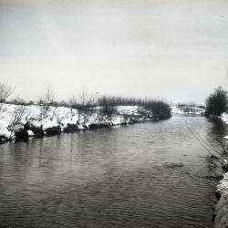
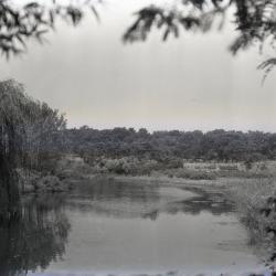
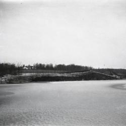
DuPage River in winter near Ozark Lake (3.33576)
Date: 1924Type: Photographic image
Description:DuPage River in winter near Ozark Lake
Extent: 1 negative
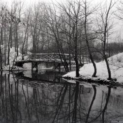
Jopamaca footbridge over DuPage River in winter (3.33981)
Type: Photographic image
Description:Jopamaca footbridge over DuPage River in winter
Extent: 1 negative
Lake Jopamaca and footbridge, looking east toward DuPage River (3.33982)
Date: 1930 – 1949Type: Photographic image
Description:Lake Jopamaca and footbridge, looking east toward DuPage River
Extent: 1 negative
Lake Jopamaca footbridge, looking south (3.33984)
Date: 1930 – 1949Type: Photographic image
Description:Lake Jopamaca footbridge, looking south
Extent: 1 negative
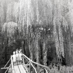
Three boys on Lake Jopamaca Footbridge (3.33985)
Date: 1930sType: Photographic image
Description:Three boys on Lake Jopamaca footbridge with two women in background
Extent: 1 negative
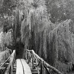
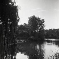
On Lake Jopamaca footbridge looking toward weeping willows (3.33986)
Date: 1930Type: Photographic image
Description:On Lake Jopamaca footbridge looking toward Salix babylonica (weeping willows)
Extent: 1 negative
DuPage River and Ozark Collection (3.33987)
Date: 1930sType: Photographic image
Description:DuPage River and Ozark Collection
Extent: 1 negative
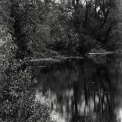
DuPage River inlet to Lake Jopamaca (3.33988)
Date: 1930 – 1949Type: Photographic image
Description:DuPage River inlet to Lake Jopamaca
Extent: 1 negative
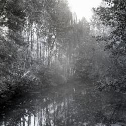
Lake Jopamaca north end from river inlet looking west (3.33991)
Date: 1920sType: Photographic image
Description:Lake Jopamaca north end from river inlet looking west
Extent: 1 negative
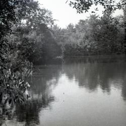
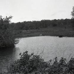
Lake Ozark, plants in water in foreground (3.33996)
Date: 1930Type: Photographic image
Description:Lake Ozark, plants in water in foreground
Extent: 1 negative
Lake Ozark in distance viewed from the north (3.33997)
Date: 1930sType: Photographic image
Description:Lake Ozark in distance viewed from the north
Extent: 1 negative
View from Lake Ozark toward Thornhill residence (3.33998)
Date: 1923Type: Photographic image
Description:View from Lake Ozark toward Thornhill residence
Extent: 1 negative
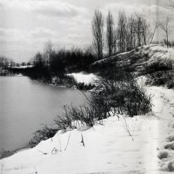
West side of Ozark Collection in winter looking south (3.33999)
Date: 1930sType: Photographic image
Description:West side of Ozark Collection in winter
Lake Ozark looking south
Extent: 1 negative
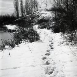
Footprints in snow along east side of old Caprifoliaceae Collection (3.34000)
Date: 1920sType: Photographic image
Description: Footprints in snow along east side of old Caprifoliaceae Collection
Lake Ozark looking south
Extent: 1 negative
Path on left side along Lake Jopamaca (3.34002)
Date: 1930 – 1949Type: Photographic image
Description:Path on left side along Lake Jopamaca
Extent: 1 negative
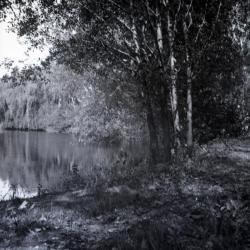
Lake Jopamaca vegetation along west side shoreline (3.34005)
Date: 1930 – 1949Type: Photographic image
Description:Lake Jopamaca vegetation along west side shoreline
Extent: 1 negative
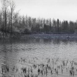
Lake Jopamaca in summer looking west (3.34006)
Date: 1930 – 1949Type: Photographic image
Description:Lake Jopamaca in summer looking west
Extent: 1 negative
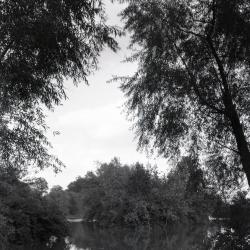
Lake Jopamaca framed by two trees (3.34008)
Date: 1930 – 1949Type: Photographic image
Description:Lake Jopamaca framed by two trees
Extent: 1 negative

Map & Visitor Guide, The Morton Arboretum (3.34271)
Date: 1982 – 1986Type: Map
Description:Double-sided brochure, Map & Visitor Guide for The Morton Arboretum
Map details Arboretum roads, trails, plant collections, buildings and boundaries. Includes photographs of various Arboretum buildings with descriptive information.
Reverse side provides general information about the Arboretum, trails for walking and hiking, driving through the Arboretum, areas and collections of special interest, native plant communities, wildlife at the Arboretum, regulations, facilities and services, and information on membership. A section of the map is enlarged to identify landmarks around the Visitor Center, Administration Building, and Thornhill Education Center.
Extent: 1 sheet
Concept Park Boulevard Entrance (3.47501)
Date: January 9 2001Creator: Christopher B. Burke, Engineering West, Ltd.
Type: Map
Description:Color aerial map showing existing entrance and exit to be removed and proposed entrance, exit, and parking facility in 2001.
"Project No. 00-910"
Extent: 1 Sheet
Morton Arboretum, The Poplar Group [planting plan] (3.5654)
Date: March 21 – June 20 1925Creator: Teuscher, Henry
Type: Plan
Description:Planting plan for the Poplar Group in the Lake Jopamaca area. Includes the Asiatic species, European species, and American species
Note on back: Original planting plans by Teuscher and CEG
Extent: 1 sheet