
Arboretum Landscape Teaching Aid Series: Three Norway Spruces (3.19506)
Date: 1940 – 1960Creator: Watts, May Theilgaard
Type: Drawing
Description:Primarily textual teaching aid depicting Arboretum landscape. This material describes the three Norway spruce trees planted by Joy Morton, Wirt Morton, and Sterling Morton, including a pasted Arboretum map of their location on the grounds.
Header: THREE Norway Spruces [image of three stylized trees] were planted by THREE Mortons / JOY MORTON / WIRT MORTON / STERLING MORTON
Text and illustrations from top to bottom:
- [Depicted in stylized scroll] THE RECORD: Three Tall Trees [Illustration of three trees] On Forest Road [followed by an arrow pointing downward to map below]
- map: the 3 spruces [arrow pointing downward to spot on map where trees are located, on Forest Road]. Label in lower right: GUIDE MAP of THE MORTON ARBORETUM LISLE, ILLINOIS
- text below map: *these trees are one answer to the ever occurring question: HOW FAST DO TREES GROW?
Extent: 1 sheet

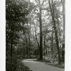
Forest Road overlook (3.31932)
Date: 1940sType: Photographic image
Description:Forest Road overlook
Extent: 1 negative filmstrip

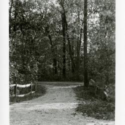
Forest Road return at east end of Arboretum (3.31933)
Date: 1940sType: Photographic image
Description:Forest Road return at east end of Arboretum
Extent: 1 photograph

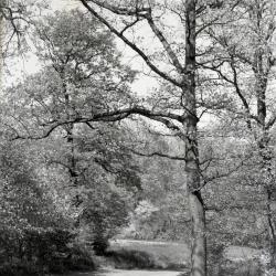
View looking southeast toward Downers Grove from high point on Forest Road (3.31937)
Date: 1940sType: Photographic image
Description:View looking southeast toward Downers Grove from high point where Forest Road starts curving back. Land just across fence became University of Illinois Research Area
Extent: 1 photograph
Forest Road return before intersection of Meadow Road (3.31940)
Date: 1939Type: Photographic image
Description:Forest Road return before intersection of Meadow Road
Extent: 1 photograph
Cut-off at Meadow Road and Forest Road return looking north (3.31941)
Date: 1939Type: Photographic image
Description:Cut-off at Meadow Road and Forest Road return looking north
Extent: 1 photograph
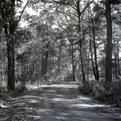
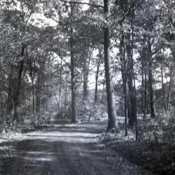
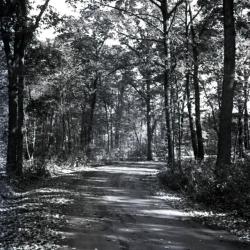
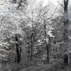
Forest Road looking east with open area ahead (3.32132)
Type: Photographic image
Description:Forest Road looking east with open area ahead
*located at about 124-L on Arboretum map/grid
Extent: 1 negative
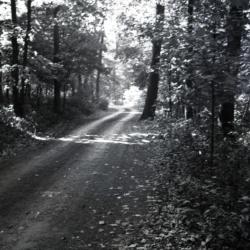
Forest Road looking east (3.32133)
Type: Photographic image
Description:Forest Road looking east
*located at about 107-H on Arboretum map/grid
Extent: 1 negative
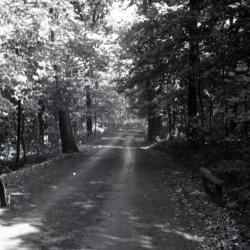
Forest Road looking east curving to right (3.32134)
Type: Photographic image
Description:Forest Road looking east curving to right
*located at about 94-FF on Arboretum map/grid
Extent: 1 negative
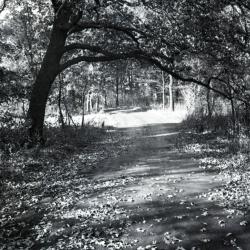
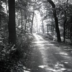
Forest Road looking northwest with overhanging tree (3.32135)
Type: Photographic image
Description:Forest Road looking northwest with overhanging tree
*located at about 94-FF on Arboretum map/grid
Extent: 1 negative

Forest Road curving left and looking northwest with overhanging tree (3.32136)
Type: Photographic image
Description:Forest Road curving left and looking northwest with overhanging tree
*located at about 94-FF on Arboretum map/grid
Extent: 1 negative
Forest Road curving to left with maple leaves hanging in foreground (3.32137)
Type: Photographic image
Description:Forest Road curving to left with maple leaves hanging in foreground
Extent: 1 negative

Forest Road curving left looking east near Spruce Plot (3.32138)
Type: Photographic image
Description:Forest Road curving left looking east near Spruce Plot
*located at about 121-U on Arboretum map/grid
Extent: 1 negative
Forest Road slightly curving left looking east near Spruce Plot (3.32139)
Type: Photographic image
Description:Forest Road slightly curving left looking east near Spruce Plot
*located at about 122-U on Arboretum map/grid
Extent: 1 negative
Forest Road curving to right looking east (3.32140)
Type: Photographic image
Description:Forest Road curving to right looking east
*located at about 23-L on Arboretum map/grid
Extent: 1 negative
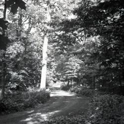
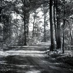
Forest Road through wooded area looking east (3.32141)
Type: Photographic image
Description:Forest Road through wooded area looking east
*located at about 125-T on Arboretum map/grid
Extent: 1 negative
Forest Road curving to right through wooded area (3.32142)
Type: Photographic image
Description:Forest Road curving to right through wooded area
Extent: 1 negative
Forest Road with partial sunlight looking northeast (?) as it curves to right (3.32143)
Type: Photographic image
Description:Forest Road with partial sunlight looking northeast (?) as it curves to right
*located at about 122-K on Arboretum map/grid
Extent: 1 negative
Forest Road looking east (?) slightly curving to the right (3.32144)
Type: Photographic image
Description:Forest Road looking east (?) slightly curving to the right
*located at about 95-FF on Arboretum map/grid
Extent: 1 negative
Forest Road Edge Loop looking southwest (3.32145)
Type: Photographic image
Description:Forest Road Edge Loop looking southwest
*located at about 132-Y on Arboretum map/grid
Extent: 1 negative
Forest Road Edge Loop looking northeast from right side of road (3.32146)
Type: Photographic image
Description:Forest Road Edge Loop looking northeast
*located at about 131-X on Arboretum map/grid
Extent: 1 negative
Forest Road Edge Loop looking northeast from left side of road (3.32147)
Type: Photographic image
Description:Forest Road Edge Loop looking northeast from left side of road
*located at about 130-W on Arboretum map/grid
Extent: 1 negative
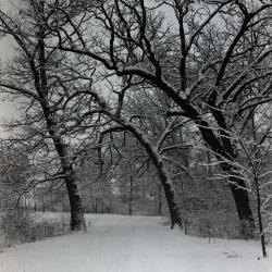
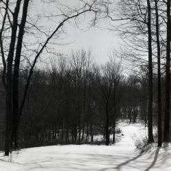
Forest Road in winter with bur oaks arching over road return (3.32164)
Date: 1950sType: Photographic image
Description:Forest Road in winter with bur oaks arching over road return
Extent: 1 negative
Forest Road in winter near Buckeye Collection (3.32165)
Date: 1950sType: Photographic image
Description:Forest Road in winter near Buckeye Collection
Extent: 1 negative
Forest Road in winter, possibly leading to woodlot (3.32166)
Date: 1950sType: Photographic image
Description:Forest Road in winter, possibly leading to woodlot
Extent: 1 negative
Forest Road in winter, probably near Buckeye Collection (3.32167)
Date: 1950sType: Photographic image
Description:Forest Road in winter, probably near Buckeye Collection
Extent: 1 negative
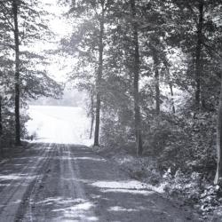
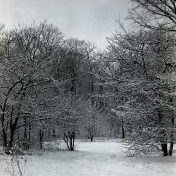
Forest Road (?) winding through wooded area in winter (3.32170)
Date: 1930sType: Photographic image
Description:Forest Road (?) winding through wooded area in winter
Extent: 1 negative
Forest Road, originally called Ridge Road (3.33196)
Date: 1935Type: Photographic image
Description:Forest Road, originally called Ridge Road
Extent: 1 negative
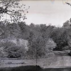
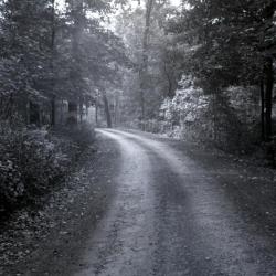
Forest Road curving to left at Crabapple Hollow in spring (3.33197)
Date: March 21 – June 20 1935Type: Photographic image
Description:Forest Road curving to left at Crabapple Hollow in spring, east of Jake Mey land
Extent: 1 negative
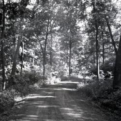
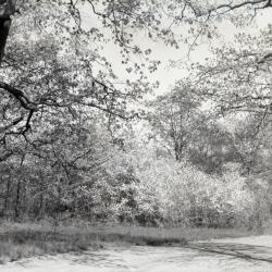
Forest Road in summer (3.33198)
Date: June 21 – September 20 1935Type: Photographic image
Description:Forest Road in summer
Original Ed Puffer land
Extent: 1 negative
Forest Road curving to right in summer (3.33199)
Date: June 21 – September 20 1935Type: Photographic image
Description:Forest Road curving to right in summer
Original Ed Puffer land
Extent: 1 negative
Forest Road, unpaved, curving to right in wooded area (3.33200)
Date: 1930 – 1949Type: Photographic image
Description:Forest Road, unpaved, curving to right in wooded area
200 feet east of lower end of Meadow Road intersection (near present parking #13)
Original Ed Puffer land
Extent: 1 negative

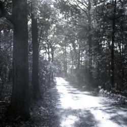
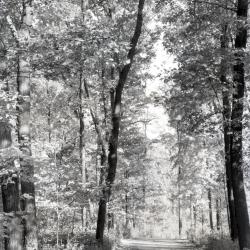
Forest Road, unpaved, in dappled sunlight (3.33201)
Date: 1922 – 1949Type: Photographic image
Description:Forest Road, unpaved, in dappled sunlight
Original Ed Puffer land
Extent: 1 negative

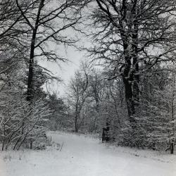
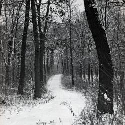
Forest Road in winter, footprints in the snow (3.33202)
Date: 1930 – 1949Type: Photographic image
Description:Forest Road in winter, footprints in the snow
Original Jake Mey land
Extent: 1 negative
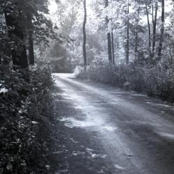
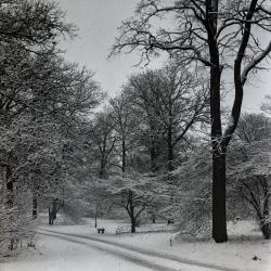
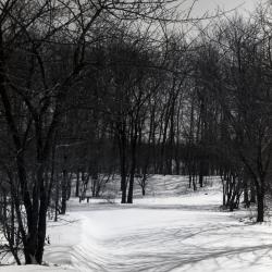
Forest Road covered with snow in winter (3.33203)
Date: 1930 – 1949Type: Photographic image
Description:Forest Road covered with snow in winter
Original Jake Mey land
Extent: 1 negative
Forest Road in winter through dense stand of trees (3.33204)
Date: 1930 – 1949Type: Photographic image
Description:Forest Road in winter through dense stand of trees
Original Jake Mey land
Extent: 1 negative