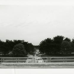
Sunday car traffic going under bridge (3.32055)
Date: 1960sType: Photographic image
Description:Sunday car traffic going under bridge
Extent: 1 photograph
[Wisconsin county maps] (3.6543)
Date: January 1964Creator: State Highway Commission of Wisconsin
Type: Map
Description:Sheet 1 - Kenosha County. Sheet 2 - Milwaukee county. Sheet 3 - Racine County. Sheet 4 - Walworth County. Sheet 5 - Waukesha County.
Extent: 5 sheets
[Utilities Rights-of-Way in the Arboretum Along the East Boundary] (3.5613)
Date: August 1 1960Type: Map
Description:Revised 1960-08-01.
Extent: 1 sheet
[Topographic maps of the United States] Wisconsin topography (3.7136)
Date: 1959 – 1960Creator: Geological Survey (U.S.)
Type: Map
Description:Eagle Quadrangle; Hales Corner Quadrangle; Lake Geneva Quadrangle; Silver Lake Quadrangle; Waukesha Quadrangle
Extent: 5 sheets
[Telephone Cable Installation] (3.5610)
Date: April 3 1961Creator: Illinois Bell Telephone Company
Type: Map
Extent: 1 sheet
[Sterling Morton Library studies] (3.6934)
Date: circa 1962Type: Plan
Description:Floor plans and projected exterior and interior layouts of the Sterling Morton Library.
Sheets numbered 3, 4, and 5.
Extent: 3 sheets
[Sterling Morton Library Studies] (3.5458)
Date: circa 1962Type: Plan
Description:Floor plans and projected exterior and interior layouts of the Sterling Morton Library.
Extent: 5 sheets, stapled
[Stairway Plan at Front of Administration Building] (3.5513)
Date: 1960sCreator: Tyznik, Anthony
Type: Plan
Description:Pencil notes on sheet 1.
Extent: 2 sheets, stapled
[Planting plans for Courtland Street and Palmer Street [cartographic material] / O.C. Simonds]. (3.24871)
Date: 20th centuryCreator: Simonds, O. C.
Type: Plan
Extent: 1 plan 98 x 37 cm.
[Ozark Bridge] (3.6266)
Date: 1964Type: Plan
Description:Note on back: "Ozark Bride [sic], 1964"
Extent: 2 sheets
[Oblique aerial photograph of the Morton Arboretum] (3.6015)
Date: May 20 1969Creator: Airpix
Type: Photographic image
Description:The set of 4 oblique photos covers the eastern portion of the Arboretum at various angles.
Extent: 4 sheets
[North-South Tollway early proposal, including Ogden Ave. interchange, route along Arboretum east and south boundaries] (3.6780)
Date: circa 1965Type: Map
Description:Stamped "Preliminary" Note on back: "Alternate Rte. 53" "Rte. 53 New"
Extent: 1 sheet
[Morton Arboretum and environs] (3.6320)
Date: November 29 1963Creator: Chicago Aerial Survey Co.
Type: Map
Extent: 1 sheet
[Landscape plan for Mrs. Suzette Morton Zurcher residence] (3.6521)
Date: circa 1962Type: Plan
Extent: 1 sheet
[Indiana topographic maps] (3.6554)
Date: 1960 – 1973Creator: Geological Survey (U.S.)
Type: Map
Description:7.5 minute series. Sheet 1 - Illiana Heights Quadrangle. Sheet 2-3 - Mongo Quadrangle. Sheet 4-5 - Orland Quadrangle. Sheet 6 - Wakarusa Quadrangle.
Extent: 6 sheets
[Building structures of] the Morton Arboretum, DuPage County, approximately one mile north of Lisle, Illinois (3.6067)
Date: July 14 1965Creator: Marsh & McLennan, Inc.
Type: Map
Extent: 1 sheet
[Aerial photographs of the AT&T property west of the Arboretum] (3.6178)
Date: July 26 1967Creator: Airpix
Type: Map
Description:Outlined areas approximate the location of the Bell Lab, AT&T site.
Extent: 2 photos in folder
[Aerial Photograph of The Morton Arboretum and Adjacent Areas] (3.6011)
Date: November 19 1967Creator: Chicago Aerial Survey Co.
Type: Photographic image
Description:The five photos in copy 1, taken as stereo pairs, are numbered 1, 2, 4, 5, and 6 and extend from east to west across the Arboretum. A portion of the collections grid is identified by white crosses on the photos.
Extent: 5 sheets
[Aerial Photograph of The Morton Arboretum and Adjacent Areas, enlargement] (3.6013)
Date: November 19 1967Creator: Chicago Aerial Survey Co.
Type: Photographic image
Description:Photographs extend from east to west across the Arboretum. A portion of the collections grid is identified by white crosses on the photos
This photographic print is an enlargement of photo 6 in c.1. See related objects for a link to the record.
Extent: 1 sheet
[Aerial Photograph of the Morton Arboretum and Adjacent Areas pt. 4] (3.5420)
Date: circa 1961Type: Photographic image
Description:The 4 survey photos, taken as stereographic pairs, are identified as follows and show the areas noted: [1] BWS-2BB-204, East half of the Arboretum and Glen Ellyn; [2] BWS-2BB-206, Northwest portion of the Arboretum and Wheaton/Glen Ellyn; [3] BWS-3BB-86, Southeastern portion of the Arboretum and Downers Grove; [4] BWS-3BB-88, Major southern portion of the Arboretum and Lisle.
Part 4
Extent: 1 sheet mounted on posterboard
[Aerial Photograph of the Morton Arboretum and Adjacent Areas pt. 3] (3.5419)
Date: circa 1961Type: Photographic image
Description:The 4 survey photos, taken as stereographic pairs, are identified as follows and show the areas noted: [1] BWS-2BB-204, East half of the Arboretum and Glen Ellyn; [2] BWS-2BB-206, Northwest portion of the Arboretum and Wheaton/Glen Ellyn; [3] BWS-3BB-86, Southeastern portion of the Arboretum and Downers Grove; [4] BWS-3BB-88, Major southern portion of the Arboretum and Lisle.
Part 3
Extent: 1 sheet mounted on posterboard
[Aerial Photograph of the Morton Arboretum and Adjacent Areas pt. 2] (3.5418)
Date: circa 1961Type: Photographic image
Description:The 4 survey photos, taken as stereographic pairs, are identified as follows and show the areas noted: [1] BWS-2BB-204, East half of the Arboretum and Glen Ellyn; [2] BWS-2BB-206, Northwest portion of the Arboretum and Wheaton/Glen Ellyn; [3] BWS-3BB-86, Southeastern portion of the Arboretum and Downers Grove; [4] BWS-3BB-88, Major southern portion of the Arboretum and Lisle.
Part 2
Extent: 1 sheet mounted on posterboard
[Aerial Photograph of the Morton Arboretum and Adjacent Areas pt. 1] (3.5417)
Date: circa 1961Type: Photographic image
Description:The 4 survey photos, taken as stereographic pairs, are identified as follows and show the areas noted: [1] BWS-2BB-204, East half of the Arboretum and Glen Ellyn; [2] BWS-2BB-206, Northwest portion of the Arboretum and Wheaton/Glen Ellyn; [3] BWS-3BB-86, Southeastern portion of the Arboretum and Downers Grove; [4] BWS-3BB-88, Major Southern portion of the Arboretum and Lisle.
Part 1
Extent: 1 sheet mounted on posterboard
[1965]/07/23: Suzette Morton Zurcher to Evelyn Naser (3.85905)
Date: July 23 1965Creator: Davidson, Suzette Morton
Type: Document
Description:Letter from Suzette Morton Zurcher to Evelyn Naser asking her to arrange for young Vince and her to be picked up at O'Hare on August 1. She would also like Larsson and Hannah picked up at the Lisle train station on the 30th. She asks Naser to reconnect her phone, water-softener, and other appliances before she returns home. She is anxious to be back and hear all the news.
"will do Friday" is handwritten by the telephone number
Extent: 1 sheet
Zurcher-Morton Arboretum Trustees Assessment Plat of Part of Lots Two (2), Three (3), and Four (4) in Owner's Assessment Plat of Parts of Sections 33 and 34, Milton Township and Part of Sections 3 and 4, Lisle Township, According to the Plat Thereof Recorded July 25, 1935 as Document 360768 in DuPage County, Illinois (3.6084)
Date: February 3 1965Creator: Steinbrecher, Harold F.
Type: Map
Description:The area surveyed, totalling 10.8 acres, is located in the Leask Lane area, a part of the Slusser farm.
Extent: 1 sheet
Zurcher-Morton Arboretum Trustees Assessment Plat of Part of Lots Two (2), Three (3), and Four (4) in Owner's Assessment Plat of Parts of Sections 33 and 34, Milton Township and Part of Sections 3 and 4, Lisle Township, According to the Plat Thereof Recorded July 25, 1935 as Document 360768 in DuPage County, Illinois (3.5395)
Date: September 9 1964Creator: Steinbrecher, Harold F.
Type: Map
Description:The area surveyed, totalling 10.8 acres, is located in the Leask Lane area, a part of the Slusser farm. This is a partially unsigned copy.
Extent: 1 sheet
Young ferns [graphic] / Clare Leighton. (3.26525)
Date: 20th centuryCreator: Leighton, Clare, 1898-1989.
Type: Print
Extent: 1 print : wood engraving, b&w 17 x 13 cm.
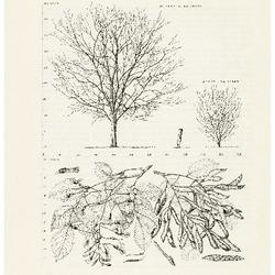
Yellow-wood, Cladrastis lutea: Pea Family (Leguminosae) (3.10504)
Date: March 21 – June 20 1967Creator: Tyznik, Anthony
Type: Article
Yellow Variegated Sweet Gum (3.18635)
Date: 1964Creator: Kammerer, E. Lowell, Chirpe, Rodney.
Type: Drawing
Wren on Rock with Cream Rose- cock (3.17779)
Date: 1964Creator: Doughty, Dorothy, 1892-1962.
Type: Sculpture