Browsing by Subject/Keyword: collection:
Lunching & Learning with Clarence Godshalk: Evolution of the Arboretum - From Farm to Arboretum (3.31582)
Date: January 25 1978Type: Audio
Description:Lunching and Learning program presented by Clarence Godshalk as he describes the evolution of the Arboretum, from farm land to Arboretum.
Extent: 1 audio cassette

Map & Visitor Guide, The Morton Arboretum (3.34271)
Date: 1982 – 1986Type: Map
Description:Double-sided brochure, Map & Visitor Guide for The Morton Arboretum
Map details Arboretum roads, trails, plant collections, buildings and boundaries. Includes photographs of various Arboretum buildings with descriptive information.
Reverse side provides general information about the Arboretum, trails for walking and hiking, driving through the Arboretum, areas and collections of special interest, native plant communities, wildlife at the Arboretum, regulations, facilities and services, and information on membership. A section of the map is enlarged to identify landmarks around the Visitor Center, Administration Building, and Thornhill Education Center.
Extent: 1 sheet
Drainage--Frost Hill (3.36065)
Date: November 7 1988Creator: Kelsey, Pat
Type: Plan
Description:Design plan and graphs
Sections A-A thru F-F
Extent: 1 sheet

Lake Marmo in winter looking east toward Frost Hill in distance (3.36881)
Date: 1930 – 1949Type: Photographic image
Description:Lake Marmo in winter looking east toward Frost Hill in distance
Extent: 1 negative
Frost Hill looking north (3.36984)
Type: Photographic image
Description:Frost Hill looking north
Extent: 1 photograph

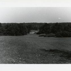
View southeast from Cedar Point, Frost Hill in the far distance (3.37821)
Type: Photographic image
Description:View southeast from Cedar Point
Frost Hill, Thicket, and Forest Road in the far distance
Extent: 1 negative
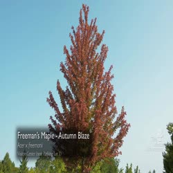
Fall Color Report, Highlights, September 15-21, 2017 (3.63013)
Date: September 2017Creator: The Morton Arboretum
Type: Video
Description: Reported fall color at The Morton Arboretum for September 15-21, 2017
[Arboretum - Southwest Section of East Side] (3.6577)
Date: circa 1978Type: Plan
Description:Administration Building proposed additions added in pencil. Collections labeled in ink. Date hint: East-West Tollway is marked Illinois 5.
Extent: 1 sheet