Picnic Area Landscape Plan (3.31969)
Date: June 5 2003Creator: Hitchcock Design Group, Pelkonen, Peggy
Type: Plan
Description:Includes cover sheet, planting plan, plant list & details, and planting details [Hitchcock]
Extent: 4 sheets
Entry Road Landscape Plan (3.32000)
Date: April 22 2004Creator: Pelkonen, Peggy
Type: Plan
Description:Labeled "As-Built"
Sheets include the following titles: Entry Road Landscape Plan; Main Parking Lot Landscape Plan & Plant List; Picnic Area Landscape Plan & Plant List; Visitor Center Landscape Plan; Visitor Center Retail & Roof Garden Planting Plan; Staff Lot Landscape Plan & Plant List; Arbor Court & Maze Garden Overstory Landscape Plan; Arbor Court & Maze Garden Understory Landscape Plan.
Extent: 9 sheets
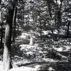
Former picnic area looking west (3.34114)
Type: Photographic image
Description:Former picnic area looking west
*located at about 10-CC on Arboretum map/grid
Extent: 1 negative

A Guide Map of The Morton Arboretum (3.34269)
Date: 1969Creator: Tyznik, Anthony
Type: Map
Description:A guide map of The Morton Arboretum created by Tony Tyznik in 1969. The background is a dark green with the inner Arboretum being a light green and Arboretum roads highlighted in solid orange and checkered orange lines.
Extent: 1 sheet

Arboretum picnic shelter in flood (3.37357)
Date: 1960sType: Photographic image
Description:Arboretum picnic shelter in flood
Extent: 1 photograph
Morton Arboretum map [proposed land use 1969] (3.5764)
Date: December 1969Creator: Hart, Nancy
Type: Plan
Description:Shows Arboretum structures and major connecting roads/trails from the Thornhill area to Meadow Lake and South Farm. An updated version of this map was done at a later date by Anthony Tyznik. Cover sheet states: 1969 Proposed Land Use Morton Arboretum.
Extent: 1 sheet attached to posterboard
[Picnic Shelter] Plan and Elevation (3.6333)
Creator: Tyznik, Anthony
Type: Plan
Description:Purpose of plan unknown. Precursor of Thornhill shelter?
Extent: 1 sheet
[Picnic Shelter] Plan, End and Front Elevations (3.6336)
Date: 1954Creator: Tyznik, Anthony
Type: Plan
Description:Located north of Park Blvd. and west of Rte. 53.
Front and end elevations.
Extent: 1 sheet