The Morton Arboretum Children's Discovery Center: Visitation [1500 visitors] (3.7161)
Date: circa 2003Creator: EDAW
Type: Plan
Description:Shows Children's Garden with 1500 visitors, one red dot per visitor
Extent: 1 sheet

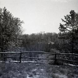
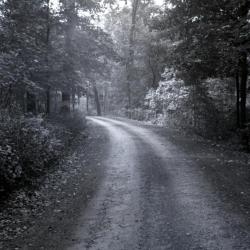
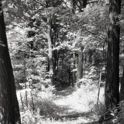
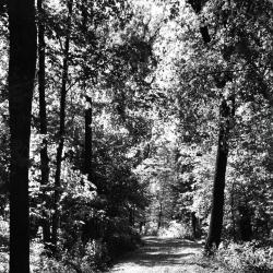
Meadow Road as it comes out of woods, looking southeast (3.3015)
Date: 1930 – 1935Type: Photographic image
Description:Meadow Road as it comes out of woods, looking southeast
Extent: 1 photograph

Larch trees camouflaging power towers near Puffer Lake (3.31909)
Date: January 1972Type: Photographic image
Description:Early plantings of larch near Puffer Lake help camouflage power towers. Rare Kentucky coffee-tree appears in the upper portion of the photo.
Extent: 1 negative

Ridge Road above geographic groups looking east, stereograph (3.31927)
Date: 1930sType: Photographic image
Description:Ridge Road above geographic groups looking east, stereograph
Extent: 1 stereograph

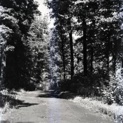
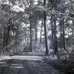
Forest Road curving left looking east near Spruce Plot (3.32138)
Type: Photographic image
Description:Forest Road curving left looking east near Spruce Plot
*located at about 121-U on Arboretum map/grid
Extent: 1 negative
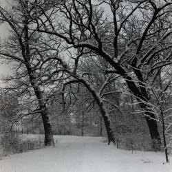
Forest Road in winter with bur oaks arching over road return (3.32164)
Date: 1950sType: Photographic image
Description:Forest Road in winter with bur oaks arching over road return
Extent: 1 negative
View of Morton residence on horizon from Ridge Road near Geographical Groups (3.32761)
Date: 1922 – 1949Type: Photographic image
Description:View of Morton residence on horizon from Ridge Road near Geographical Groups
Extent: 1 negative
Looking northeast over Jake Mey spruce plot from Overlook Drive (3.32770)
Date: 1930sType: Photographic image
Description:Looking northeast over Jake Mey spruce plot along wooden railing from Overlook Drive
Extent: 1 negative
East side road unpaved (3.33189)
Date: 1935Type: Photographic image
Description:East side road unpaved
Extent: 1 negative

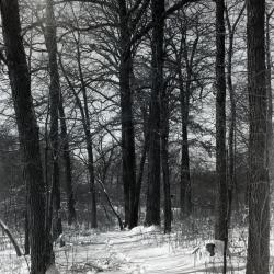
Forest Road in winter, footprints in the snow (3.33202)
Date: 1930 – 1949Type: Photographic image
Description:Forest Road in winter, footprints in the snow
Original Jake Mey land
Extent: 1 negative
Ridge Road lookout looking west/northwest (3.33271)
Type: Photographic image
Description:Ridge Road lookout looking west/northwest
*located at about 71-BB on Arboretum map/grid
Extent: 1 negative
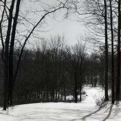
East side nature trail in winter (3.33770)
Date: 1930 – 1949Type: Photographic image
Description:East side nature trail in winter
Extent: 1 negative
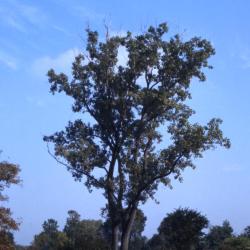
Populus deltoides (eastern cottonwood), fall (3.37717)
Date: October 3 1973Creator: Stickney, William S.
Type: Photographic image
Description:Populus deltoides (eastern cottonwood), large tall tree in fall amongst smaller trees and shrubs on east side of Arboretum, view across DuPage River from Elm Collection along Route 53
Extent: 1 slide

Administration Building entrance and drive, stereograph (3.38480)
Date: 1930 – 1949Type: Photographic image
Description:Administration Building entrance and drive, stereograph
Administration Building entrance and drive, before pool was made in front
Extent: 1 stereograph
[Children's Garden Support Building Proposals] (3.7145)
Date: circa 2003Type: Plan
Description:Shows front elevation (sketch) and 3 plan designs on one sheet, one on the other for building and adjoining area
Extent: 2 sheets
The Morton Arboretum Children's Discovery Center: Visitation [750-1500 visitors] (3.7162)
Date: circa 2003Creator: EDAW
Type: Plan
Description:Shows Children's Garden with four numbers of visitors: 750, 1000, 1250 and 1500, one red dot per visitor
Extent: 1 sheet

Puffer Lake with cattails in foreground (3.31910)
Date: January 1972Type: Photographic image
Description:Puffer Lake Bird Sanctuary retains some of its birds, cattails, and water, but power lines dominate the scenery.
Extent: 1 negative
View looking north on Spring Road at Oakwood Drive (3.31931)
Date: 1930sCreator: Oates, Howard Arthur
Type: Photographic image
Description:View looking north on Spring Road at Oakwood Drive. There was an old basement, probably from early Thompson house, under the bur oak on left.
Extent: 1 photograph
Forest Road slightly curving left looking east near Spruce Plot (3.32139)
Type: Photographic image
Description:Forest Road slightly curving left looking east near Spruce Plot
*located at about 122-U on Arboretum map/grid
Extent: 1 negative
Forest Road in winter near Buckeye Collection (3.32165)
Date: 1950sType: Photographic image
Description:Forest Road in winter near Buckeye Collection
Extent: 1 negative

View east from Meadow Road near Puffer gravel pit (3.32771)
Date: 1930Type: Photographic image
Description:View east from Meadow Road near Puffer gravel pit
Extent: 1 negative
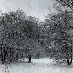
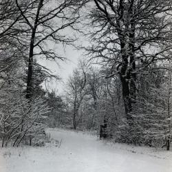
Forest Road covered with snow in winter (3.33203)
Date: 1930 – 1949Type: Photographic image
Description:Forest Road covered with snow in winter
Original Jake Mey land
Extent: 1 negative
Ridge Road lookout looking west/northwest with tree in front of railing (3.33272)
Type: Photographic image
Description:Ridge Road lookout looking west/northwest with tree in front of railing
*located at about 77-BB on Arboretum map/grid
Extent: 1 negative
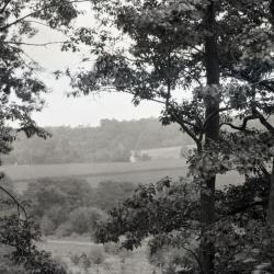
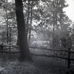
Trail leading through woods, east side (3.33442)
Date: 1930 – 1949Type: Photographic image
Description:Trail leading through woods, east side
Sunlight along path
Extent: 1 negative
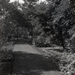
View along path in Ground Cover Collection (3.34106)
Date: September 23 1938Type: Photographic image
Description:View along path in Ground Cover Collection
Extent: 1 negative
[Aerial photograph of] the Morton Arboretum (3.5438)
Date: March 25 1986Creator: Sidwell Company
Type: Photographic image
Description:Photographs taken from west to east; individual sheets overlap.
Extent: 5 sheets in binder
Meadow Lake Reconstruction (3.6723)
Date: 1990sCreator: Mehaffey, Scott A.
Type: Plan
Description:Sheet 1 - scope drawing; Sheet 2 - site context
Extent: 2 sheets
An East Side Glade of Spring Flowers, 2000 Volunteer Giving Program (3.7039)
Date: 2000Creator: Mehaffey, Scott A.
Type: Plan
Extent: 1 sheet
Children's Garden, Lisle, Illinois: Site Improvements Construction Set (3.7146)
Date: November 18 2003Creator: Hitchcock Design Group
Type: Plan
Extent: 31 sheets bound

Looking north across snow covered Puffer Lake (3.31911)
Date: January 1972Type: Photographic image
Description:Looking north across Puffer Lake from the former site of the bird observatory.
Extent: 1 negative

Forest Road overlook (3.31932)
Date: 1940sType: Photographic image
Description:Forest Road overlook
Extent: 1 negative filmstrip
Forest Road curving to right looking east (3.32140)
Type: Photographic image
Description:Forest Road curving to right looking east
*located at about 23-L on Arboretum map/grid
Extent: 1 negative
Forest Road in winter, possibly leading to woodlot (3.32166)
Date: 1950sType: Photographic image
Description:Forest Road in winter, possibly leading to woodlot
Extent: 1 negative
Unpaved road through wooded area near Puffer gravel pit (3.32772)
Date: 1930Type: Photographic image
Description:Unpaved road through wooded area near Puffer gravel pit
Extent: 1 negative

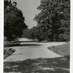
Oakwood loop and cutoff with car approaching (3.33192)
Date: 1922 – 1949Type: Photographic image
Description:Oakwood loop and cutoff with car approaching
Extent: 1 negative
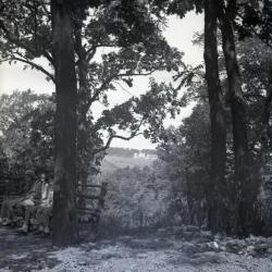
Ridge Road lookout looking west/northwest, children on bench to left, farm buildings in distance (3.33273)
Type: Photographic image
Description:Ridge Road lookout looking west/northwest, children on bench to left, farm buildings in distance
*located at about 71-BB on Arboretum map/grid
Extent: 1 negative