Browsing by Subject/Keyword: year:
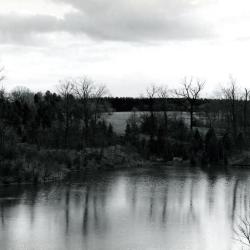
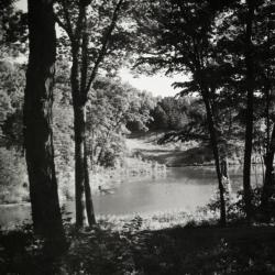
Looking south across Sterling Pond from Cricket Hill. Road on right becomes Evergreen Drive. (3.2980)
Date: circa 1960 – 1979Creator: Helmick, William K.
Type: Photographic image
Description:Looking south across Sterling Pond from Cricket Hill. Road on right becomes Evergreen Drive.
Extent: 1 photograph
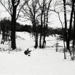
View of Sterling Pond looking north from Clarence Godshalk's yard in winter (3.31809)
Date: 1960sType: Photographic image
Description:View of Sterling Pond looking north from Clarence Godshalk's yard in winter. Open area across Sterling Pond used to be a gravel pit before 1959 when pond was dug.
Extent: 1 negative filmstrip
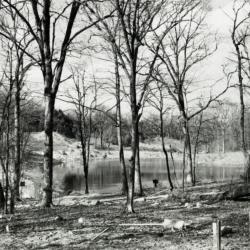
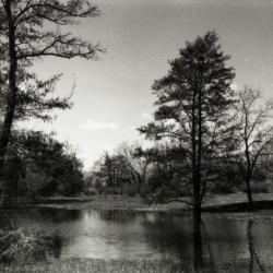
Sterling Pond looking north through bare trees from Clarence Godshalk's yard (3.31810)
Date: 1960sType: Photographic image
Description:Sterling Pond looking north through bare trees from Clarence Godshalk's yard. Open area across Sterling Pond used to be a gravel pit before 1959 when pond was dug.
Extent: 1 negative filmstrip
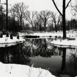
Pond west of Sterling Pond Bridge over inlet in winter (3.31811)
Date: 1960sType: Photographic image
Description:Pond west of Sterling Pond Bridge over inlet in winter
Extent: 1 negative filmstrip
Sterling Pond looking north from Clarence Godshalk's yard (3.31812)
Date: 1960sType: Photographic image
Description:Sterling Pond looking north from Director Clarence Godshalk's yard. Open area across Sterling Pond used to be a gravel pit before 1959 when pond was dug.
Extent: 1 negative filmstrip
Sterling Pond looking north (3.31813)
Date: 1960sType: Photographic image
Description:Sterling Pond looking north
Extent: 1 negative filmstrip

A Guide Map of The Morton Arboretum (3.34269)
Date: 1969Creator: Tyznik, Anthony
Type: Map
Description:A guide map of The Morton Arboretum created by Tony Tyznik in 1969. The background is a dark green with the inner Arboretum being a light green and Arboretum roads highlighted in solid orange and checkered orange lines.
Extent: 1 sheet