Northern Illinois Toll Highway: east-west route, plan & profile, Sta. 7520 to [Sta. 7637] Contract E-2A, Hurst-Rosche, Inc. (3.5884)
Date: 1957Creator: Illinois State Toll Highway Authority
Type: Map
Description:Sheets have the following numbering sequences: printed, "Sheet 15[-23] of 70"; stamped, 8265-8273; and in ms., 15-23.
Extent: 9 sheets stapled
Northern Illinois Toll Highway Parcel No. E-2-70, Sec. 3, T.38N., R.10E. of the 3rd P.M., DuPage County, Illinois (3.6092)
Date: 1956Creator: Illinois State Toll Highway Authority
Type: Map
Description:This map is a portion along the East-West Tollway easement in Lot 7 of Petersen-Tate Assessment Plat no. 2. This copy (Copy 2), dated from about 1956, includes surveyed area of 0.583 acres of the permanent easement.
Extent: 1 sheet
Northern Illinois Toll Highway Parcel No. E-2-68E [and E-2-68E.1], Sec. 3, T.38N., R.10E. of the 3rd P.M., DuPage County, Illinois (3.6093)
Date: May 1978Creator: Illinois State Toll Highway Authority
Type: Map
Description:Area surveyed, 0.313 acres, is a portion along the East-West Tollway easement in Lot 6 of Petersen-Tate Assessment Plat no. 2.
Extent: 3 sheets
Northern Illinois Toll Highway Parcel no. E-2-70E, Sec. 3, T.38N., R.10E. of the 3rd P.M., DuPage County, Illinois (3.6094)
Date: May 1978Creator: Illinois State Toll Highway Authority
Type: Map
Description:Area surveyed, 0.295 acres, is a portion along the East-West Tollway easement in Lot 7 of Petersen-Tate Assessment Plat no. 2.
Extent: 2 sheets
Northern Illinois Toll Highway Parcel No. E-2-71E [and] E-2-71E.1, Sec. 3, T.38N., R.10E. of the 3rd P.M., DuPage County, Illinois (3.6095)
Date: May 1978Creator: Illinois State Toll Highway Authority
Type: Map
Description:Area surveyed, 0.206 acres, is a portion along the East-West Tollway easement in Lot 6 of Petersen-Tate Assessment Plat no. 2.
Extent: 4 sheets
North-South Tollway - tunnel modifications, Contract CIP615A, Centerline Station 1150+00 to Station 1165 = 00, NW Ramp Station 57 + 50 to Station 63 + 50 (3.6288)
Date: circa 1993Creator: Illinois State Toll Highway Authority
Type: Map
Description:Tunnel located where North-South and East-West Tollways intersect. A few red pencil corrections.
Extent: 14 sheets stapled
Tollway Right-of-Way and Easement at Morton Arboretum (3.6366)
Date: January 14 1988Creator: Illinois State Toll Highway Authority
Type: Map
Extent: 3 sheets
Preliminary Response to Category 4: Agreement between the Morton Arboretum and the Illinois Toll Highway Authority [draft] (3.67152)
Type: Document
Description:A draft document discussing the preliminary agreement between the Morton Arboretum and the Illinois Toll Highway Authority regarding concessions and environmental impacts of the Tollway on the Arboretum.
Extent: 3 sheets
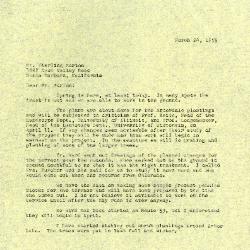
1959/03/24: C. E. Godshalk to Sterling Morton (3.86062)
Date: March 24 1959Creator: Godshalk, Clarence E.
Type: Document
Description:Letter from C. E. Godshalk to Sterling Morton stating the plans are about done for the Arbordale plantings. The plans will be reviewed by Professor Keith (Head of the Landscape Department, University of Illinois) and Professor Longenecker (Head of the Landscape Department, University of Wisconsin). Mr. Ward sent out drawings for the planned changes to the terrace. Godshalk is doubtful of the plan; Mrs. Zurcher will come out to the Arboretum to see it when she returns from Colorado. Work on Route 53 should begin in April. Godshalk has started staking out the shrub plantings around Arbor Lake. He is meeting with Mr. Kress to see how much planting the Arboretum will be allowed to do along the toll road.
Extent: 2 sheets