Browsing by Subject/Keyword: year:

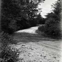
Residence Drive near Thornhill Residence (3.3000)
Date: 1920sCreator: Henry Fuermann and Sons
Type: Photographic image
Description:Residence Drive near Thornhill Residence
Extent: 1 photograph
Morton residence entrance drive curving right, east of Redwood (Outpost) building site (3.32172)
Date: 1920sType: Photographic image
Description:Morton residence entrance drive curving right, east of Redwood (Outpost) building site
Extent: 1 negative
Muddy Arboretum dirt road curving to the left (3.32173)
Date: 1920sType: Photographic image
Description:Muddy Arboretum dirt road curving to the left
Dirt roads as they used to be until 1935 when Mrs. Jean Morton Cudahy became chairman. Muddy when wet, dusty when dry.
Extent: 1 negative

Arboretum dirt road curving to left (3.32174)
Date: 1920sType: Photographic image
Description:Arboretum dirt road curving to left
Dirt road as they used to be until 1935 when Mrs. Cudahy (Jean Morton) became chairman. Muddy when wet, dusty when dry.
Extent: 1 negative

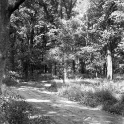
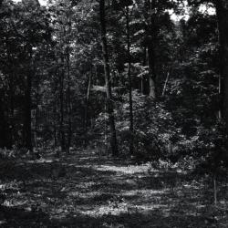
Arboretum dirt road through trees (3.32175)
Date: 1920sType: Photographic image
Description:Arboretum dirt road through trees
Arboretum dirt road as they used to be until 1935 when Mrs. Cudahy (Jean Morton) became chairman. Muddy when wet, dusty when dry.
Extent: 1 negative

Arboretum road through trees (3.32176)
Date: 1920sType: Photographic image
Description:Arboretum road through trees
Extent: 1 negative

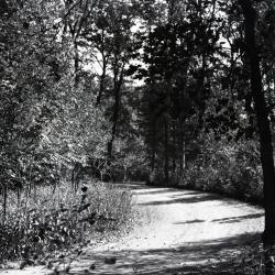
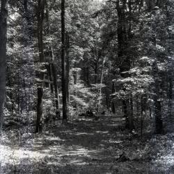
Arboretum unpaved road in forest curving to right (3.32178)
Date: 1920sType: Photographic image
Description:Arboretum unpaved road in forest curving to right
Early roads - muddy when wet, dusty when dry
Extent: 1 negative
Arboretum unpaved sunlit road curving right into forest (3.32179)
Date: 1920sType: Photographic image
Description:Arboretum unpaved sunlit road curving right into forest
Early roads - muddy when wet, dusty when dry
Extent: 1 negative
Early unpaved Arboretum road curving to left (3.33511)
Date: 1920sType: Photographic image
Description:Early unpaved Arboretum road curving to left
Extent: 1 negative

Area cleared for road, before stumps were blown and bed graded (3.33512)
Date: 1920sType: Photographic image
Description:Area cleared of brush and small trees for road, before stumps were blown and bed graded
Extent: 1 negative

Area cleared for road, before stumps were blown and bed graded (3.33513)
Date: 1920sType: Photographic image
Description:Area cleared of brush and small trees for road, before stumps were blown and bed graded
Extent: 1 negative

Area cleared for road, horses in the distance (3.33514)
Date: 1920sType: Photographic image
Description:Area cleared of brush and small trees for road, before stumps were blown and bed graded
Horses in the distance
Extent: 1 negative

Area cleared of brush and small trees for road (3.33515)
Date: 1920sType: Photographic image
Description:Area cleared of brush and small trees, but before stumps were blown and bed graded
Extent: 1 negative
Area cleared of brush and small trees for road in woods (3.33516)
Date: 1920sType: Photographic image
Description:Area cleared of brush and small trees for road in woods, before stumps were blown and bed graded
Extent: 1 negative
Area cleared for road, before stumps were blown and bed graded (3.33517)
Date: 1920sType: Photographic image
Description:Area cleared of brush and small trees for road, before stumps were blown and bed graded
Extent: 1 negative
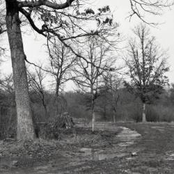
Looking north from Clarence Godshalk's yard, DuPage River bridge in center (3.33989)
Date: 1920sType: Photographic image
Description:Looking north from Clarence Godshalk's yard, DuPage River bridge in center
Extent: 1 negative

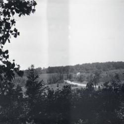
West end of Lake Marmo from unpaved Lake Road (3.36856)
Date: 1920sType: Photographic image
Description:West end of Lake Marmo from unpaved Lake Road
Extent: 1 negative
Topographical Plat of Portion of Land to be Used for Morton Arboretum, Lisle, Illinois, July 1921-October 1922 (3.5246)
Date: July 1921 – October 1922Creator: O. C. Simonds & Co.
Type: Map
Description:Sheet titles vary. The first sheet has title shown above and subtitle: Sheet No. 2. The second sheet: Topographical Plat, Morton Arboretum, sheet No. 3. The third sheet: Topographical Plat, Morton Arboretum, sheet No. 4. The three sheets are attached as one map. True elevations are given. Survey covers the east portion of the Arboretum only. Topographical data are provided in the areas planned for road development only, and roadways have been marked with color. Native woodland cover is shown, with 14 species identified.
Extent: 3 sheets mounted as 1 map