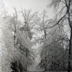
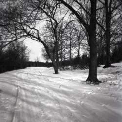
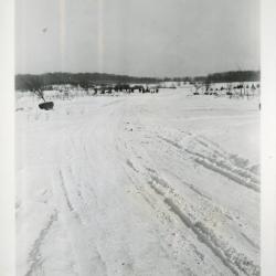
Lake Road just west of Thornhill in winter (3.32742)
Type: Photographic image
Description:Lake Road just west of Thornhill in winter
Extent: 1 negative
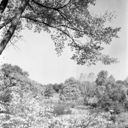
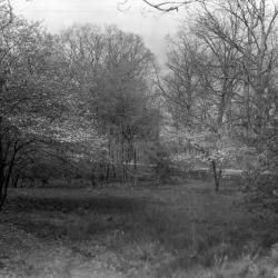
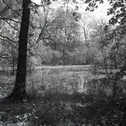
Arboretum grounds, natural area near Parking Lot 7, close view from unpaved road (3.33277)
Type: Photographic image
Description: Arboretum grounds, natural area near Parking Lot 7, close view from unpaved road
Extent: 1 negative
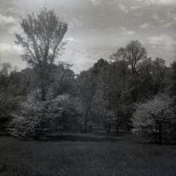
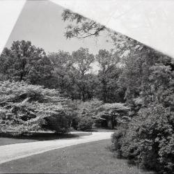
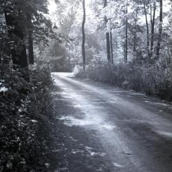
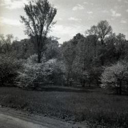
Summer view with overhanging tree on left and road in distance (3.37860)
Type: Photographic image
Description:Summer view with overhanging tree on left and road in distance
Extent: 1 negative
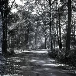
Forest Road with partial sunlight looking northeast (?) as it curves to right (3.32143)
Type: Photographic image
Description:Forest Road with partial sunlight looking northeast (?) as it curves to right
*located at about 122-K on Arboretum map/grid
Extent: 1 negative

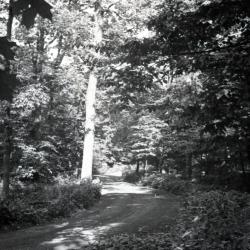
Forest Road curving left and looking northwest with overhanging tree (3.32136)
Type: Photographic image
Description:Forest Road curving left and looking northwest with overhanging tree
*located at about 94-FF on Arboretum map/grid
Extent: 1 negative
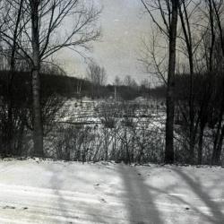
Lake Road in winter, south side of Lake Marmo looking east (3.32746)
Type: Photographic image
Description:Lake Road in winter, south side of Lake Marmo looking east
Extent: 1 negative
Forest Road Edge Loop looking northeast from left side of road (3.32147)
Type: Photographic image
Description:Forest Road Edge Loop looking northeast from left side of road
*located at about 130-W on Arboretum map/grid
Extent: 1 negative
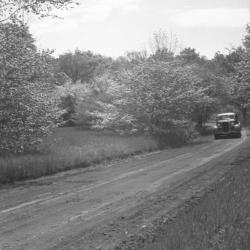
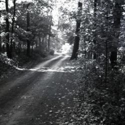
Car driving along unpaved Arboretum road (3.37731)
Type: Photographic image
Description:Car driving along unpaved Arboretum road
Extent: 1 negative
Forest Road curving to right looking east (3.32140)
Type: Photographic image
Description:Forest Road curving to right looking east
*located at about 23-L on Arboretum map/grid
Extent: 1 negative
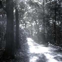
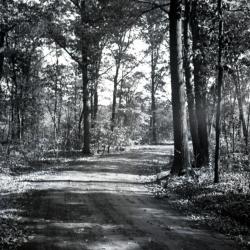
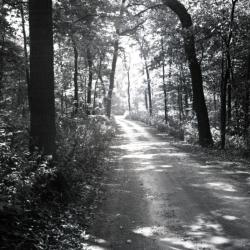
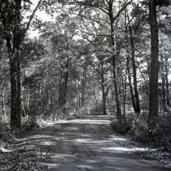
Forest Road looking east (3.32133)
Type: Photographic image
Description:Forest Road looking east
*located at about 107-H on Arboretum map/grid
Extent: 1 negative
Main Entrance/Main Road Phase Two Storm Sewer & Grading As-Built (3.47238)
Creator: Christopher B. Burke, Engineering West, Ltd.
Type: Plan
Description:As-built plan and topographical survey of the storm sewer and grading of the main road near the entrance in 2004.
"Project No. 00-927AA"
Extent: 1 Sheet

Arboretum road along north side of Lake Marmo in winter (3.32743)
Type: Photographic image
Description:Arboretum road along north side of Lake Marmo in winter
Extent: 1 negative
Arboretum unpaved roads intersection (3.32180)
Type: Photographic image
Description:Arboretum unpaved roads intersection
Extent: 1 negative
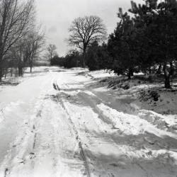
Snow-covered landscape and road, tree with balled roots for transplanting in distance to left of the road (3.60070)
Type: Photographic image
Description:Snow-covered landscape and road, tree with balled roots for transplanting in distance to left of the road
Extent: 1 photograph
Arboretum grounds, natural area near Parking Lot 7, unpaved road in foreground (3.33282)
Type: Photographic image
Description:Arboretum grounds, natural area near Parking Lot 7, unpaved road in foreground
Extent: 1 negative
Landscape alongside road on Morton residence grounds near burial plot (3.37869)
Type: Photographic image
Description:Landscape alongside road on Morton residence grounds near burial plot
Extent: 1 negative
Forest Road looking east (?) slightly curving to the right (3.32144)
Type: Photographic image
Description:Forest Road looking east (?) slightly curving to the right
*located at about 95-FF on Arboretum map/grid
Extent: 1 negative

Car driving along Arboretum road in winter (3.34123)
Type: Photographic image
Description:Car driving along Arboretum road in winter
Extent: 1 negative
Forest Road curving to left with maple leaves hanging in foreground (3.32137)
Type: Photographic image
Description:Forest Road curving to left with maple leaves hanging in foreground
Extent: 1 negative
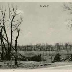
View from road, men working in field with uprooted and bare trees (3.37353)
Type: Photographic image
Description:View from road of field with bare trees, some uprooted in foreground; men working in the distance
Extent: 1 photograph
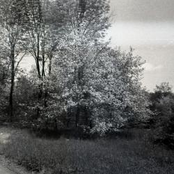
Water view through trees with road in background (3.33548)
Type: Photographic image
Description:Water view through trees with road in background, looking southwest
*located at about 99-T on Arboretum map/grid
Extent: 1 negative
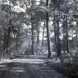
Forest Road through wooded area looking east (3.32141)
Type: Photographic image
Description:Forest Road through wooded area looking east
*located at about 125-T on Arboretum map/grid
Extent: 1 negative
Forest Road looking east curving to right (3.32134)
Type: Photographic image
Description:Forest Road looking east curving to right
*located at about 94-FF on Arboretum map/grid
Extent: 1 negative
Main Entrance/Main Road Phase Two Storm Sewer & Grading As-Built (3.47239)
Creator: Christopher B. Burke, Engineering West, Ltd.
Type: Plan
Description:As-built plan of the storm sewer and grading and topographical survey of the main road near the main exit in 2004.
"Project No. 00-927AA"
Extent: 1 Sheet

Lake Road along south side of Lake Marmo looking east in winter (3.32744)
Type: Photographic image
Description:Lake Road along south side of Lake Marmo looking east in winter
Hemlock Hill on right, Arbor vitae straight ahead
Extent: 1 negative
Main Entrance/Main Road Phase Two Planting Specifications (3.44581)
Creator: Christopher B. Burke, Engineering West, Ltd.
Type: Plan
Extent: 5 Sheets
Spring Road looking north in winter (3.32246)
Type: Photographic image
Description:Spring road looking north in winter
Rhododendron Collection now in pines on the right
Extent: 1 negative
Lake Marmo looking north from snow covered road (3.33283)
Type: Photographic image
Description:Lake Marmo looking north from snow covered road
*located at about 14-S on Arboretum map/grid
Extent: 1 negative
Forest Road Edge Loop looking southwest (3.32145)
Type: Photographic image
Description:Forest Road Edge Loop looking southwest
*located at about 132-Y on Arboretum map/grid
Extent: 1 negative

Forest Road curving left looking east near Spruce Plot (3.32138)
Type: Photographic image
Description:Forest Road curving left looking east near Spruce Plot
*located at about 121-U on Arboretum map/grid
Extent: 1 negative
[Morton Arboretum East End Roads and Marshes] (3.7111)
Creator: Brown and Associates, Inc.
Type: Map
Description:Includes Puffer, Etter, and Bur Reed marshes. Road layout predates 2002.
Extent: 1 sheet
[Retaining Wall, I-88 Parapet Over Route 53] (3.32017)
Type: Plan
Description:One sheet with eight elevations of I-88 parapet over Route 53, with retaining wall, abutments, and wing walls.
Extent: 1 sheet
[Administration Building, Research Wing, and Greenhouses] (3.6808)
Type: Plan
Description:Map includes South Farm buildings, Route 53, service drive and "public parking" south of service drive.
Extent: 1 sheet
Morton Arboretum Main Road Phase One Storm Sewer & Grading As-Built (3.47236)
Creator: Christopher B. Burke, Engineering West, Ltd.
Type: Plan
Description:Topographic map of a section of the main road to depict storm sewer and grading information.
"Project No. 00-927AA"
Extent: 1 Sheet
A Parking Plan for Parking Lot No. 25, the Morton Arboretum, Lisle, Illinois (3.6516)
Creator: Tyznik, Anthony
Type: Map
Description:Includes plantings for areas around parking lot
Extent: 1 sheet
Arboretum grounds, natural area near Parking Lot 7, view from unpaved road (3.33276)
Type: Photographic image
Description: Arboretum grounds, natural area near Parking Lot 7, view from unpaved road
Extent: 1 negative