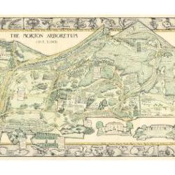
Morton Arboretum Map (3.19479)
Date: 1943Creator: Watts, May Theilgaard
Type: Map
Description:2014 reprint of The Morton Arboretum's first color map, circa 1943.
Detailed map of Arboretum grounds, showing roads, paths, landscaping, shelters, structures, enlargement of some specific features, hedge garden, some specific trees, and trails with markers numbered 1 - 42. Other features include a scale, a calendar, and a compass rose consisting of directions depicted with leaves. A highly ornamental border includes grid marks, as well as drawings of animal tracks and detailed drawings and labels of plants. The Morton Arboretum encompassed 813 acres at time of map.
Extent: 1 sheet

Morton Arboretum Map: Preliminary Drawing for Colored Map (3.19480)
Date: 1943Creator: Watts, May Theilgaard
Type: Drawing
Description:Preliminary drawing for detailed colored map of Arboretum grounds that was printed in 1943, showing roads, paths, landscaping, shelters, enlargement of some specific features, hedge garden, and center of hedge garden. Blank spaces indicate water and text placement. Tree symbols show exceptional specimens on east and west sides. The Morton Arboretum encompassed 813 acres at time of map. Drawing is in two pieces.
Extent: 2 sheets

Morton Arboretum Map (3.19481)
Date: 1943Creator: Watts, May Theilgaard
Type: Map
Description:Detailed map of Arboretum grounds, showing roads, paths, landscaping, shelters, structures, enlargement of some specific features, hedge garden, some specific trees, and trails with markers numbered 1 - 42. Other features include a scale, a calendar, and a compass rose consisting of directions depicted with leaves. A highly ornamental border includes grid marks, as well as drawings of animal tracks and detailed drawings and labels of plants. Some replacement illustration and text has been adhered to the map. The Morton Arboretum encompassed 813 acres at time of map. One section is partially missing.
Extent: 1 sheet
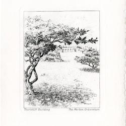
Notecards: Views of the Arboretum (3.27751)
Date: 1940 – 1960Creator: Watts, May Theilgaard
Type: Print
Description:Nine notecards showing 5 different views of The Morton Arboretum. Notecards are black ink etchings on cream paper, folded, with a deckle edge, accompanied by nine matching cream envelopes with a deckle edge and housed in a two-sided, gray leatherette portfolio with an orange paper tie. All notecards are blank with the exception of one which has a letter written inside.
Text in blue on front of the portfolio: THE MORTON ARBORETUM LISLE, ILLINOIS
Title on the bottom left and The Morton Arboretum on the bottom right of each notecard:
- From the hedge collection [1 card]
- Illustration depicts stone steps leading up to hedge collection and evergreen trees
- Along a small stream [3 cards]
- Illustration depicts a stream, bridge, tress, and shrubbery in winter
- Thornhill Building [2 cards]
- Illustration depicts view up the hill to the Thornhill building, with bare trees and mushrooms in foreground, clouds and trees behind building in background
- Along walk to Thornhill Building [2 cards, one containing correspondence regarding plans for a field trip]
- Illustration depicts trees and flowers in forest
- White oak [1 card]
- Illustration depicts a winter white oak in forest with shrubbery
Extent: 9 notecards with envelopes
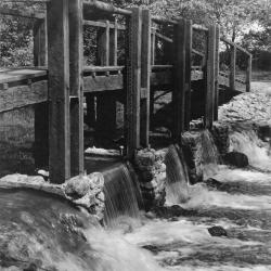
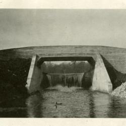
Bridge and dam across DuPage River (west branch) (3.2979)
Date: 1950sCreator: Miller, W. L.
Type: Photographic image
Description:Bridge and dam across DuPage River (west branch)
Bridge and dam with gates designed by Clarence Godshalk to control water level of Lake Jopamaca.
Replaced the artificial concrete & stone rapids built in 1930's. This bridge/gate taken out around 1980
Extent: 1 photograph
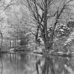
Early Snowfall, The Morton Arboretum (3.2983)
Creator: Webb, Ralph E.
Type: Photographic image
Description:First snowfall at the west end of Lake Marmo
Extent: 1 photograph
Arbor Lake under construction (3.3013)
Date: 1957Type: Photographic image
Description:Arbor Lake under construction
Extent: 1 photograph
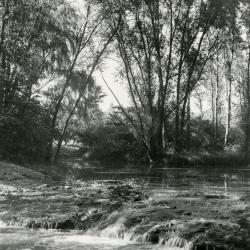
The Waterfall (3.3031)
Date: 1930sCreator: Hartshorn, Ken
Type: Photographic image
Description:The Waterfall - the rapids built in DuPage River to raise water level in Lake Jopamaca. These were made from concrete with stones set in while soft. Later replaced by dam with gates to control water level. Used to see large northern pike go up over the rapids in Spring
Extent: 1 photograph
Lake Marmo dam & bridge as originally designed by O.C. Simonds (3.3032)
Date: 1922Type: Photographic image
Description:Lake Marmo dam & bridge as originally designed by O.C. Simonds
Extent: 1 photograph
Lake Marmo, looking southeast (3.3033)
Date: 1930sType: Photographic image
Description:Lake Marmo, looking southeast, bridge and dam in the distance
Extent: 1 photograph

Footbridge view over water (3.3039)
Creator: Linchester, Ed
Type: Photographic image
Description:Footbridge view over water
Extent: 1 photograph
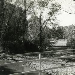
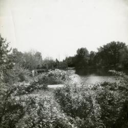
Looking southwest from bridge over DuPage River toward Lake Jopamaca (3.3040)
Date: October 1941Type: Photographic image
Description:Looking southwest from bridge over DuPage River toward Lake Jopamaca
Extent: 1 photograph
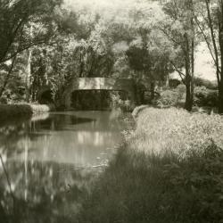
Bridge over Lake Marmo inlet looking upstream (3.3048)
Date: 1940Type: Photographic image
Description:Bridge over Lake Marmo inlet looking upstream
Extent: 1 photograph
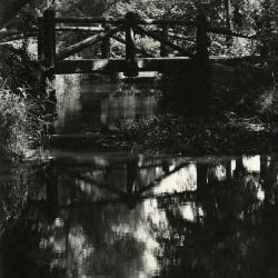
Concrete bridge over DuPage River, looking north (3.3050)
Date: 1920sCreator: Melton, W.
Type: Photographic image
Description:Concrete bridge over DuPage River, looking north, before metal railings were installed
Extent: 1 photograph
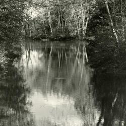
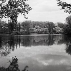
Lake with birch reflections (3.3052)
Creator: McLean, O. C.
Type: Photographic image
Description:Lake with birch reflections
Extent: 1 photograph
Lake Marmo looking north (3.3056)
Date: 1940sType: Photographic image
Description:Lake Marmo looking north
Extent: 1 negative
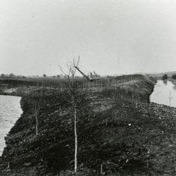
Ozarks first planting alongside nearly constructed Lake Jopamaca, DuPage River to the right (3.3070)
Date: March 21 – June 20 1922Type: Photographic image
Description:Looking north at Ozarks first planting alongside nearly constructed Lake Jopamaca, DuPage River to the right
Extent: 1 photograph
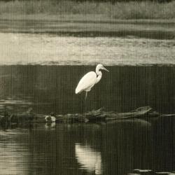
Egret On Log (3.3089)
Date: 1933Creator: Streator, Sidney V.
Type: Photographic image
Description:Egret On Log
Extent: 1 photograph
Morton Arboretum Willoway Brook tributary stream enhancement project, phase II, DuPage County, Illinois (3.31598)
Date: March 28 2005Type: Map
Description:Thomas Burke, Jr.
Extent: 11 sheets bound
Geese sitting on snow covered Arbor Lake in winter (3.31676)
Date: 1977Type: Photographic image
Description:Geese sitting on snow covered Arbor Lake in winter
Extent: 1 negative
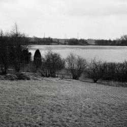
View of Arbor Lake from behind wire fence in winter (3.31677)
Date: 1977Type: Photographic image
Description:View of Arbor Lake from behind wire fence in winter
Extent: 1 negative
Snow covered Arbor Lake with geese, view from behind wire fence in winter (3.31678)
Date: 1977Type: Photographic image
Description:Snow covered Arbor Lake with geese, view from behind wire fence in winter
Extent: 1 negative
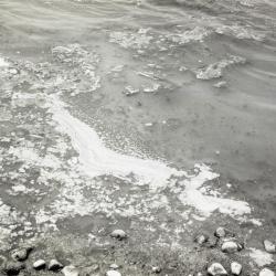
Floating ice in Arbor Lake, closeup view (3.31679)
Date: 1977Type: Photographic image
Description:Floating ice in Arbor Lake, closeup view in winter
Extent: 1 negative
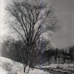
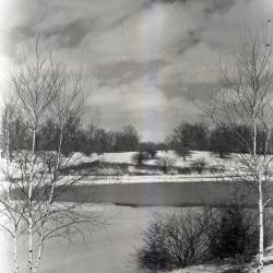
Lake Marmo inlet in winter (3.31773)
Date: 1930 – 1949Type: Photographic image
Description:Lake Marmo Inlet in winter with tree on bank
Extent: 1 negative
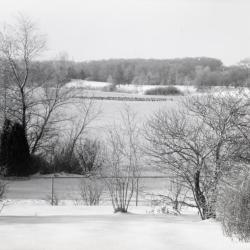
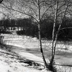
Lake Marmo landscape in winter (3.31774)
Date: 1930 – 1949Type: Photographic image
Description:Lake Marmo landscape in winter
Extent: 1 negative
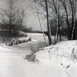
Lake Marmo looking east to island from west shore in winter (3.31776)
Date: 1930 – 1949Type: Photographic image
Description:Lake Marmo looking east to island from west shore in winter
Extent: 1 negative
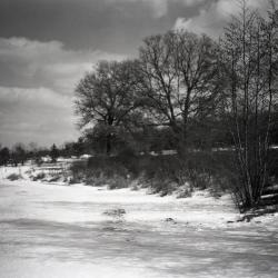
Lake Marmo looking northeast to island from inlet in winter (3.31777)
Date: 1925 – 1949Type: Photographic image
Description:Lake Marmo looking northeast to island from inlet in winter
Extent: 1 negative
Japanese Island pond, looking north over Geographic groups in winter (3.31778)
Date: 1925 – 1949Type: Photographic image
Description:Japanese Island pond, looking north over Geographic groups in winter
Extent: 1 negative
Looking south over Sterling Pond in winter (3.31779)
Date: February 1970Type: Photographic image
Description:Looking south over Sterling Pond in winter
Extent: 1 negative
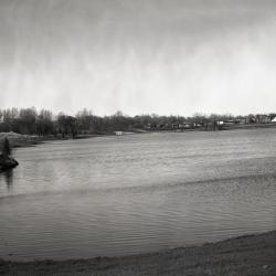
Arbor Lake with staff houses in background (3.31780)
Date: 1959Type: Photographic image
Description:Arbor Lake with staff houses in background
Extent: 1 negative
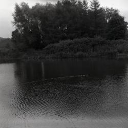
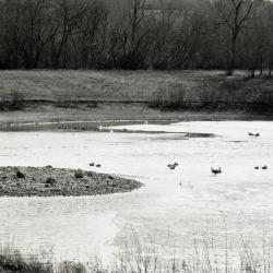
Meadow Lake with ducks (3.31781)
Type: Photographic image
Description:Meadow Lake with ducks
Extent: 1 negative
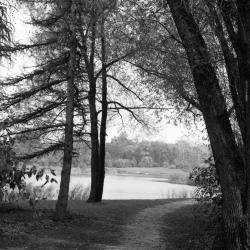
Meadow Lake along Illinois Trees Trail Loop (3.31782)
Date: 1969Type: Photographic image
Description:Meadow Lake along Illinois Trees Trail Loop
Extent: 1 negative
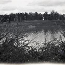
Puffer Lake looking north (3.31783)
Date: 1920sType: Photographic image
Description:Puffer Lake looking north
Extent: 1 negative
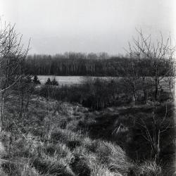
Path near Puffer Lake looking south (3.31784)
Date: 1930sType: Photographic image
Description:Path near Puffer Lake looking south
Extent: 1 negative
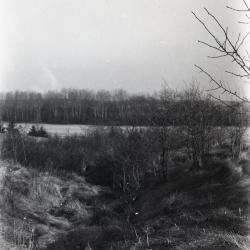
Landscape along path near Puffer Lake looking south (3.31785)
Date: 1930sType: Photographic image
Description:Landscape along path near Puffer Lake looking south
Extent: 1 negative
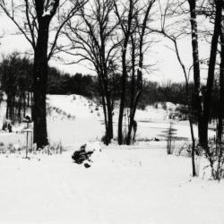
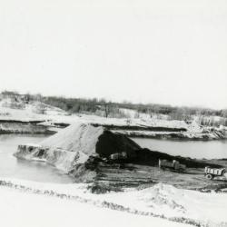
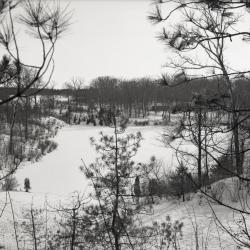
View of Sterling Pond looking north from Clarence Godshalk's yard in winter (3.31809)
Date: 1960sType: Photographic image
Description:View of Sterling Pond looking north from Clarence Godshalk's yard in winter. Open area across Sterling Pond used to be a gravel pit before 1959 when pond was dug.
Extent: 1 negative filmstrip