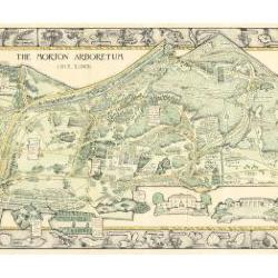
Morton Arboretum Map (3.19479)
Date: 1943Creator: Watts, May Theilgaard
Type: Map
Description:2014 reprint of The Morton Arboretum's first color map, circa 1943.
Detailed map of Arboretum grounds, showing roads, paths, landscaping, shelters, structures, enlargement of some specific features, hedge garden, some specific trees, and trails with markers numbered 1 - 42. Other features include a scale, a calendar, and a compass rose consisting of directions depicted with leaves. A highly ornamental border includes grid marks, as well as drawings of animal tracks and detailed drawings and labels of plants. The Morton Arboretum encompassed 813 acres at time of map.
Extent: 1 sheet

Morton Arboretum Map: Preliminary Drawing for Colored Map (3.19480)
Date: 1943Creator: Watts, May Theilgaard
Type: Drawing
Description:Preliminary drawing for detailed colored map of Arboretum grounds that was printed in 1943, showing roads, paths, landscaping, shelters, enlargement of some specific features, hedge garden, and center of hedge garden. Blank spaces indicate water and text placement. Tree symbols show exceptional specimens on east and west sides. The Morton Arboretum encompassed 813 acres at time of map. Drawing is in two pieces.
Extent: 2 sheets

Morton Arboretum Map (3.19481)
Date: 1943Creator: Watts, May Theilgaard
Type: Map
Description:Detailed map of Arboretum grounds, showing roads, paths, landscaping, shelters, structures, enlargement of some specific features, hedge garden, some specific trees, and trails with markers numbered 1 - 42. Other features include a scale, a calendar, and a compass rose consisting of directions depicted with leaves. A highly ornamental border includes grid marks, as well as drawings of animal tracks and detailed drawings and labels of plants. Some replacement illustration and text has been adhered to the map. The Morton Arboretum encompassed 813 acres at time of map. One section is partially missing.
Extent: 1 sheet

Horseback riders through Puffer land when road is being constructed (3.2936)
Date: 1927Type: Photographic image
Description:Horseback riders through Puffer land when road is being constructed
Extent: 1 negative

One of the first black topping road jobs done in the Arboretum (3.2939)
Date: 1930sType: Photographic image
Description:Man and machine blacktopping roads. One of the first black topping road jobs done in the Arboretum.
Extent: 1 photograph

Early summer gravel road, railing to left (3.2969)
Date: circa 1938Creator: Oates, Howard Arthur
Type: Photographic image
Description:Early summer gravel road, railing to left
Extent: 1 photograph

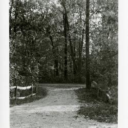
Gravel road curving through trees (3.2972)
Date: 1930sCreator: Oates, Howard Arthur
Type: Photographic image
Description:Gravel road curving through trees
Extent: 1 photograph

Ridge Road looking east from point near Japanese Island (3.2978)
Date: circa 1929 – 1930Type: Photographic image
Description:Ridge Road looking east from point near Japanese Island, before 1935 when road was graveled & blacktopped
Extent: 1 photograph

Residence Drive near Thornhill Residence (3.3000)
Date: 1920sCreator: Henry Fuermann and Sons
Type: Photographic image
Description:Residence Drive near Thornhill Residence
Extent: 1 photograph
Looking east from archway of Thornhill residence toward main entrance on Park Blvd. (3.3001)
Date: 1916Creator: Henry Fuermann and Sons
Type: Photographic image
Description:Looking east from archway of Thornhill residence toward main entrance on Park Blvd.
Extent: 1 photograph

O.C. Simonds landscape along a west side road in the Arboretum (3.3003)
Type: Photographic image
Description:O.C. Simonds landscape along a west side road in the Arboretum
Extent: 1 photograph

West Side Thornhill Drive Old Japanese Garden (3.3010)
Date: July 1990Type: Photographic image
Description:West Side Thornhill Drive Old Japanese Garden
Extent: 1 photograph

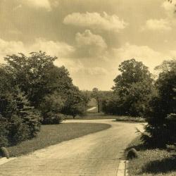
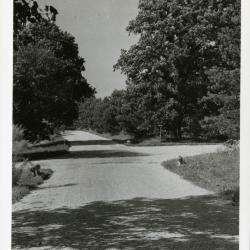
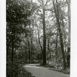
Meadow Road as it comes out of woods, looking southeast (3.3015)
Date: 1930 – 1935Type: Photographic image
Description:Meadow Road as it comes out of woods, looking southeast
Extent: 1 photograph
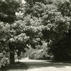
Maple alongside gravel road (3.3018)
Date: 1940sType: Photographic image
Description:Maple alongside gravel road
Extent: 1 photograph

Old car driving through west entrance (3.3019)
Date: October 1941Creator: Teuscher, Henry
Type: Photographic image
Description:Old car driving through west entrance
Extent: 1 photograph
Spruce Hill from bridge at Lake Marmo (3.3020)
Date: 1942Creator: Arden, Richard J.
Type: Photographic image
Description:Spruce Hill from bridge at Lake Marmo
Extent: 1 photograph
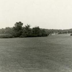
Division 3 Arboretum View (3.3028)
Date: June 1942Creator: Freriks, Dick J.
Type: Photographic image
Description:Division 3 Arboretum View
Extent: 1 photograph

Road curving through trees in spring on Morton residence grounds (3.3080)
Date: 1933Creator: Streator, Sidney V.
Type: Photographic image
Description:Road curving through trees in spring on Morton residence grounds
Extent: 1 photograph
Lunching & Learning with Clarence Godshalk: Evolution of the Arboretum - From Farm to Arboretum (3.31582)
Date: January 25 1978Type: Audio
Description:Lunching and Learning program presented by Clarence Godshalk as he describes the evolution of the Arboretum, from farm land to Arboretum.
Extent: 1 audio cassette

Ridge Road above geographic groups looking east, stereograph (3.31927)
Date: 1930sType: Photographic image
Description:Ridge Road above geographic groups looking east, stereograph
Extent: 1 stereograph
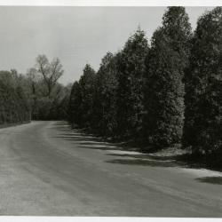
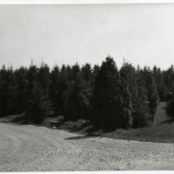
Arborvitaes along Lake Road, south side of Lake Marmo (3.31928)
Date: 1930sType: Photographic image
Description:Arborvitaes along Lake Road, south side of Lake Marmo
Extent: 1 photograph

Arbor vitaes along Lake Road with overhead tree branches in foreground, south side Lake Marmo (3.31929)
Date: 1950sType: Photographic image
Description:Arbor vitaes along Lake Road with overhead tree branches in foreground- south side Lake Marmo.
Extent: 1 photograph
Approaching arborvitaes along Lake Road on south side of Lake Marmo in winter (3.31930)
Date: 1930sType: Photographic image
Description:Approaching arborvitaes along Lake Road on south side of Lake Marmo in winter
Extent: 1 negative filmstrip
View looking north on Spring Road at Oakwood Drive (3.31931)
Date: 1930sCreator: Oates, Howard Arthur
Type: Photographic image
Description:View looking north on Spring Road at Oakwood Drive. There was an old basement, probably from early Thompson house, under the bur oak on left.
Extent: 1 photograph

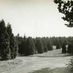
Forest Road overlook (3.31932)
Date: 1940sType: Photographic image
Description:Forest Road overlook
Extent: 1 negative filmstrip

Forest Road return at east end of Arboretum (3.31933)
Date: 1940sType: Photographic image
Description:Forest Road return at east end of Arboretum
Extent: 1 photograph
Spruce Hill at intersection just west of Lake Marmo dam and bridge (3.31934)
Date: 1940sType: Photographic image
Description:Spruce Hill at inersection just west of Lake Marmo dam and bridge
Extent: 1 photograph

View looking southeast toward Downers Grove from high point on Forest Road (3.31937)
Date: 1940sType: Photographic image
Description:View looking southeast toward Downers Grove from high point where Forest Road starts curving back. Land just across fence became University of Illinois Research Area
Extent: 1 photograph

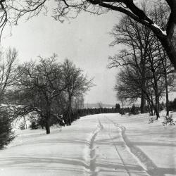
Meadow or Forest Road in winter (3.31938)
Date: 1930sType: Photographic image
Description:Meadow or Forest Road in winter
Extent: 1 negative filmstrip

Road leading up to bridge over DuPage River looking northwest (3.31939)
Date: circa 1935Type: Photographic image
Description:Road leading up to bridge over DuPage River looking northwest
Extent: 1 photograph
Forest Road return before intersection of Meadow Road (3.31940)
Date: 1939Type: Photographic image
Description:Forest Road return before intersection of Meadow Road
Extent: 1 photograph
Cut-off at Meadow Road and Forest Road return looking north (3.31941)
Date: 1939Type: Photographic image
Description:Cut-off at Meadow Road and Forest Road return looking north
Extent: 1 photograph
[Retaining Wall Elevations] (3.32016)
Date: November 24 2004Type: Plan
Description:Elevations of retaining wall, likely related to the I-88 retaining wall/noise wall locations as seen on STRU:A-III(f)7 (3.32018).
Extent: 1 sheet
[Retaining Wall, I-88 Parapet Over Route 53] (3.32017)
Type: Plan
Description:One sheet with eight elevations of I-88 parapet over Route 53, with retaining wall, abutments, and wing walls.
Extent: 1 sheet
I-88 (Ronald Reagan Tollway) Retaining Wall / Noise Wall Locations (3.32018)
Date: November 2004Creator: Bowman, Barrett & Associates, Inc.
Type: Plan
Description:Two sheets showing I-88 from west of Yackley east to Finley; one sticky note attached on sheet one: "North wall 1050 lf/ South wall 680 lf/Bridge 260 lf/800 lf wall South side of 88 (E. bound)"
Extent: 2 sheets
Site Improvement Plans for Main Road, Phase One, The Morton Arboretum (3.32047)
Date: October 17 2002Creator: Christopher B. Burke, Engineering West, Ltd.
Type: Plan
Description:"Project No: 00-927A"; road sections proposed removed, replaced, repaired on east and west sides.
Extent: 15 sheets, bound