Lunching & Learning with Clarence Godshalk: Evolution of the Arboretum - From Farm to Arboretum (3.31582)
Date: January 25 1978Type: Audio
Description:Lunching and Learning program presented by Clarence Godshalk as he describes the evolution of the Arboretum, from farm land to Arboretum.
Extent: 1 audio cassette

General Information and Guide Map of The Morton Arboretum (3.34267)
Date: 1941Type: Map
Description:Doublesided brochure with general information and a guide map of The Morton Arboretum.
Guide map details Arboretum roads, trails, parking, plant collections, buildings and points of interest. Fifteen areas on the grounds highlighted in the key and identified with circled numbers on the map. Surfaced roads, gravel roads, and paths distinguished on the map by the type of line drawn. Compass showing directions north, south, east, west as well as scale indicator above top center of map.
Reverse side provides general information about the Arboretum, rules and regulations, and information about the Arboretum publication, Bulletin of Popular Information.
Extent: 1 sheet

General Information and Guide Map of The Morton Arboretum (3.34268)
Date: 1942Type: Map
Description:Doublesided brochure with general information and a guide map of The Morton Arboretum.
Guide map details Arboretum roads, trails, parking, plant collections, buildings and points of interest. Vegetation illustrated throughout map. Three stylized trees under compass showing directions north, south, east, west as well as scale indicator above top center of map.
Reverse side provides general information about the Arboretum, rules and regulations, outstanding features, buildings, Arboretum publications, and location.
Extent: 1 sheet

A Guide Map of The Morton Arboretum (3.34269)
Date: 1969Creator: Tyznik, Anthony
Type: Map
Description:A guide map of The Morton Arboretum created by Tony Tyznik in 1969. The background is a dark green with the inner Arboretum being a light green and Arboretum roads highlighted in solid orange and checkered orange lines.
Extent: 1 sheet

Map & Visitor Guide, The Morton Arboretum (3.34271)
Date: 1982 – 1986Type: Map
Description:Double-sided brochure, Map & Visitor Guide for The Morton Arboretum
Map details Arboretum roads, trails, plant collections, buildings and boundaries. Includes photographs of various Arboretum buildings with descriptive information.
Reverse side provides general information about the Arboretum, trails for walking and hiking, driving through the Arboretum, areas and collections of special interest, native plant communities, wildlife at the Arboretum, regulations, facilities and services, and information on membership. A section of the map is enlarged to identify landmarks around the Visitor Center, Administration Building, and Thornhill Education Center.
Extent: 1 sheet
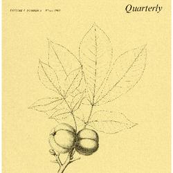
The Morton Arboretum Quarterly V. 04 No. 04 (3.34565)
Date: December 21 1968 – March 20 1969Type: Serial
Description:
- The Arboretum Landscape – A Sesquicentennial Perspective (49-61)
- Blue Beech, Carpinus caroliniana: Birch Family (Betulaceae) (62-63)
- The Lookout/ Climatological Summary (64)
Extent: 16 pages
Topographical Map of Part of Thornhill Farm, DuPage County, Illinois (3.5231)
Date: 1920sCreator: Webster, Arthur L.
Type: Map
Description:Shows the Thornhill residential area and its immediate surroundings as they existed at date of issuance.
Extent: 1 sheet
Topographical Map of Part of Thornhill Farm, DuPage County, Illinois [annotated] (3.5232)
Date: 1920sCreator: Webster, Arthur L.
Type: Map
Description:Shows the Thornhill residential area and its immediate surroundings as they existed at date of issuance. This copy contains extensive annotations on recto and verso made by C.E. Godshalk. These treat early Arboretum plantings and other observations regarding layouts at Thornhill in 1921.
Extent: 1 sheet
South Farm Land Use [and topographic survey] (3.5273)
Date: February 13 1989Creator: Kelsey, Pat
Type: Map
Description:First issued Dec.30,1988 showing the South Farm area and building layout; the collection lacks this issuance. Collection has issuance dated Feb.13,1989 on which true elevation points determined upon by Richard G. Hootman have been added. A subsequent copy of the map (3.5275) showing additions dated February 14, 1989 and March 3, 1989 is also represented in the collections. Contour lines linking elevation points and benchmark indicators were added by P.D.Kelsey under date of Feb. 14 and a subsurface drainage installation was added by R.G.Hootman under date of March 3.
Extent: 1 sheet
South Farm Land Use [and topographic survey] (3.5275)
Date: February 14 – March 3 1989Creator: Kelsey, Pat
Type: Map
Description:First issued Dec.30,1988 showing the South Farm area and building layout; the collection lacks this issuance. Collection has issuance dated Feb.13,1989 on which true elevation points determined upon by Richard G. Hootman have been added. This copy of the map also shows additions dated February 14, 1989 and March 3, 1989 is also represented in the collections. Contour lines linking elevation points and benchmark indicators were added by P.D.Kelsey under date of Feb. 14 and a subsurface drainage installation was added by R.G.Hootman under date of March 3.
Extent: 1 sheet
Thornhill Farm [owned by] Joy Morton, Esq., drawn [and] traced by R.K.Warren (3.5283)
Date: January 1 – 14 1917Creator: Warren, R. K.
Type: Map
Description:Shows fields and other areas comprising Thornhill Farm and adjoining properties.This copy's margins have been cropped and has ms. note: "Crop rotations from records available. Prepared Jan. 14th 1917. Joy Morton." Crops grown on 38 numbered fields variously between 1912-1920 are noted in ms.
Extent: 1 sheet
Thornhill Farm [owned by] Joy Morton, Esq., drawn [and] traced by R.K.Warren (3.5284)
Date: January 1917Creator: Warren, R. K.
Type: Map
Description:Shows fields and other areas comprising Thornhill Farm and adjoining properties. This copy has numerous ms. annotations by C.E.Godshalk regarding tillage and land rentals.
Extent: 1 sheet
Thornhill Farm [owned by] Joy Morton, Esq., drawn [and] traced by R.K.Warren (3.5285)
Date: January 1917Creator: Warren, R. K.
Type: Map
Description:Shows fields and other areas comprising Thornhill Farm and adjoining properties. Ms. annotations on this copy gives acreage of various fields and plots.
Extent: 1 sheet
Thornhill Farm [owned by] Joy Morton, Esq., drawn [and] traced by R.K.Warren (3.5286)
Date: January 1917Creator: Warren, R. K.
Type: Map
Description:Shows fields and other areas comprising Thornhill Farm and adjoining properties. Ms. annotations on this copy gives acreage of various fields and plots.
Extent: 1 sheet
The Morton Arboretum and Joy Morton properties in DuPage County (3.5302)
Date: May 1934Creator: Kammerer, E. Lowell
Type: Map
Description:Shows lands within the Arboretum boundaries, giving original ownership, acreages, roadways, and some data on woodland cover; as well as Morton properties outside of northern Arboretum boundaries.
Extent: 1 sheet
The Morton Arboretum and Joy Morton Properties in DuPage County (3.5303)
Date: May 1934Creator: Kammerer, E. Lowell
Type: Map
Description:Shows lands within the Arboretum boundaries, giving original ownership, acreages, roadways, and some data on woodland cover; as well as Morton properties outside of northern Arboretum boundaries.
Extent: 1 sheet
The Morton Arboretum and Joy Morton Properties in DuPage County (3.5304)
Date: May 1934Creator: Kammerer, E. Lowell
Type: Map
Description:Shows lands within the Arboretum boundaries, giving original ownership, acreages, roadways, and some data on woodland cover; as well as Morton properties outside of northern Arboretum boundaries. Includes handwritten notes in pencil.
"Arboretum & Lisle Farms, Color coded; Late 40s" written in marker on back.
Extent: 1 sheet
Morton Arboretum: Warrenville Road North to Administration Building Indicating the Extent of Zoning (3.5366)
Date: circa 1953Creator: Tyznik, Anthony
Type: Map
Extent: 1 sheet
Morton Arboretum: Warrenville Road North to Administration Building Indicating the Extent of Zoning (3.5367)
Date: circa 1953Creator: Tyznik, Anthony
Type: Map
Description:Additional information in pencil included.
Extent: 1 sheet
A complied tract map of the Morton Arboretum, being parts of Sections 33, 34, 35, and 36, township 39 North, Range 10 East of the 3rd Principal Meridian, and parts of Sections 1, 2, 3, and 4,, township 38 North, Range 10 East of the third Principal Meridian in DuPage County, Illinois. [1982 ed.] (3.5405)
Date: May 25 1982Creator: Steinbrecher, Harold F.
Type: Map
Description:First issued in 1 sheet version Nov. 22, 1971. A revision was issued March 7, 1972 in 2 sheets: Map on sheet 1 and narrative table on sheet 2. The map on sheet 1 was upgraded with scale readings in a version dated July 5, 1972. A second revision was issued Nov. 29, 1979. This version of the map was updated on May 25, 1982. All issuances, 1971-1982, are represented in the collections.
Sheet 1 shows plats throughout the Arboretum; and sheet 2, a tabular layout, identifies 40 tracts keyed numerically to areas shown on the map. Data supplied for tracts include name, location, prior ownership, previous land usage, acreage, and date of plat surveys.
Extent: 2 sheets
A complied tract map of the Morton Arboretum, being parts of Sections 33, 34, 35, and 36, township 39 North, Range 10 East of the 3rd Principal Meridian, and parts of Sections 1, 2, 3, and 4,, township 38 North, Range 10 East of the third Principal Meridian in DuPage County, Illinois. [1979 ed.] (3.5408)
Date: November 29 1979Creator: Steinbrecher, Harold F.
Type: Map
Description:First issued in 1 sheet version Nov. 22, 1971. A revision was issued March 7, 1972 in 2 sheets:Map on sheet 1 and narrative table on sheet 2. The map on sheet 1 was upgraded with scale readings in a version dated July 5, 1972. This map is the second revision, which was issued Nov. 29, 1979. All issuances, 1971-1982, are represented in the collections.
Sheet 1 shows plats throughout the Arboretum; and sheet 2, a tabular layout, identifies 40 tracts keyed numerically to areas shown on the map. Data supplied for tracts include name, location, prior ownership, previous land usage, acreage, and date of plat surveys.
Extent: 2 sheets
A complied tract map of the Morton Arboretum, being parts of Sections 33, 34, 35, and 36, township 39 North, Range 10 East of the 3rd Principal Meridian, and parts of Sections 1, 2, 3, and 4,, township 38 North, Range 10 East of the third Principal Meridian in DuPage County, Illinois. [1972 ed.] (3.5409)
Date: March 7 1972Creator: Steinbrecher, Harold F.
Type: Map
Description:First issued in 1 sheet version Nov. 22, 1971. This map is a revision, which was issued March 7, 1972 in 2 sheets: Map on sheet 1 and narrative table on sheet 2. The map on sheet 1 was upgraded with scale readings in a version dated July 5, 1972. A second revision was issued Nov. 29, 1979. All issuances, 1971-1982, are represented in the collections.
Sheet 1 shows plats throughout the Arboretum; and sheet 2, a tabular layout, identifies 40 tracts keyed numerically to areas shown on the map. Data supplied for tracts include name, location, prior ownership, previous land usage, acreage, and date of plat surveys.
Extent: 2 sheets
A complied tract map of the Morton Arboretum, being parts of Sections 33, 34, 35, and 36, township 39 North, Range 10 East of the 3rd Principal Meridian, and parts of Sections 1, 2, 3, and 4,, township 38 North, Range 10 East of the third Principal Meridian in DuPage County, Illinois. [1971 ed.] (3.5410)
Date: November 22 1971Creator: Steinbrecher, Harold F.
Type: Map
Description:This map is the first version which was issued as 1 sheet Nov. 22, 1971. A revision was issued March 7, 1972 in 2 sheets: Map on sheet 1 and narrative table on sheet 2. The map on sheet 1 was upgraded with scale readings in a version dated July 5, 1972. A second revision was issued Nov. 29, 1979. All issuances, 1971-1982, are represented in the collections.
Sheet 1 shows plats throughout the Arboretum; and sheet 2, a tabular layout, identifies 40 tracts keyed numerically to areas shown on the map. Data supplied for tracts include name, location, prior ownership, previous land usage, acreage, and date of plat surveys.
Extent: 1 sheet
The Morton Arboretum and Joy Morton properties in DuPage County (3.5618)
Date: May 1934Creator: Kammerer, E. Lowell
Type: Map
Description:Shows lands within the Arboretum boundaries, giving original ownership, acreages, roadways, and some data on woodland cover: as well as Morton properties outside of northern Arboretum boundaries.
Extent: 1 negative
Proposed future Morton Arboretum space development: needs and their suggested relationships [colored] (3.5742)
Date: 1970sCreator: Tyznik, Anthony
Type: Plan
Description:Based on the map prepared by Nancy Hart Stieber, Morton Arboretum map [proposed land use 1969]. This version is colored in marker.
Extent: 1 sheet
Proposed future Morton Arboretum space development: needs and their suggested relationships (3.5743)
Date: 1970sCreator: Tyznik, Anthony
Type: Plan
Description:Based on the map prepared by Nancy Hart Stieber, Morton Arboretum map [proposed land use 1969].
Extent: 1 sheet
A Guide Map of The Morton Arboretum, Lisle, Illinois [1970, printed in color] (3.5785)
Date: April 1970Creator: Tyznik, Anthony
Type: Map
Description:Map appears on the verso of the "General Information" flier, an issuance in the Arboretum's informal series titled: Map & Visitor Guide.
Extent: 1 sheet
Hidden Lake Forest Preserve [site survey, ecological reconstruction, ecosystems/ecological value, slope, hydrology, soils, minerals, cultural improvements, and neighboring land use] (3.5833)
Date: circa 1975Creator: Forest Preserve District of DuPage County
Type: Map
Description:Subtitle above is summary of sheet-titles. A portion of this land parcel is leased by the Arboretum as a part of the Illinois State Toll Highway agreement of 1985. For a representation of the area leased, see DuPage County. Forest Preserve District. Hidden Lake Forest Preserve ... Arboretum-Forest Preserve District cooperative research program space study (SURV:B VI (c) 1).
Extent: 9 sheets stapled
[Morton Property Purchase Map for Section 34, T.39N., R.10E. And N1/2 Section 3, T.39N., R.10E, of the 3rd P.M.] (3.5989)
Date: 1910sType: Map
Extent: 1 sheet
Joy Morton DuPage County properties numbered according to date of purchase (3.5990)
Date: August 1934Creator: Kammerer, E. Lowell
Type: Map
Description:Ink drawing with parcels shaded with colored pencil.
Extent: 1 sheet
Satellite image map of northeastern Illinois (3.5991)
Date: 1985Creator: Dahlberg, Richard E.
Type: Map
Description:Front of map has infrared image of northeastern Illinois and small-scale maps showing general transportion, geology, and soils of the region. Verso has land use and land cover maps of northeast Illinois.
Extent: 1 sheet
A Guide Map of The Morton Arboretum, Lisle, Illinois [1958? with written notes regarding land purchases and use] (3.5997)
Date: circa 1958Creator: Tyznik, Anthony
Type: Map
Description:Probably prepared for collateral use in the Arboretum's informal series titled: Map & Visitor Guide.
Includes misc notes by C.E. Godshalk regarding land purchases and use.
Extent: 1 sheet
Sketch [of the Thornhill area] for Mr. Joy Morton (3.6006)
Date: January 16 1912Creator: Naperville Nurseries
Type: Plan
Description:Landscape plan for area surrounding Thornhill residence, including Orchard and Rockery
Extent: 1 sheet
Landscapes of Northern Illinois (3.6050)
Date: 1986Creator: Luman, Donald
Type: Map
Description:"Map" includes infrared image of northern Illinois and smaller scale maps of land use and land cover, population, and a locator map of northern Illinois.
Extent: 1 sheet
[Building structures of] the Morton Arboretum, DuPage County, approximately one mile north of Lisle, Illinois (3.6067)
Date: July 14 1965Creator: Marsh & McLennan, Inc.
Type: Map
Extent: 1 sheet
A complied tract map of the Morton Arboretum, being parts of Sections 33, 34, 35, and 36, township 39 North, Range 10 East of the 3rd Principal Meridian, and parts of Sections 1, 2, 3, and 4,, township 38 North, Range 10 East of the third Principal Meridian in DuPage County, Illinois. [1982 ed. with parcel numbers] (3.6117)
Date: May 25 1982Creator: Steinbrecher, Harold F.
Type: Map
Description:First issued in 1 sheet version Nov. 22, 1971. A revision was issued March 7, 1972 in 2 sheets: Map on sheet 1 and narrative table on sheet 2. The map on sheet 1 was upgraded with scale readings in a version dated July 5, 1972. A second revision was issued Nov. 29, 1979. This version of the map was updated on May 25, 1982. All issuances, 1971-1982, are represented in the collections.
Sheet 1 shows plats throughout the Arboretum; and sheet 2, a tabular layout, identifies 40 tracts keyed numerically to areas shown on the map. Data supplied for tracts include name, location, prior ownership, previous land usage, acreage, and date of plat surveys.
This version of the map includes parcel numbers written in red pencil.
Extent: 2 sheets