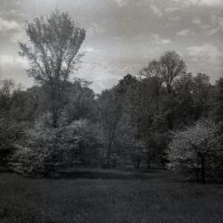
Arboretum grounds, natural area near Parking Lot 7, close view from unpaved road (3.33277)
Type: Photographic image
Description: Arboretum grounds, natural area near Parking Lot 7, close view from unpaved road
Extent: 1 negative
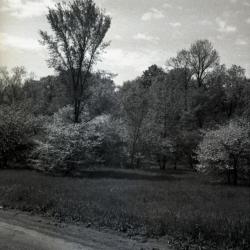
Arboretum grounds, natural area near Parking Lot 7, view from unpaved road (3.33276)
Type: Photographic image
Description: Arboretum grounds, natural area near Parking Lot 7, view from unpaved road
Extent: 1 negative
A bridge railing detail for the Morton Arboretum (3.6696)
Date: 1988Creator: Tyznik, Anthony
Type: Plan
Description:Plan view, south elevation, end section, post bracket detail construction drawings [Lake Marmo]
Extent: 1 sheet
A Bridge Railing Detail for the Morton Arboretum (3.6185)
Date: 1988Creator: Tyznik, Anthony
Type: Plan
Description:Plan view, south elevation, end section, post bracket detail construction drawings [Lake Marmo]
Extent: 1 sheet
A General Plan of a Section of The Morton Arboretum, Showing Water Lines, Wells, Roads, Buildings, Elevations (3.6412)
Date: circa 1955Creator: Tyznik, Anthony
Type: Map
Extent: 2 sheets

A Guide Map of The Morton Arboretum (3.34269)
Date: 1969Creator: Tyznik, Anthony
Type: Map
Description:A guide map of The Morton Arboretum created by Tony Tyznik in 1969. The background is a dark green with the inner Arboretum being a light green and Arboretum roads highlighted in solid orange and checkered orange lines.
Extent: 1 sheet
A Guide Map of The Morton Arboretum, Lisle, Illinois [1958? with roads and parking colored] (3.5780)
Date: circa 1958Creator: Tyznik, Anthony
Type: Map
Description:The map was probably designed for collateral use in the Arboretum's informal series titled: Map & visitor guide. Roads showing direction of traffic and parking areas have been colored in with colored pencil.
Extent: 1 sheet
A Guide Map of The Morton Arboretum, Lisle, Illinois [1958? with updates] (3.5781)
Date: circa 1958Creator: Tyznik, Anthony
Type: Map
Description:Probably prepared for collateral use in the Arboretum's informal series titled: Map & Visitor Guide. The map has been updated by mounting a small mylar sheet on the left margin. The addition shows the Sterling Pond and nearby areas. Roads, lakes, and parking have been colored in colored pencil.
Extent: 1 sheet
A Guide Map of The Morton Arboretum, Lisle, Illinois [1958? with written notes on major planting dates since 1922] (3.5996)
Date: circa 1958Creator: Tyznik, Anthony
Type: Map
Description:Probably prepared for collateral use in the Arboretum's informal series titled: Map & Visitor Guide.
Includes misc notes by C.E. Godshalk on major planting dates since 1922 for various collections and landmarks.
Extent: 1 sheet
A Guide Map of The Morton Arboretum, Lisle, Illinois [1958? with written notes on road development] (3.5995)
Date: circa 1958Creator: Tyznik, Anthony
Type: Map
Description:Probably prepared for collateral use in the Arboretum's informal series titled: Map & Visitor Guide.
Includes misc notes by C.E. Godshalk on road building and lakes.
Extent: 1 sheet
A Guide Map of The Morton Arboretum, Lisle, Illinois [1958? with written notes regarding land purchases and use] (3.5997)
Date: circa 1958Creator: Tyznik, Anthony
Type: Map
Description:Probably prepared for collateral use in the Arboretum's informal series titled: Map & Visitor Guide.
Includes misc notes by C.E. Godshalk regarding land purchases and use.
Extent: 1 sheet
![A Guide Map of The Morton Arboretum, Lisle, Illinois [1958?]](https://acorn.mortonarb.org/media/morton/images/2/8/7/3004_ca_object_representations_media_28709_iconlarge.jpg)
A Guide Map of The Morton Arboretum, Lisle, Illinois [1958?] (3.5782)
Date: circa 1958Creator: Tyznik, Anthony
Type: Map
Description:Probably prepared for collateral use in the Arboretum's informal series titled: Map & Visitor Guide.
Extent: 1 sheet
A Guide Map of The Morton Arboretum, Lisle, Illinois [1965?] (3.6118)
Date: circa 1965Creator: Tyznik, Anthony
Type: Map
Description:Prepared for the series "Map & Visitor Guide." Possibly the original drawing for 1970 map incorporated into Map & Visitor Guide.
Extent: 1 sheet
A Guide Map of The Morton Arboretum, Lisle, Illinois [1970, printed in color] (3.5785)
Date: April 1970Creator: Tyznik, Anthony
Type: Map
Description:Map appears on the verso of the "General Information" flier, an issuance in the Arboretum's informal series titled: Map & Visitor Guide.
Extent: 1 sheet
A Parking Plan for Parking Lot No. 25, the Morton Arboretum, Lisle, Illinois (3.6516)
Creator: Tyznik, Anthony
Type: Map
Description:Includes plantings for areas around parking lot
Extent: 1 sheet
A Plot Plan for the Visitor Center, the Morton Arboretum, Lisle, Illinois (3.6506)
Date: circa 1972Creator: Tyznik, Anthony
Type: Plan
Description:Shows landscape design, some plantings, and roads in the area extending from the entrance cloverleaf to the Meadow Lake area.
Extent: 1 sheet
A Space Use Plan for the Morton Arboretum, Lisle, Illinois (3.6134)
Date: October 1986Creator: Tyznik, Anthony
Type: Plan
Description:First issued April 06,1982. Shows structures, roads, parking, and plantings extending north from the Tollway berm to the Research Building and the Hedge Garden. The proposal was subsequently modified for the reconstruction and paving carried out in the South Farm area.
Extent: 1 sheet
Access map, Morton Arboretum (3.6329)
Date: 1989 – 1990Creator: Butkovich, Dianne
Type: Map
Extent: 1 sheet
Access map, Morton Arboretum (3.6330)
Date: 1989 – 1990Creator: Butkovich, Dianne
Type: Map
Extent: 1 sheet
Access map, Morton Arboretum (3.6331)
Date: 1989 – 1990Creator: Butkovich, Dianne
Type: Map
Extent: 1 sheet
Access Map, Schulenberg Prairie of the Morton Arboretum (3.6332)
Date: 1989 – 1990Creator: Butkovich, Dianne
Type: Map
Description:Marked "Not using"
Extent: 1 sheet
Aerial Image of Arboretum Grounds (3.47230)
Date: December 2007Creator: Pelkonen, Peggy
Type: Map
Description:Aerial image of Arboretum grounds in 2007 with handwritten notes and circled regions showing detention basins.
Black and white with some color.
Extent: 1 Sheet
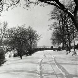
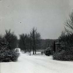
Approaching arborvitaes along Lake Road on south side of Lake Marmo in winter (3.31930)
Date: 1930sType: Photographic image
Description:Approaching arborvitaes along Lake Road on south side of Lake Marmo in winter
Extent: 1 negative filmstrip
Approximate Locations of Existing and Proposed Arboretum Signs (3.6292)
Date: circa 1990Creator: Hootman, Rick
Type: Map
Description:Map includes only signs at main entrances to west side from Route 53.
Extent: 1 sheet

Arbor vitaes along Lake Road with overhead tree branches in foreground, south side Lake Marmo (3.31929)
Date: 1950sType: Photographic image
Description:Arbor vitaes along Lake Road with overhead tree branches in foreground- south side Lake Marmo.
Extent: 1 photograph
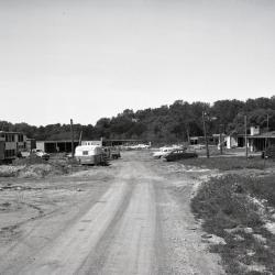
Arbordale houses under construction, unpaved road leading up to development with cars parked (3.36469)
Date: 1958Type: Photographic image
Description:Arbordale houses under construction, unpaved road leading up to development with cars parked
Extent: 1 negative
Arbordale Paving Plan, Spring 2000 (3.7084)
Date: 2000Creator: Mehaffey, Scott A.
Type: Plan
Extent: 1 sheet
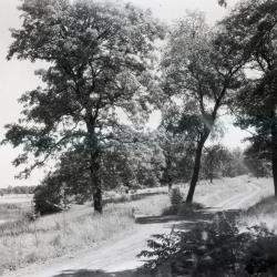
Arboretum unpaved road alongside body of water on left (3.33191)
Date: 1922 – 1949Type: Photographic image
Description:Arboretum unpaved road alongside body of water on left
Extent: 1 negative

Arboretum dirt road curving to left (3.32174)
Date: 1920sType: Photographic image
Description:Arboretum dirt road curving to left
Dirt road as they used to be until 1935 when Mrs. Cudahy (Jean Morton) became chairman. Muddy when wet, dusty when dry.
Extent: 1 negative

Arboretum dirt road through trees (3.32175)
Date: 1920sType: Photographic image
Description:Arboretum dirt road through trees
Arboretum dirt road as they used to be until 1935 when Mrs. Cudahy (Jean Morton) became chairman. Muddy when wet, dusty when dry.
Extent: 1 negative

Arboretum east gate entrance (3.32156)
Date: 1930sType: Photographic image
Description:Arboretum east gate entrance
Extent: 1 negative
Arboretum east gate entrance in winter with close view of east side (3.32159)
Date: 1930sType: Photographic image
Description:Arboretum east gate entrance in winter with close view of east side
Extent: 1 negative

Arboretum east gate entrance in winter with sign on right side (3.32158)
Date: 1930sType: Photographic image
Description:Arboretum east gate entrance in winter with sign on right side
Extent: 1 negative

Arboretum East Gate Entrance in winter with stop sign on left (3.32157)
Date: 1930sType: Photographic image
Description:Arboretum East Gate Entrance in winter with stop sign on left
Extent: 1 negative
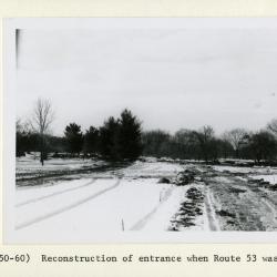
Arboretum entrance drive in winter during reconstruction when Route 53 was widened (3.32051)
Date: 1950sType: Photographic image
Description:Arboretum entrance drive in winter during reconstruction when Route 53 was widened
Extent: 1 photograph
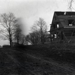
Arboretum entrance road (Joliet Road), showing Clarence Godshalk's first Arboretum house under construction along right side of road (3.36083)
Date: 1922Type: Photographic image
Description:Arboretum entrance road (Joliet Road), showing Clarence Godshalk's first Arboretum house under construction along right side of road
Extent: 1 negative