Arboretum Landscape Teaching Aid Series: An Apple Tree was Planted on a Farm (3.19499)
Date: 1940 – 1960Creator: Watts, May Theilgaard
Type: Drawing
Description:Primarily textual teaching aid depicting Arboretum landscape. This material describes the remains of the farm that later became the Arboretum, including an apple tree that still stood at the time.
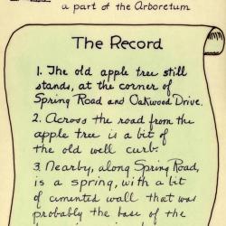
[Illustration of a farmer with a shovel standing next to a sapling] Header: AN APPLE TREE was planted on a farm, many years ago / The farm later became a part of the Arboretum
Text and illustrations from top to bottom:
- [Depicted in stylized scroll] The Record:
- 1) The old apple tree still stands, at the corner of Spring Road and Oakwood Drive.
- 2) Across the road from the apple tree is a bit of the old well curb.
- 3) Nearby, along Spring Road, is a spring, with a bit of cemented wall that was probably the base of the farmer's spring house. [illustration of a tree]
Extent: 1 sheet
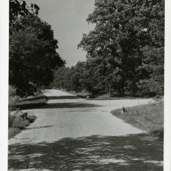
View looking north on Spring Road at Oakwood Drive (3.31931)
Date: 1930sCreator: Oates, Howard Arthur
Type: Photographic image
Description:View looking north on Spring Road at Oakwood Drive. There was an old basement, probably from early Thompson house, under the bur oak on left.
Extent: 1 photograph
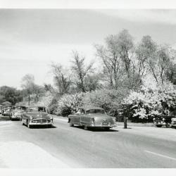
Traffic at intersection of Oakwood Drive and Route 53 looking north (3.32063)
Date: 1940sType: Photographic image
Description:Traffic at intersection of Oakwood Drive and Route 53 looking north.
Extent: 1 photograph
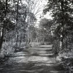
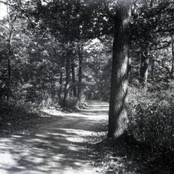
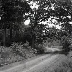
Unpaved road along Oakwood Loop looking east (3.32114)
Date: 1930sType: Photographic image
Description:Unpaved road along Oakwood Loop looking east
*located at about 88-S on Arboretum map/grid
Extent: 1 negative
Unpaved road slightly curving along Oakwood Loop looking east (3.32115)
Date: 1930sType: Photographic image
Description:Unpaved road slightly curving along Oakwood Loop looking east
*located at about 82-W on Arboretum map/grid
Extent: 1 negative
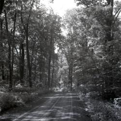
Unpaved road straight through wooded area along Oakwood Loop looking east (3.32116)
Date: 1930sType: Photographic image
Description:Unpaved road straight through wooded area along Oakwood Loop looking east
*located at about 90-AA on Arboretum map/grid
Extent: 1 negative
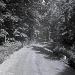
Unpaved road slightly curving to the right along Oakwood Loop looking east (3.32117)
Date: 1930sType: Photographic image
Description:Unpaved road slightly curving to the right along Oakwood Loop looking east
*located at about 105-AA on Arboretum map/grid
Extent: 1 negative
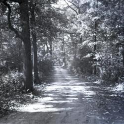
Unpaved road slightly directed left along Oakwood Loop looking northeast (3.32118)
Date: 1930sType: Photographic image
Description:Unpaved road slightly directed left along Oakwood Loop looking northeast
*located at about 89-T on Arboretum map/grid
Extent: 1 negative

Oakwood loop and cutoff with car approaching (3.33192)
Date: 1922 – 1949Type: Photographic image
Description:Oakwood loop and cutoff with car approaching
Extent: 1 negative
Oakwood loop looking east, man standing at curve (3.33193)
Date: 1930 – 1949Type: Photographic image
Description:Oakwood loop looking east, man standing at curve
Extent: 1 negative

General Information and Guide Map of The Morton Arboretum (3.34267)
Date: 1941Type: Map
Description:Doublesided brochure with general information and a guide map of The Morton Arboretum.
Guide map details Arboretum roads, trails, parking, plant collections, buildings and points of interest. Fifteen areas on the grounds highlighted in the key and identified with circled numbers on the map. Surfaced roads, gravel roads, and paths distinguished on the map by the type of line drawn. Compass showing directions north, south, east, west as well as scale indicator above top center of map.
Reverse side provides general information about the Arboretum, rules and regulations, and information about the Arboretum publication, Bulletin of Popular Information.
Extent: 1 sheet

General Information and Guide Map of The Morton Arboretum (3.34268)
Date: 1942Type: Map
Description:Doublesided brochure with general information and a guide map of The Morton Arboretum.
Guide map details Arboretum roads, trails, parking, plant collections, buildings and points of interest. Vegetation illustrated throughout map. Three stylized trees under compass showing directions north, south, east, west as well as scale indicator above top center of map.
Reverse side provides general information about the Arboretum, rules and regulations, outstanding features, buildings, Arboretum publications, and location.
Extent: 1 sheet

A Guide Map of The Morton Arboretum (3.34269)
Date: 1969Creator: Tyznik, Anthony
Type: Map
Description:A guide map of The Morton Arboretum created by Tony Tyznik in 1969. The background is a dark green with the inner Arboretum being a light green and Arboretum roads highlighted in solid orange and checkered orange lines.
Extent: 1 sheet

Map & Visitor Guide, The Morton Arboretum (3.34271)
Date: 1982 – 1986Type: Map
Description:Double-sided brochure, Map & Visitor Guide for The Morton Arboretum
Map details Arboretum roads, trails, plant collections, buildings and boundaries. Includes photographs of various Arboretum buildings with descriptive information.
Reverse side provides general information about the Arboretum, trails for walking and hiking, driving through the Arboretum, areas and collections of special interest, native plant communities, wildlife at the Arboretum, regulations, facilities and services, and information on membership. A section of the map is enlarged to identify landmarks around the Visitor Center, Administration Building, and Thornhill Education Center.
Extent: 1 sheet
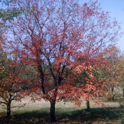
Acer ginnala (Amur maple), fall (3.37285)
Date: October 1953Type: Photographic image
Description:Acer ginnala (Amur maple), tree with sparse fall foliage along Oakwood Drive, red and orange leaves on branches and on the ground
Extent: 1 slide
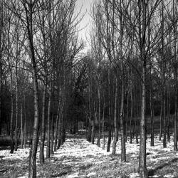
Oakwood Drive Plot, Populus robusta (3.38282)
Date: November 23 1937Type: Photographic image
Description:Oakwood Drive Plot, Populus robusta
Extent: 1 negative