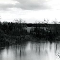
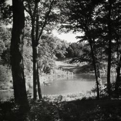
Looking south across Sterling Pond from Cricket Hill. Road on right becomes Evergreen Drive. (3.2980)
Date: circa 1960 – 1979Creator: Helmick, William K.
Type: Photographic image
Description:Looking south across Sterling Pond from Cricket Hill. Road on right becomes Evergreen Drive.
Extent: 1 photograph
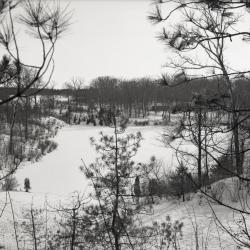
Looking south over Sterling Pond in winter (3.31779)
Date: February 1970Type: Photographic image
Description:Looking south over Sterling Pond in winter
Extent: 1 negative
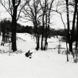
View of Sterling Pond looking north from Clarence Godshalk's yard in winter (3.31809)
Date: 1960sType: Photographic image
Description:View of Sterling Pond looking north from Clarence Godshalk's yard in winter. Open area across Sterling Pond used to be a gravel pit before 1959 when pond was dug.
Extent: 1 negative filmstrip
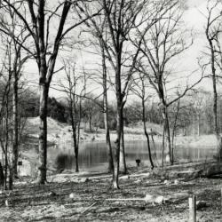
Sterling Pond looking north through bare trees from Clarence Godshalk's yard (3.31810)
Date: 1960sType: Photographic image
Description:Sterling Pond looking north through bare trees from Clarence Godshalk's yard. Open area across Sterling Pond used to be a gravel pit before 1959 when pond was dug.
Extent: 1 negative filmstrip

Pond west of Sterling Pond Bridge over inlet in winter (3.31811)
Date: 1960sType: Photographic image
Description:Pond west of Sterling Pond Bridge over inlet in winter
Extent: 1 negative filmstrip
Sterling Pond looking north from Clarence Godshalk's yard (3.31812)
Date: 1960sType: Photographic image
Description:Sterling Pond looking north from Director Clarence Godshalk's yard. Open area across Sterling Pond used to be a gravel pit before 1959 when pond was dug.
Extent: 1 negative filmstrip

Sterling Pond looking north (3.31813)
Date: 1960sType: Photographic image
Description:Sterling Pond looking north
Extent: 1 negative filmstrip

A Guide Map of The Morton Arboretum (3.34269)
Date: 1969Creator: Tyznik, Anthony
Type: Map
Description:A guide map of The Morton Arboretum created by Tony Tyznik in 1969. The background is a dark green with the inner Arboretum being a light green and Arboretum roads highlighted in solid orange and checkered orange lines.
Extent: 1 sheet

Map & Visitor Guide, The Morton Arboretum (3.34271)
Date: 1982 – 1986Type: Map
Description:Double-sided brochure, Map & Visitor Guide for The Morton Arboretum
Map details Arboretum roads, trails, plant collections, buildings and boundaries. Includes photographs of various Arboretum buildings with descriptive information.
Reverse side provides general information about the Arboretum, trails for walking and hiking, driving through the Arboretum, areas and collections of special interest, native plant communities, wildlife at the Arboretum, regulations, facilities and services, and information on membership. A section of the map is enlarged to identify landmarks around the Visitor Center, Administration Building, and Thornhill Education Center.
Extent: 1 sheet
1979/01/22: William Rust to George Ware (3.37855)
Date: January 22 1979Creator: Rust, William
Type: Document
Description:Letter from William Rust of Sheaffer & Roland, Inc. to George Ware concerning a paper and findings of a 1978 study on Sterling Pond.
Extent: 1 sheet
Prairie Visitor Station: Trail Development (3.40111)
Date: April 5 2004Creator: Pelkonen, Peggy
Type: Plan
Description:Trail development plan fro Prairie Visitor Station drawn over aerial photograph showing Sterling Pond, Acre Trail, Main Trail Loop 4, Savanna Trail, and Prairie Trail with trails mapped and named, located near Leask Lane.
Extent: 1 sheet
Sterling Pond Dam Reconstruction: Alternative New Dam Layout and Grading Plan (3.47218)
Date: July 2002Creator: Montgomery Watson Harza (MWH)
Type: Plan
Description:Plan of new dam layout with topographic map of Sterling Pond area.
Topographic map provided by Christopher B.Burke Engineering, LTD. (2002)
Extent: 1 Sheet
Sterling Pond Dam Reconstruction: Alternative New Dam Layout and Grading Plan (3.47219)
Date: April 2002Creator: Montgomery Watson Harza (MWH)
Type: Plan
Description:Plan of new dam layout with topographic map of Sterling Pond area.
Topographic map provided by Christopher B.Burke Engineering, LTD. (2002).
Handwritten numbers and equations.
Extent: 1 Sheet
Sterling Pond Dam Reconstruction: New Dam Layout and Grading Plan (3.47220)
Date: April 2002Creator: Montgomery Watson Harza (MWH)
Type: Plan
Description:Plan of new dam layout with topographic map of Sterling Pond area.
Topographic map provided by Christopher B.Burke Engineering, LTD. (2002).
Extent: 1 Sheet
Sterling Pond Bridge Replacement (3.47243)
Date: August 8 2002Creator: Christopher B. Burke, Engineering West, Ltd.
Type: Plan
Description:Plans and topographical surveys for the Sterling Pond bridge replacement in 2002.
"Issued for Permit"
"Project No. 02-273"
Each page is stamped and signed by the DuPage County Dept. of Development & Stormwater, Stormwater Management Division. (Oct 07 2002)
Index:
S-1 Site plan and general notes
S-2 Existing bridge plan and details
S-3 Pre-Engineered bridge plan and details
Appendix A1 For information purposes only
Appendix A2 For information purposes only
Appendix A3 For information purposes only
Copy 2 lacks the certification stamps.
Extent: 7 Sheets
Sterling Pond Bridge Replacement (3.47244)
Creator: Christopher B. Burke, Engineering West, Ltd.
Type: Plan
Description:Plans and topographical surveys for the Sterling Pond bridge replacement in 2002.
"Issued for Permit"
"Project No. 02-273"
Index:
S-1 Site plan and general notes
S-2 Existing bridge plan and details
S-3 Pre-Engineered bridge plan and details
Appendix A1 For information purposes only
Appendix A2 For information purposes only
Appendix A3 For information purposes only
Extent: 7 Sheets
Sterling Pond Bridge Replacement (3.47245)
Date: July 23 2002Creator: Christopher B. Burke, Engineering West, Ltd.
Type: Plan
Description:Plans and topographical surveys for the Sterling Pond bridge replacement in 2002.
"Issued for Bid"
"Project No. 02-273"
Index:
S-1 Site plan and general notes
S-2 Existing bridge plan and details
S-3 Pre-Engineered bridge plan and details
Appendix A1 For information purposes only
Appendix A2 For information purposes only
Appendix A3 For information purposes only
Extent: 7 Sheets
Plat of Survey of Part of the South West Quarter of Section 34, Township 39 North, Range 10 East of the Third Principal Meridian, and Part of the North West Quarter of Section 3, Township 38 North, Range 10 East of the 3rd Prin. Meridian in DuPage County, Illinois (3.5351)
Date: August 30 1940Creator: Steinbrecher, Harold F.
Type: Map
Description:Survey of 17.164 acres in the Sterling Pond area.
Extent: 1 sheet
House for Mrs. Suzette Morton Zurcher, Lisle, Illinois [contract set] (3.5507)
Date: March 1962Creator: Arthur Myhrum & Edward H. Bennett, Jr.
Type: Plan
Description:Residence constructed in the Sterling Pond area on a parcel of land originally within the Slusser Farm. Includes revisions made in April and May 1962.
Extent: 10 sheets
Caretaker's House for Mrs. Morton Zurcher, Lisle, Illinois [revision] (3.5508)
Date: March 1962Creator: Myhrum, Arthur
Type: Plan
Description:Structure constructed in the Sterling Pond area on a parcel of land originally within the Slusser farm.
Includes revisions and an extra sheet showing a roof plan that was drawn December 20, 1971.
Extent: 4 sheets in binder
General Specifications, House for Mrs. Suzette M. Zurcher, Lisle, Illinois (3.5509)
Date: March 1962Type: Plan
Description:General specifications. [March] 1962.
Extent: 24 sheets
Morton Arboretum, Round Meadow Lane Bridge Replacement (3.5598)
Date: May 1988Creator: Tyznik, Anthony, Ciorba Group, Inc.
Type: Plan
Description:Sheet 7 prepared by Anthony Tyznik and titled: A Bridge Railing Detail for The Morton Arboretum.
Extent: 7 sheets in binder
A Construction Plan for the Sterling Pond Bridge, The Morton Arboretum, Lisle, Illinois (3.5602)
Date: circa 1970Creator: Tyznik, Anthony
Type: Plan
Description:Bridge not constructed according to this plan.
Extent: 1 sheet
A construction plan for the Sterling Pond bridge, the Morton Arboretum, Lisle, Illinois Illinois (3.5603)
Date: circa 1970Creator: Tyznik, Anthony
Type: Plan
Description:Bridge not constructed according to this plan.
Extent: 1 sheet
1978/11/27: Marion T. Hall to Jack T. Knuepfer (3.57370)
Date: November 27 1978Creator: Hall, Marion Trufant
Type: Document
Description:A set of two documents.
The first document is a letter from Marion T. Hall to Jack T. Knuepfer outlining the negative impact of ineffective sewage and stormwater management on the Morton Arboretum's land and waterways.
The second document is a flyer promoting a one day conference sponsored by the George Williams College's Institute for Environmental Awareness.
Extent: 4 sheets
New Garage for Mr. and Mrs. E. Davidson, Lisle, Illinois (3.6179)
Date: July 1 1971Creator: Myhrum, Arthur
Type: Plan
Extent: 1 sheet
House for Mrs. Suzette Morton Davidson, Lisle, Illinois [1970 revision] (3.6180)
Date: November 15 1970Creator: Myhrum, Arthur
Type: Plan
Description:Revision of page 1 of Accession number 277 (3.5507), dated November 15, 1970.
Extent: 1 sheet
House for Mrs. Suzette Morton Zurcher, Lisle, Illinois (3.6182)
Date: March 1962Creator: Arthur Myhrum & Edward H. Bennett, Jr.
Type: Plan
Description:Residence constructed in the Sterling Pond area on a parcel of land originally within the Slusser Farm.
Extent: 6 sheets

Fall Color Report, October 20-27, 2016 (3.62382)
Date: October 2016Creator: The Morton Arboretum
Type: Video
Description:Where fall color has been reported at The Morton Arboretum for October 20-27, 2016

Fall Color Report, October 27-November 3, 2016 (3.62383)
Date: 2016Creator: The Morton Arboretum
Type: Video
Description:Where fall color has been reported at The Morton Arboretum for October 27-November 3, 2016
[Sterling Pond Bridge Modifications] (3.6305)
Type: Plan
Description:Note on back: "CEG Bridge." Side elevation.
Extent: 1 sheet
Morton Arboretum, Round Meadow Lane Bridge Replacement (3.6357)
Date: May 1988Creator: Ciorba Group, Inc.
Type: Plan
Description:Copy 2 marked "Final," and inclues spiral bound "Contract Documents."
Extent: 6 sheets in binder
A proposed septic system for the Suzette Morton Zurcher residence The Morton Arboretum, Lisle, IL. (3.6785)
Date: circa 1962Creator: Tyznik, Anthony
Type: Map
Extent: 1 sheet
A proposed septic system for the Director's Residence, The Morton Arboretum (3.6786)
Date: January 1962Creator: Tyznik, Anthony
Type: Map
Description:Includes "Cross section of seepage trench." Note: "CEG septic plan."
Extent: 1 sheet
A proposed septic system for the Director's Residence, The Morton Arboretum (3.6787)
Date: January 1962Creator: Tyznik, Anthony
Type: Map
Description:Includes "Cross section of seepage trench."
Extent: 1 sheet
A proposed septic system for the Director's Residence, The Morton Arboretum (3.6788)
Date: January 1962Creator: Tyznik, Anthony
Type: Map
Description:Includes "Cross section of seepage trench." Has attached application for permit from DuPage County.
Extent: 1 sheet